- Tihuatlán (municipality)
-
Tihuatlán — Municipality — Location of Tihuatlán within Mexico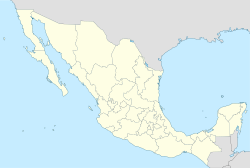
 Tihuatlán
Coordinates: 18°27′N 96°21′W / 18.45°N 96.35°W Country  Mexico
State Veracruz Foundation 1598 Government – Municipal President José Enrique Romero Alarcón Area – Total 828.3 km2 (319.8 sq mi) Population – Total 80 923 – Density 97.7/km2 (253/sq mi) Time zone CST (UTC-6) – Summer (DST) CDT (UTC-7) Website Official Website Tihuatlán is a municipality located in the north zone in the State of Veracruz, about 316 km from state capital Xalapa. It has a surface of 828.29 km2. It is located at 18°27′N 96°21′W / 18.45°N 96.35°W. The name comes from the language Náhuatl, Cihua-tlán; that means “Women’s place " but refers to gods.
Contents
Geographic limits
The municipality of Tihuatlán is delimited to the north by Temapache and Tuxpam, to the east by Papantla, Poza Rica and Cazones de Herrera to the south by Coatzintla and to the south-west by Puebla State.[1] It is watered by the rivers Cazones and Tontepec, which end in the gulf of Mexico.
Agriculture
It produces principally maize, beans, green chile and orange fruit.
Celebrations
In Tihuatlán, in October takes place the celebration in honor of Saint Francis of Assisi, Patron of the town, and in December takes place the celebration in honor to the Virgin of Guadalupe.
Transportation
El Tajín National Airport is located in Tihuatlán.[2]
Weather
The weather in Tihuatlán is warm and wet all year with rains in summer and autumn.
References
- ^ "Enciclopedia de los Municipios de México: Tihuatlán" (in Spanish). Gobierno Estatal. http://www.e-local.gob.mx/work/templates/enciclo/veracruz/municipios/30175a.htm. Retrieved 2009-06-16.
- ^ "DIRECTORIO DE OFICINAS DE VENTAS." Aeromar. 4/7. Retrieved on December 18, 2010.
External links
- (Spanish) Municipal Official webpage
- (Spanish) Municipal Official Information
Xalapa (capital)Huasteca Alta
RegionChalma · Chiconamel · Chinampa de Gorostiza · El Higo · Naranjos · Ozuluama de Mascareñas · Pánuco · Platón Sánchez · Pueblo Viejo · Tamalín · Tamiahua · Tampico Alto · Tantima · Tantoyuca · Tempoal de Sánchez
Huasteca Baja
RegionBenito Juárez · Castillo de Teayo · Cerro Azul · Chicontepec de Tejeda · Chontla · Citlaltépetl · Huayacocotla · Ilamatlán · Ixcatepec · Ixhuatlán de Madero · Tancoco · Temapache (Álamo) · Tepetzintla · Texcatepec · Tlachichilco · Tuxpan · Zacoalpan · Zontecomatlán de López y Fuentes
Totonaca
RegionCazones de Herrera · Chumatlán · Progreso de Zaragoza · Coatzintla · Coxquihi · Coyutla · Espinal · Filomeno Mata · Gutiérrez Zamora · Mecatlán · Papantla · Poza Rica · Tecolutla · Tihuatlán · Zococolco de Hidalgo
Nautla
RegionAtzalán · Colipa · Juchique de Ferrer · Martínez de la Torre · Misantla · Nautla · San Rafael · Tenochtitlán · Tlapacoyan · Vega de Alatorre · Yecuatla
Capital
RegionAcajete · Acatlán · Actopan · Alto Lucero · Altotonga · Apazapan · Ayahualulco · Banderilla · Chiconquiaco · Coacoatzintla · Coatepec · Cosautlán de Carvajal · Emiliano Zapata (Dos Ríos) · Ixhuacán de los Reyes · Jalacingo · Jalcomulco · Jilotepec de Molina Enríquez · Las Minas · Las Vigas de Ramírez · Landero y Coss · Miahuatlán · Naolinco de Victoria · Perote · Rafael Lucio · Tatatila · Teocelo · Tepetlán · Tlacolulan · Tlalnelhuayocan · Tonayán · Villa Aldama · Xalapa · Xico
Sotavento
RegionBoca del Río · Cotaxtla · Jamapa · La Antigua (José Cardel) · Manlio Fabio Altamirano · Medellín · Puente Nacional · Soledad de Doblado · Tlalixcoyan · Úrsulo Galván · Veracruz
Mountains
RegionAcultzingo · Alpatláhuac · Amatlán de los Reyes · Aquila · Astacinga · Atlahuico · Atoyac · Atzacan · Calcahualco · Camarón de Tejeda · Camerino Z. Mendoza (Ciudad Mendoza) · Carrillo Puerto (Tamarindo) · Chocamán · Coetzala · Comapa · Córdoba · Coscomatepec de Bravo · Cuichapa · Cuitláhuac · Fortín de las Flores · Huatusco · Huiloapan de Cuauhtémoc · Ixhuatlán del Café · Ixhuatlancillo · Ixtaczoquitlán · La Perla · Los Reyes · Magdalena · Maltrata · Mariano Escobedo · Mixtla de Altamirano · Naranjal · Nogales · Omealca · Orizaba · Paso del Macho · Rafael Delgado · Río Blanco · San Andrés Tenejapan · Sochiapa · Soledad Atzompa · Tehuipango · Tenampa · Tepatlaxco · Tequila · Tezonapa · Tlacotepec de Mejía · Tlaltetela · Tlaquilpa · Tlilapan · Totutla · Xoxocotla · Yanga · Zentla · Zongolica
Papaloapan
RegionAcula · Ángel R. Cabada · Alvarado · Amatitlán · Carlos A. Carrillo · Chacaltianguis · Cosamaloapan · Ignacio de la Llave · Isla · Ixmatlahuacan · José Azueta (Villa Azueta) · Juan Rodríguez Clara · Lerdo de Tejada · Otatitlán · Playa Vicente · Saltabarranca · Santiago Sochiapan (Xochiapa) · Tierra Blanca · Tlacojalpan · Tlacotalpan · Tres Valles · Tuxtilla
Los Tuxtlas
RegionCatemaco · San Andrés Tuxtla · Santiago Tuxtla · Hueyapan de Ocampo
Olmeca
RegionAcayucan · Agua Dulce · Chinameca · Coatzacoalcos · Cosoleacaque · Hidalgotitlán · Ixhuatlán del Sureste · Jáltipan · Jesús Carranza · Las Choapas · Mecayapan · Minatitlán · Moloacán · Nanchital · Oluta · Oteapan · Pajapan · San Juan Evangelista · Sayula de Alemán · Soconusco · Soteapan · Tatahuicapan · Texistepec · Uxpanapa) · Zaragoza
Categories:

Wikimedia Foundation. 2010.