- Ouse Bridge
-
Ouse Bridge 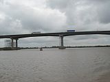
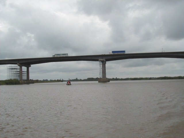
Central spans over the OuseCarries Vehicles (M62) Crosses River Ouse Locale Goole Maintained by Highways Agency Designer Scott Wilson Kirkpatrick & Partners Design Plate girder bridge Material Reinforced concrete Total length 1.6km Height 30 metres Longest span 89 metres (three main spans) Number of spans 29 Piers in water 4 Constructed by Costain Fabrication by Redpath Dorman Long Construction begin January 1973 Construction cost £6.75 million Inaugurated 24 May 1976 Replaces Boothferry Bridge (A614) Coordinates 53°43′41″N 0°52′44″W / 53.728°N 0.879°WCoordinates: 53°43′41″N 0°52′44″W / 53.728°N 0.879°W The Ouse Bridge carries the M62 between junctions 36 and 37 over the River Ouse north of Goole.
Contents
History
Traffic to and from Hull to the A1 historically went over Boothferry Bridge, on the A614, which was a swing bridge.
The position of the bridge and the M62 resulted from a study carried out in 1964 by Scott Wilson Kirkpatrick & Partners. They would also design the bridge. It is a haunched girder bridge.
Design
In the early stages an immersed tube tunnel was considered, which was thought to be too expensive. The superstructure was designed by Redpath Dorman Long and G Maunsell & Partners. 1310 metres of the River Ouse had to be bridged. The area was in the Boothferry district of Humberside. The gradient of the road on the approach to the bridge is 1 in 33.
Construction
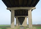 View from underneath
The Ouse Bridge Contract for £6.75 million (£61 million in today's figures) was awarded in January 1973 to a consortium of Costain Civil Engineering and Redpath Dorman Long.
There were 120 large steel cylinder piles of 1.5 metre diameter and 20 metres long driven into the ground by a self-elevating platform barge with a steam hammer. These were carried out by Raymond International.[1]
The steelwork was fabricated at RDL works in Teesside. There were steel supply problems.
In July 1975 there was a partial collapse of a military trestle on pier 15.[2]
It was opened on 24 May 1976. It was the last section of the main part of the M62 to open. The A63 Caves Bypass and M62 Balkholme sections (built by Clugston Construction) had opened on 19 February 1976. The Balkholme to Caves section was the first use on a UK motorway of continuously reinforced concrete pavement (CRCP), which has no transverse joints.
References
External links
Categories:- Bridges in the East Riding of Yorkshire
- Costain
- Bridges completed in 1976
- Plate girder bridges
- Concrete bridges

Wikimedia Foundation. 2010.