- Ottergem
-
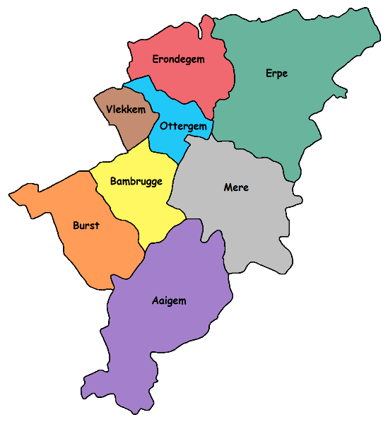
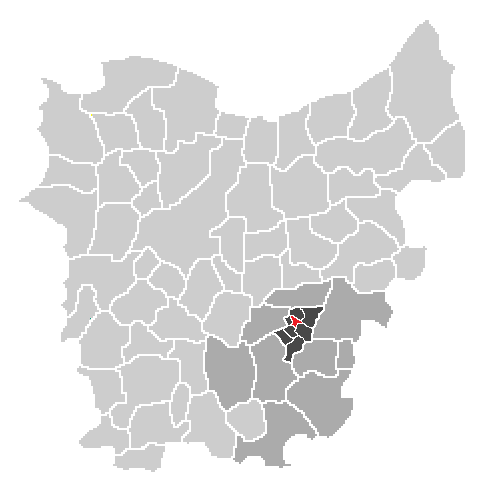
Ottergem — Village — Erpe-Mere in East-Flanders Localisation of Ottergem in Erpe-Mere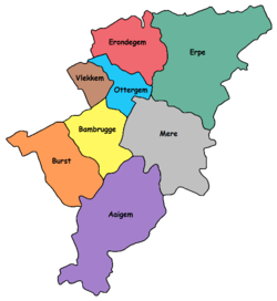
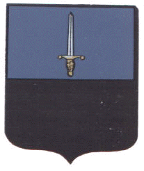
Coat of armsLocalisation of Ottergem in the community of Erpe-Mere in the arrondissement of Aalst in the province of East-Flanders.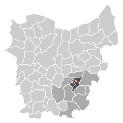
Country Belgium Region  Flanders
Province  East Flanders
Arrondissement Aalst Municipality  Erpe-Mere
Area – Total 1.55 km2 (0.6 sq mi) Elevation 0 m (0 ft) Population (2003) – Total 500 – Density 322/km2 (834/sq mi) Source: NIS Postal code 9420 Ottergem is a sub-municipality of Erpe-Mere in Flanders. It is located in the Denderstreek in the southeast of East Flanders and belongs to Arrondissement of Aalst. The sub-municipality is bordered by the sub-municipalities of Erondegem, Erpe, Mere, Bambrugge (and its hamlet Egem) and Vlekkem and the municipality Sint-Lievens-Houtem (sub-municipality Vlierzele). Ottergem has 500 inhabitants as of 1 January 2003 and an area of 1.55 km. The population density is 322 inhabitants / km ².
History
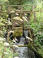
Ottergem was one of the smallest villages of the district of Dendermonde at the beginning of the 19th Century, with 155 hectares and 520 people, it was much smaller than the surrounding villages. The village was first mentioned in an official document in 1036. In this charter the emperor Koenraad II recognized the Abbey Sint-Pietersabdij in Ghent and their possessions, they spoke of "et in Bursinghem et terram in Ottringhem et terram in Flachem". Since the year 1142 they spoke of Ottergem, but the variations Ottrenghem, Ottregem and Oterghem were also known. The name is in the opinion of the historian De Smet derived from the otter (animal) but the opinion of his colleague Föstermann is that the name is derived from a personal name. Etymologically, Flemish locations ending with –gem refer to a Germanic compound with –haim, meaning ‘home’ or ‘residence’, and a derative ending with –inga. Towards the end of the 19th Century there was a water mill and an oil mill.
Landmarks
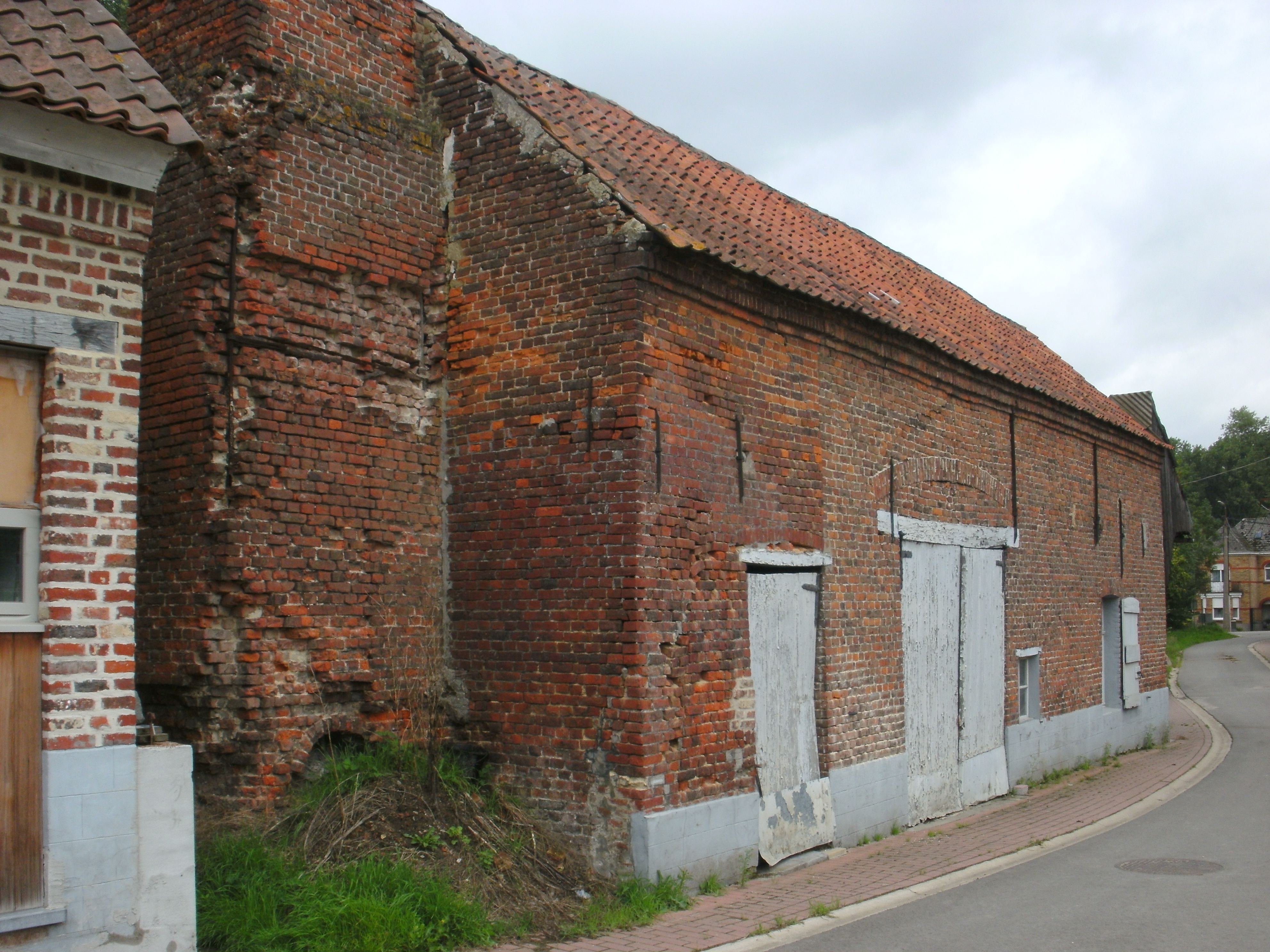
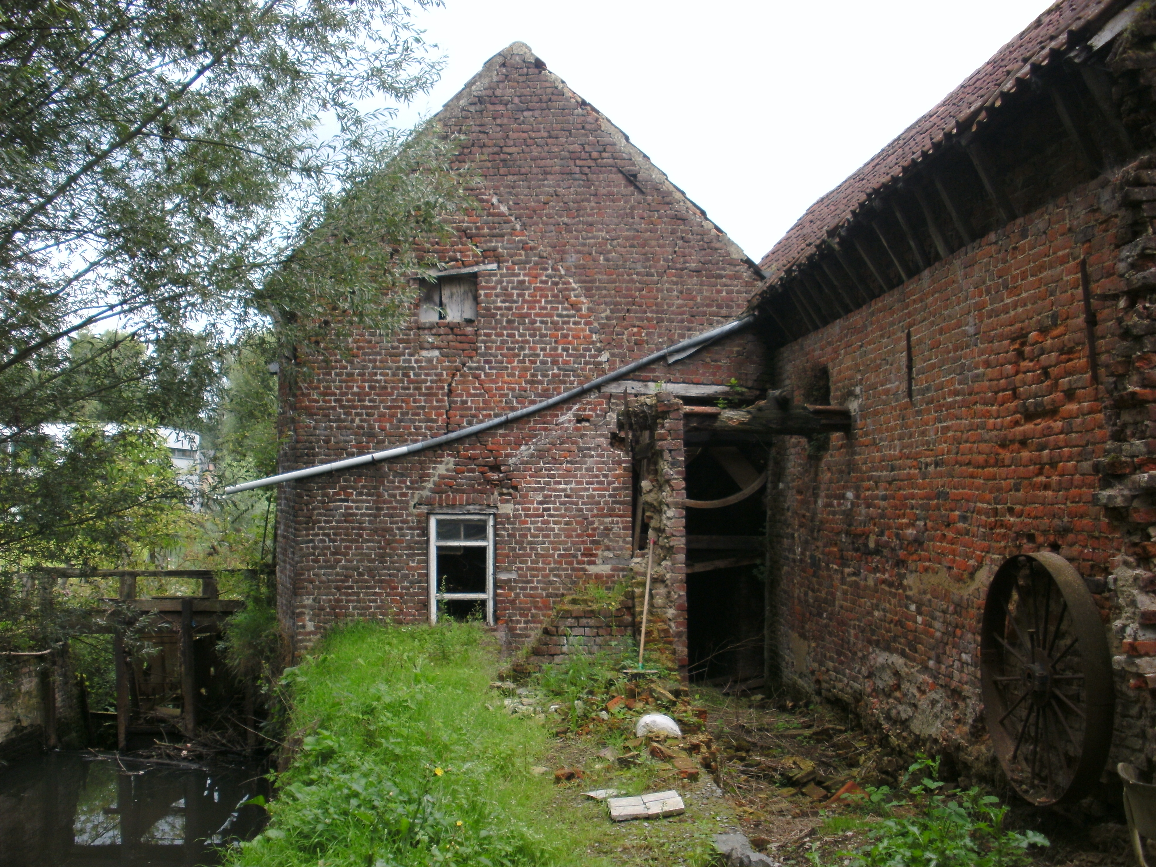
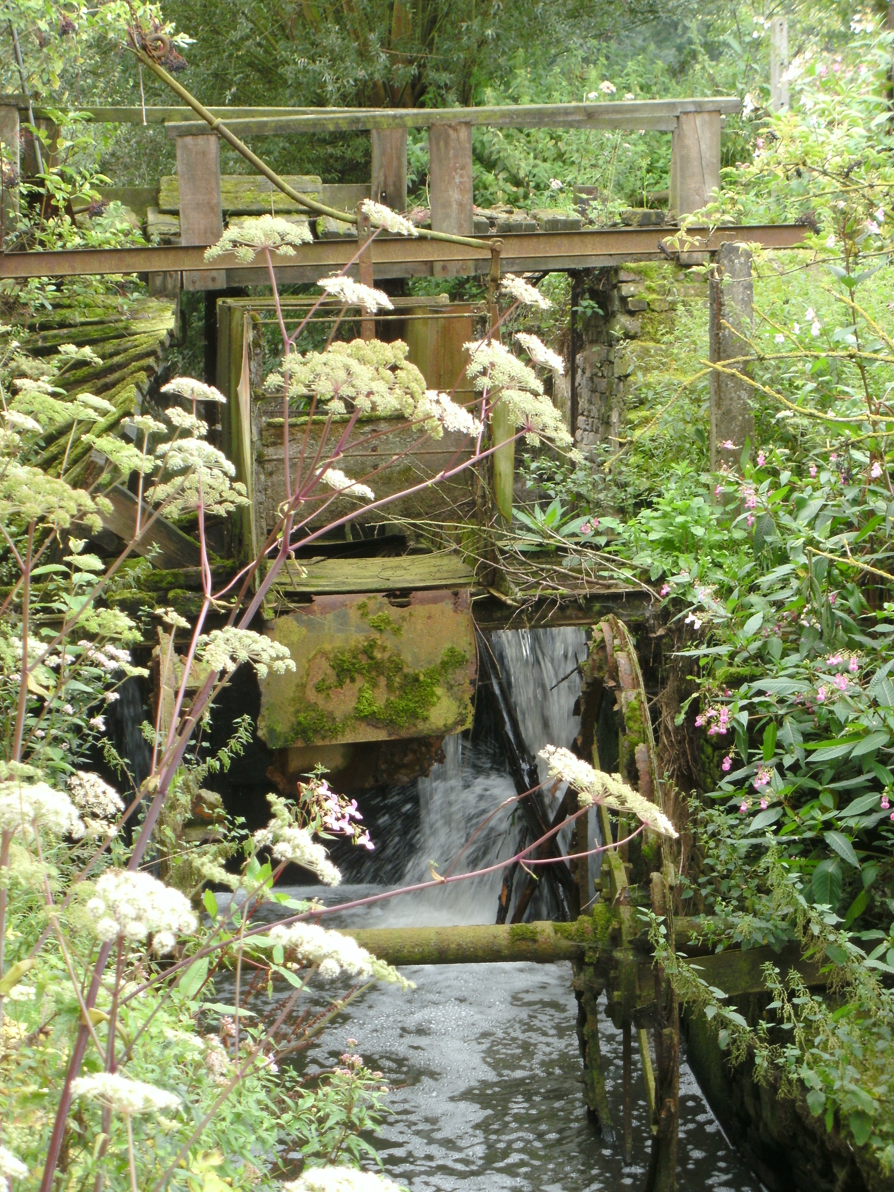
- The "De Watermeulen" is located in the Ruststraat 10-12 on the Molenbeek Brook. It's an overshot watermill and it is
 protected by law. It was originally a wheat mill and an oil mill, but later on it was only a wheat mill.
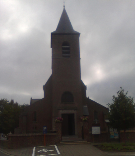
- In Ottergem the Sint-Paulus-Bekering Church can be found. Ottergem belongs to deanery of Lede.
-

Front view of the De Watermeulen at Ottergem
-

Rear view of the De Watermeulen at Ottergem
-
Mill wheel of the De Watermeulen at Ottergem
-
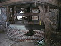
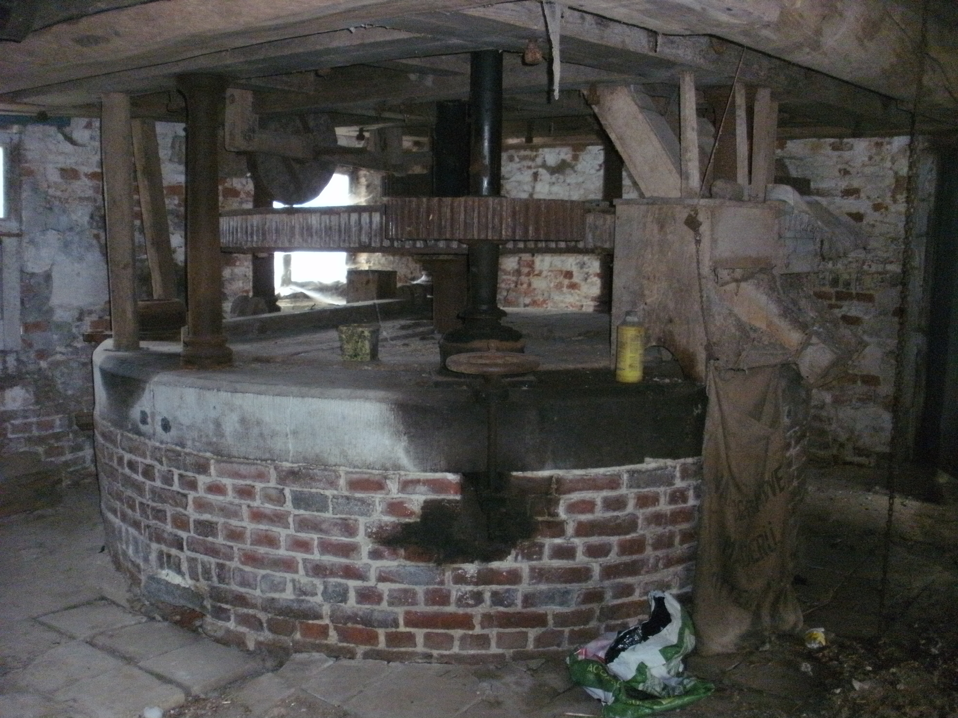
The De Watermeulen inside at Ottergem
-
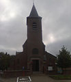
The church of Ottergem front view
-
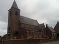
The church of Ottergem side-view
Tourism
Through Ottergem runs the Molenbeekroute. The Molenbeekroute is a cycle track network, known primarily for the mills of the municipality Erpe-Mere and two brooks that can be found there, both of which have the name Molenbeek (mill brook).
 Sub-municipalities: Aaigem · Bambrugge · Burst · Erondegem · Erpe · Mere · Ottergem · Vlekkem
Hamlet: Egem
List of municipalities · Arrondissement of Aalst · East Flanders · Flemish RegionCategories:- Erpe-Mere
- Populated places in Belgium
- Villages in Belgium
- The "De Watermeulen" is located in the Ruststraat 10-12 on the Molenbeek Brook. It's an overshot watermill and it is

Wikimedia Foundation. 2010.