- Osborne Acres, Alberta
-
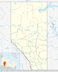
 Osborne AcresLocation of Osborne Acres Alberta
Osborne Acres is an unincorporated community in Alberta, Canada within Parkland County that is recognized as a designated place by Statistics Canada.[1] It is located on the west side of Range Road 264, 1.0 km (0.62 mi) south of Highway 16.
Demographics
As of the 2006 Census of Canada, Osborne Acres had a total population of 120 living in 37 dwellings. With a land area of 1.16 km2 (0.45 sq mi), it had a population density of 103.2 /km2 (267 /sq mi).[1]
See also
References
- ^ a b Statistics Canada (2008-11-05). "Population and dwelling counts, for Canada, provinces and territories, and designated places, 2006 and 2001 censuses - 100% data (Alberta)". http://www12.statcan.ca/english/census06/data/popdwell/Table.cfm?T=1302&SR=1&S=1&O=A&RPP=9999&PR=48&CMA=0. Retrieved 2010-10-17.
 Subdivisions of Alberta
Subdivisions Regions · Census divisions · Municipal districts (counties) · Specialized municipalities · School districts · Regional health authoritiesCommunities Cities · Towns · Villages · Summer villages · Hamlets · Indian reserves · Métis settlements · Ghost towns · Designated placesCities and Urban
Service AreasAirdrie · Brooks · Calgary · Camrose · Cold Lake · Edmonton (capital) · Fort McMurray · Fort Saskatchewan · Grande Prairie · Lacombe · Leduc · Lethbridge · Lloydminster · Medicine Hat · Red Deer · Sherwood Park · Spruce Grove · St. Albert · WetaskiwinCategories:- Designated places in Alberta
- Edmonton Capital Region geography stubs

Wikimedia Foundation. 2010.