- Florenville
-
Florenville Church of Our Lady of the Assumption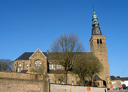
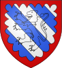
Coat of armsLocation in Belgium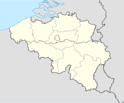
 Florenville
Coordinates: 49°41.9′N 5°18.6′E / 49.6983°N 5.31°E Country Belgium Region Wallonia Community French Community Province Luxembourg Arrondissement Virton Government – Mayor Richard Lambert (cdH) – Governing party/ies cdH, PS Area – Total 146.91 km2 (56.7 sq mi) Population (1 January 2010)[1] – Total 5,428 – Density 36.9/km2 (95.7/sq mi) Postal codes 6820-6824 Area codes 061 Website www.florenville.be Map of Florenville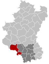
Florenville is a Walloon municipality located in the Belgian province of Luxembourg. On 1 January 2007 the municipality had 5,448 inhabitants. The total area is 146.91 km², giving a population density of 37.1 inhabitants per km².
It is located on the Semois River, facing the French border.
Apart from Florenville itself, the municipality also contains the sections of Chassepierre, Fontenoille, Lacuisine, Muno, Sainte-Cécile and Villers-devant-Orval.
Orval Abbey is located in Villers-devant-Orval. Nearby is the citadel of Godfrey de Bouillon.
References
- ^ Population per municipality on 1 January 2010 (XLS; 221 KB)
External links
- Florenville official website (French)
Arlon 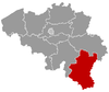
Bastogne Marche-en-Famenne Durbuy · Erezée · Hotton · La Roche-en-Ardenne · Manhay · Marche-en-Famenne · Nassogne · Rendeux · TennevilleNeufchâteau Bertrix · Bouillon · Daverdisse · Herbeumont · Léglise · Libin · Libramont-Chevigny · Neufchâteau · Paliseul · Saint-Hubert · Tellin · WellinVirton Chiny · Étalle · Florenville · Habay · Meix-devant-Virton · Musson · Rouvroy · Saint-Léger · Tintigny · VirtonCategories:- Municipalities of Luxembourg (Belgium)
- Belgian Luxembourg geography stubs


Wikimedia Foundation. 2010.