- Old Forge Airport
-
Old Forge Airport IATA: none – ICAO: none – FAA LID: NK26 Location of airport in New York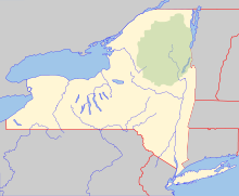
 Old Forge
Summary Airport type Private Owner Adirondack Homes LLC Serves Old Forge, New York Elevation AMSL 1,753 ft / 534 m Coordinates 43°43′31″N 074°58′34″W / 43.72528°N 74.97611°W Runways Direction Length Surface ft m 9/27 3,200 975 Turf Source: Federal Aviation Administration[1] Old Forge Airport (FAA LID: NK26) is a private use airport located one nautical mile (1.85 km) north of the central business district of Old Forge, a village in Herkimer County, New York, United States.[1]
The Air Route Traffic Control Center for the airport is Boston Center, and Flight service station is the Buffalo Flight Service Station The airport is unattended and is privately owned. To land there, pilots must get permission from the owner, Adirondack Homes LLC .[2]
Facilities
Old Forge Airport covers an area of 18 acres (7.3 ha) at an elevation of 1,753 feet (534 m) above mean sea level. It has one runway designated 9/27 with a turf surface measuring 3,200 by 100 feet (975 x 30 m).[1]
References
- ^ a b c FAA Airport Master Record for NK26 (Form 5010 PDF). Federal Aviation Administration. Effective 3 June 2010.
- ^ "Old Forge Airport". Airnav.com. Archived from the original on 2010-04-20. http://www.webcitation.org/5p8FIhADN. Retrieved 20 April 2010.
External links
- Aerial image as of 24 May 1998 from USGS The National Map
- Resources for this airport:
- AirNav airport information for NK26
- FlightAware airport information and live flight tracker
- SkyVector aeronautical chart for NK26
Categories:- Airports in New York
- Transportation in Herkimer County, New York
- Buildings and structures in Herkimer County, New York
- Adirondacks

Wikimedia Foundation. 2010.