- Ullakaarvi
-
Ullakaarvi Falls 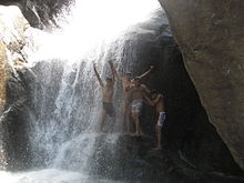
Location Nagercoil, Tamil Nadu Total height 16.8 m (55 ft) Ullakarvi (In Tamil, 'ullakarvi' literally means 'universal falls') is a waterfall on the Western Ghats hills near Nagercoil in Kanyakumari District, Tamilnadu state.
Contents
Location
Ullakarvi falls is about 35 km (22 mi) from Kanyakumari town and about 17 km (11 mi) from Nagercoil town, near Azhakiyapandiapuram village. The falls is up in the middle of forested hills (the hills of the Western Ghats), which is accessible only by foot from the base of the hills. The hour's trek from the base of the hills is through rocky, forested area, which is thrilling in itself. On a clear day, one can view the waterfalls from the base of the hills through naked eye, or even better through binoculars/zoom lens. There are two falls - the lower falls, which is a good picnic spot, and the higher falls, which is further uphill. The water is basically spring water, coming in as a stream up from the hills nearby.
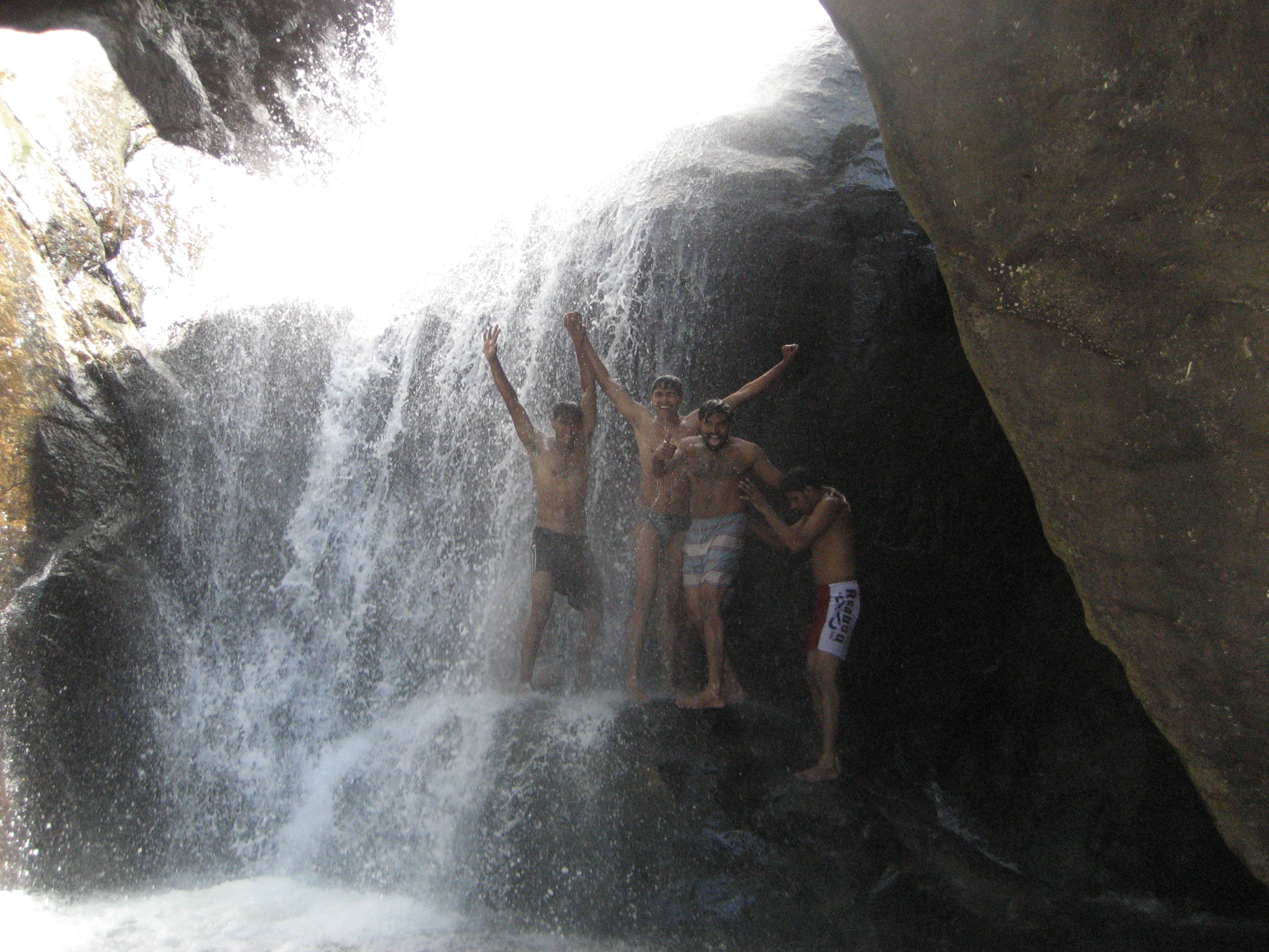
Lower falls
The lower portion of the waterfalls, and the spot one reaches after the trek. This is a good picnic spot. The view from this spot of the greenery below the hills is exhilarating.[citation needed] Good to have bath and relax for an hour. The water here is cool even during the hot months, though the waterflow is less during the summer months.
Higher falls
To reach the Higher falls, one needs to climb about 200 m (660 ft) uphill (recommended only for healthy people who can climb and swim).
External links
Hydrology of Tamil Nadu Rivers Adyar • Amaravathi • Arasalar • Bhavani • Cheyyar • Chittar • Cooum • Kaveri • Kedilam • Kodaganar • Kodavanar • Kokkiliyar • Kollidam • Kosasthalaiyar • Manimuthar • Nadari • Nambiyar • Nanganjiyar • Noyyal • Pachaiyar • Pahrali • Palar • Parambikulam • Ponnaiyar • Swetha • Thamirabarani • Vaigai • Vaippar • Vasishta • Vellar • VennaaruLakes Ambattur Lake • Berijam Lake • Chembarambakkam Lake • Kaliveli Lake • Kodaikanal Lake • Perumal Eri • Porur Lake • Pulicat Lake • Red Hills Lake • Sholavaram Lake • Singanallur Lake • Valankulam Lake • Veeranam Lake • Velachery Lake • Pykara • Ooty LakeWaterfalls Agaya Gangai • Ayyanar • Catherine • Courtallam • Hogenakkal • Kiliyur • Kumbakkarai • Law's Falls • Katary(Kateri) Falls • Kalhatti Falls • Kutladampatti • Monkey • Sengupathi • Siruvani • Suruli • Thalaiyar • Tirparappu • Ullakaarvi • Vaideki • VattaparaiBeaches Dams/ Reservoirs Aliyar Reservoir • Amaravathi Dam • Bhavanisagar Dam • Grand Anicut • Kamarajar Sagar Dam • Krishnagiri Dam • Mettur Dam • Mukkadal • Noyyal Oarathuppalayam • Pechiparai Reservoir • Perunchani Dam • Sathanur Reservoir • Solaiyar Dam • Vaigai Dam • Varattu Pallam DamSee also Kerala • Karnataka • Andhra PradeshCategories:- Western Ghats
- Waterfalls of Tamil Nadu
Wikimedia Foundation. 2010.