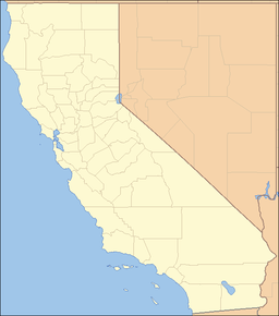
- Coso Range
-
Coso Range Mountain Range Country United States State California District Inyo County Coordinates 36°8′29.796″N 117°41′23.252″W / 36.14161°N 117.68979222°W Highest point - elevation 2,038 m (6,686 ft) Timezone Pacific (UTC-8) - summer (DST) PDT (UTC-7) Topo map USGS Coso Peak The Coso Range of eastern California is located immediately south of Owens Lake (dry), east of the Sierra Nevada Mountains, and west of the Argus Range. The southern part of the range lies in the restricted Naval Air Weapons Station China Lake. The mountains include Coso Peak, at 8,160 feet (2,487 m)above sea level, as well as Silver Peak and Silver Mountain, both more than 7,400 ft (2,300 m) in height.
The range is underlain principally by Mesozoic granitic rocks that are partly veneered by upper Cenozoic volcanic rocks of the Coso Volcanic Field. The volcanic units (in apparent decreasing age) include (1) widespread basaltic flows, (2) dacitic flows and tuff, and (3) rhyolitic domes and flows and basaltic cones and flows. These volcanic rocks are encompassed by an oval-shaped zone of late Cenozoic ring faulting that measures about 24 miles (40 km) east to west and 45 km north to south and that defines a structural basin. Most of the Coso Range and a slice of the adjacent Sierra Nevada lie within this ring structure. The youngest volcanic rocks are Pleistocene and, with associated active fumaroles, occupy a north-trending structural and topographic ridge about 18 km by 10 km near the center of the basin. The ring structure and associated volcanic rocks suggest a large underlying magma chamber that has periodically erupted lava to the surface during the past few million years.
Contents
Prehistory
Numerous rock art sites (the Coso Rock Art District) are found in the range, left by the ancient Coso People. The prehistoric Coso inhabitants exported volcanic glass (Coso obsidian) and this highly valued toolstone has been found as far distant as the Channel Islands, California.<Garfinkel 2007>. Little Petroglyph Canyon and Renegade Canyon within the Range are open for guided tours through the Maturango Museum in Ridgecrest, California.
See also
- Coso Volcanic Field
- List of mountain ranges of California
Notes
References
- California Road and Recreation Atlas. 2005, pg. 87
- C. Michael Hogan. 2008. Morro Creek, ed. by A. Burnham [1]
- Alan P. Garfinkel, 2007, Archaeology and Rock Art of the Eastern Sierra and Great Basin Frontier, Maturango Museum, Ridgecrest,California.
- Garfinkel, Alan P. (2006). "Paradigm Shifts, Rock Art Studies, and the “Coso Sheep Cult” of Eastern California". North American Archaeologist 27 (3): 203–244. ISSN 0197-6931. http://www.petroglyphs.us/article_coso_sheep_cult.htm.
Categories:- Mountain ranges of the Mojave Desert
- Volcanoes of Inyo County, California
- Volcanism of California
- Mountain ranges of Inyo County, California
Wikimedia Foundation. 2010.

