- Oakeys Brook (New Jersey)
-
Oakeys Brook 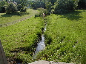
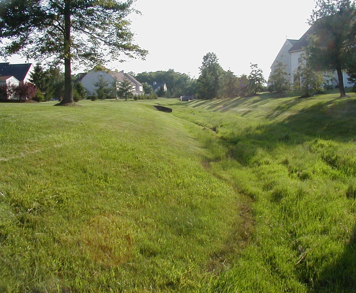
Oakeys Brook near Brunswick Acres School in North Brunswick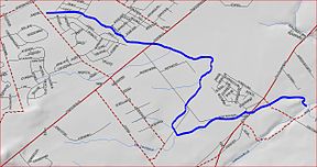
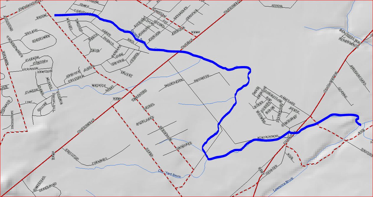
Oakeys Brook mapOrigin 40°25′56″N 74°32′39″W / 40.43222°N 74.54417°W Mouth 40°25′06″N 74°29′29″W / 40.41833°N 74.49139°W Progression Lawrence Brook, Raritan River, Atlantic Ocean Basin countries United States Mouth elevation 52 ft (16 m) River system Raritan River system Left tributaries Cow Yard Brook Oakeys Brook is a tributary of the Lawrence Brook, a branch of the Raritan River in Middlesex County, New Jersey in the United States.
Its source is in western South Brunswick. It drains into Farrington Lake in western East Brunswick.
Contents
Course
Its source is near Beekman Road in central South Brunswick. Farther downstream, it runs through the Nassau Square housing development on Augustine Drive. Then it crosses Henderson Road in northern South Brunswick (which is its official source at 40°25′56″N 74°32′39″W / 40.43222°N 74.54417°W[1]), and runs beside the Brunswick Acres School in northern South Brunswick. It then crosses Route 1 and merges with another unnamed tributary. It continues flowing away from Black Horse Lane before coming toward it and crossing the railroad tracks a little farther north than the road reaches them. Another unnamed tributary joins it, along with the Cow Yard Brook. It turns east, crosses Route 130 near Black Horse Lane, and crosses Davidson Mill Road before emptying into Farrington Lake, near Davidson Mill Road40°25′06″N 74°29′29″W / 40.41833°N 74.49139°W[1].
Animal life
It is an ecosystem full of many varieties of life, despite its proximity to human habitation in many upstream areas. Many tadpoles and frogs live in the stream, especially upstream where natural dams sometimes create small ponds. Snakes and occasionally turtles may be found by the stream. Upstream, numerous species of small fish live in it, providing food for some birds which live there.
Accessibility
It flows in many areas through developed sectors, where it is easily accessible.
Terrain
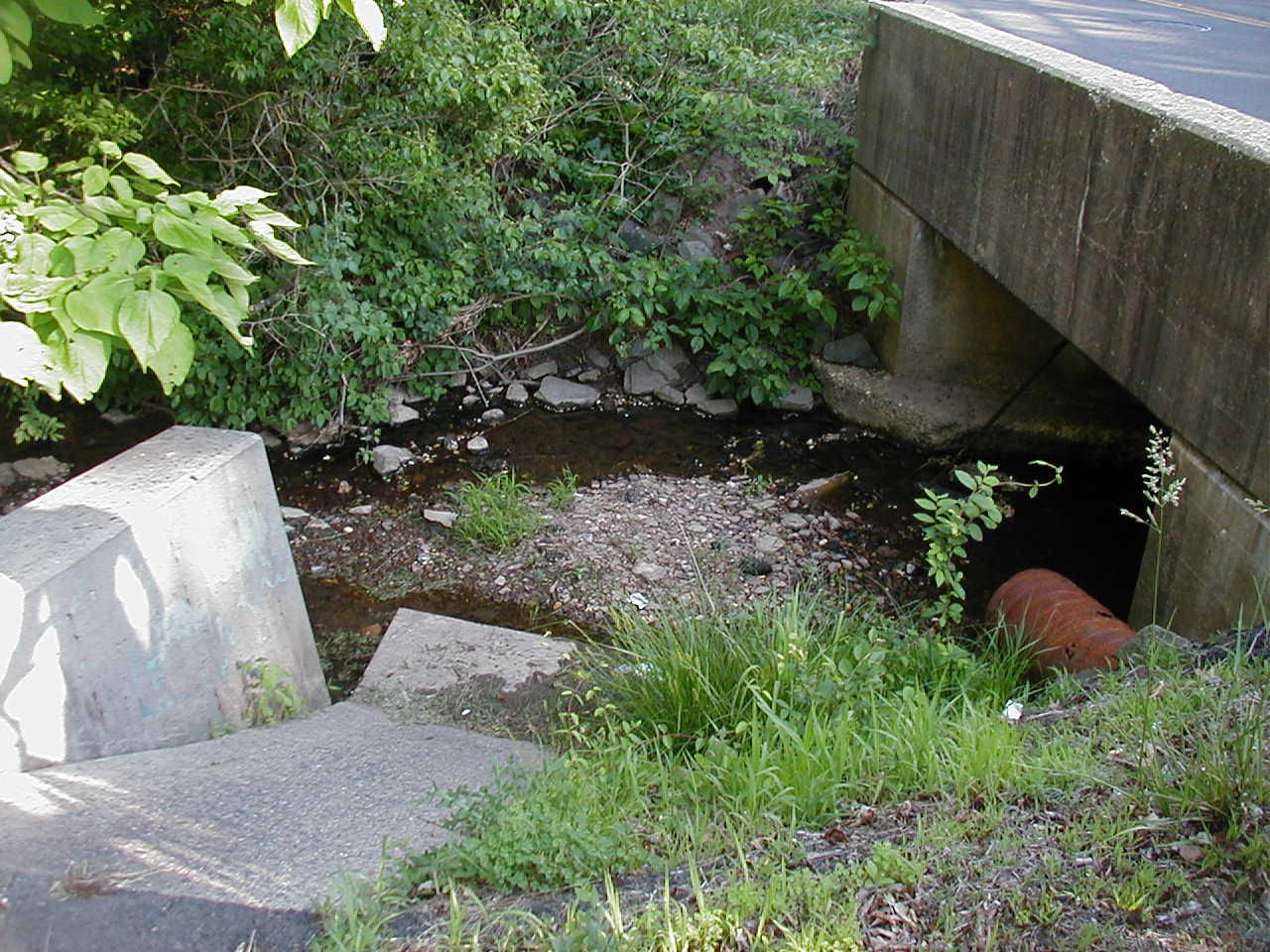
The Oakeys Brook generally has a clay streambed. Upstream decay products turn the mud black, making it an ideal place for amphibians and turtles to hide in. Downstream, there are a few more rocks, although the stream is still muddy and deep. The stream flows through wetland areas in several places near Black Horse Lane.
This stream is generally low-lying, collecting water from various storm drainage systems. It is fed by swamp drainage and springs in the downstream areas but by storm drainage and farm drainage in upstream areas. Since a major source is storm drainage, it swells considerably during rains.
Tributaries
Sister tributaries
- Beaverdam Brook
- Great Ditch
- Ireland Brook
- Sawmill Brook
- Sucker Brook
- Terhune Run
- Unnamed Brook in Rutgers Gardens, unofficially named Doc Brook
- Unnamed Brook in Rutgers' Helyar Woods
Gallery
-
Oakeys Brook near its source, in the Nassau Square housing development
-

Oakeys Brook in Nassau Square a little downstream
-
Oakeys Brook crossing Henderson Road
-

Oakeys Brook near Brunswick Acres Elementary School
-

Oakeys Brook flowing through Brunswick Acres Elementary School
See also
References
- ^ a b "GNIS Detail - Oakeys Brook". USGS. http://gnis.usgs.gov/pls/gnispublic/f?p=139:3:894584726756779::NO:3:P3_FID,P3_TITLE:878917%2COakeys%20Brook. Retrieved 6-8-2010.
External links
Categories:- Geography of Middlesex County, New Jersey
- Tributaries of the Raritan River
- Rivers of New Jersey


Wikimedia Foundation. 2010.