- Bojnord Airport
-
Bojnord Airport
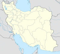
فرودگاه بجنوردIATA: BJB – ICAO: OIMN Location of airport in Iran Summary Airport type Public Operator Government Location Bojnord, Iran Elevation AMSL 3,499 ft / 1,066 m Coordinates 37°29′35″N 057°18′30″E / 37.49306°N 57.30833°E Runways Direction Length Surface m ft 07/25 3,225 10,582 Asphalt Sources:[1][2] Bojnord Airport (Persian: فرودگاه بجنورد) (IATA: BJB, ICAO: OIMN) is an airport serving Bojnord[1] (also spelled Bojnourd or Bojnurd), the capital city of the North Khorasan province in Iran.
Contents
Facilities
The airport resides at an elevation of 3,499 feet (1,066 m) above mean sea level. It has one runway designated 07/25 with an asphalt surface measuring 3,225 by 45 metres (10,581 × 148 ft).[1]
Airlines and destinations
Airlines Destinations Iran Aseman Airlines Tehran-Mehrabad References
- ^ a b c Airport information for OIMN from DAFIF (effective October 2006)
- ^ Airport information for BJB at Great Circle Mapper. Source: DAFIF (effective Oct. 2006).
External links
- Current weather for Bojnourd, Iran (OIMN) at NOAA/NWS
- Accident history for Bojnord Airport (BJB / OIMN) at Aviation Safety Network

This article about an Iranian airport is a stub. You can help Wikipedia by expanding it.

