- Nyuksenitsa
-
Nyuksenitsa (English)
Нюксеница (Russian)- Rural locality[1] -
Selo[1]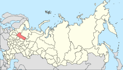
Location of Vologda Oblast in Russia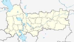
 Nyuksenitsa
Coordinates: 60°25′N 44°14′E / 60.417°N 44.233°ECoordinates: 60°25′N 44°14′E / 60.417°N 44.233°E Administrative status Country Russia Federal subject Vologda Oblast Administrative district Nyuksensky District[1] Selsoviet Nyuksensky Selsoviet[1] Administrative center of Nyuksensky District,[1] Beryozovsky Selsoviet, Nyuksensky Selsoviet[1] Municipal status (as of February 2010) Municipal district Nyuksensky Municipal District[2] Rural settlement Nyuksenskoye Rural Settlement[2] Administrative center of Nyuksensky Municipal District,[2] Nyuksenskoye Rural Settlement[2] Statistics Population (2002 Census) 4,407 inhabitants[3] Time zone MSD (UTC+04:00)[4] Nyuksenitsa (Russian: Нюксеница) is a rural locality (a selo) and the administrative center of Nyuksensky District, Vologda Oblast, Russia, located on the left bank of the Sukhona River. It also serves as the administrative center of Beryozovsky and Nyuksensky Selsoviets, two of the eleven selsoviets into which the district is administratively divided. Municipally, it is the administrative center of Nyuksenskoye Rural Settlement. Population: 4,407 (2002 Census);[3] 4,164 (1989 Census).[5]
Contents
History
Nyuksenitsa has been first mentioned in 1619.[6] At the time, the Sukhona was intensively used as a transport waterway, connecting Moscow to Arkhangelsk, till 1703 the main hub of Russian foreign trade. In 19th century, Nyuksenitsa belonged to Velikoustyugsky Uyezd of Vologda Governorate. In 1918, the area was transferred to the newly established Northern Dvina Governorate, and in 1924 the uyezds were abolished in favor of the new divisions, the districts (raions).
Nyuksensky District was established on June 25, 1924 and included areas of former Solvychegodsky and Velikoustyugsky Uyezds. On February 27, 1928, it was renamed into Sukhonsky District. On July 30, 1931 Sukhonsky and Kokshengsky Districts of the Northern Krai were merged, and Nyuksensky District was re-established, with the administrative center again located in Nyuksenitsa.[7]
Economy
Industry
In Nyuksenitsa, timber and food industry are present, including a milk factory.[8]
Transport
Nyuksenitsa is on the road connecting Vologda and Veliky Ustyug, and in Nyuksenitsa the road moves over the bridge from the left bank to the right bank of the Sukhona. Another paved road branches off in Nyuksenitsa northwest to Tarnogsky Gorodok and further to Oktyabrsky in Arkhangelsk Oblast. There is regular passenger bus service on both roads.
The Sukhona is navigable within the district, however, there is no passenger navigation.
Nyuksenitsa has an oil-pumping station in the Baltic Pipeline System.[8]
Culture and recreation
Nyuksenitsa hosts the District is the Nyuksenitsa Regional Museum.[9]
References
Notes
- ^ a b c d e f Государственный комитет Российской Федерации по статистике. Комитет Российской Федерации по стандартизации, метрологии и сертификации. №ОК 019-95 1 января 1997 г «Общероссийский классификатор объектов административно-территориального деления. Код 19 236 844 007», в ред. изменения №168/2011 от 1 октября 2011 г. (State Statistics Committee of the Russian Federation. Committee of the Russian Federation on Standardization, Metrology, and Certification. #OK 019-95 January 1, 1997 Russian Classification of Objects of Administrative Division . Code 19 236 844 007, as amended by the Amendment #168/2010 of October 1, 2011. ).
- ^ a b c d Law #1120-OZ
- ^ a b Федеральная служба государственной статистики (Federal State Statistics Service) (2004-05-21). "Численность населения России, субъектов Российской Федерации в составе федеральных округов, районов, городских поселений, сельских населённых пунктов – районных центров и сельских населённых пунктов с населением 3 тысячи и более человек (Population of Russia, its federal districts, federal subjects, districts, urban localities, rural localities—administrative centers, and rural localities with population of over 3,000)" (in Russian). Всероссийская перепись населения 2002 года (All-Russia Population Census of 2002). Federal State Statistics Service. http://www.perepis2002.ru/ct/doc/1_TOM_01_04.xls. Retrieved 2010-03-23.
- ^ Правительство Российской Федерации. Постановление №725 от 31 августа 2011 г. «О составе территорий, образующих каждую часовую зону, и порядке исчисления времени в часовых зонах, а также о признании утратившими силу отдельных Постановлений Правительства Российской Федерации». Вступил в силу по истечении 7 дней после дня официального опубликования. Опубликован: "Российская Газета", №197, 6 сентября 2011 г. (Government of the Russian Federation. Resolution #725 of August 31, 2011 On the Composition of the Territories Included into Each Time Zone and on the Procedures of Timekeeping in the Time Zones, as Well as on Abrogation of Several Resolutions of the Government of the Russian Federation. Effective as of after 7 days following the day of the official publication).
- ^ "Всесоюзная перепись населения 1989 г. Численность наличного населения союзных и автономных республик, автономных областей и округов, краёв, областей, районов, городских поселений и сёл-райцентров. (All Union Population Census of 1989. Present population of union and autonomous republics, autonomous oblasts and okrugs, krais, oblasts, districts, urban settlements, and villages serving as district administrative centers.)" (in Russian). Всесоюзная перепись населения 1989 года (All-Union Population Census of 1989). Demoscope Weekly (website of the Institute of Demographics of the State University—Higher School of Economics. 1989. http://demoscope.ru/weekly/ssp/rus89_reg.php. Retrieved 2010-03-23.
- ^ "Нюксенский район" (in Russian). Культура в Вологодской области. http://www.cultinfo.ru/nuksen/index.htm. Retrieved 31 August 2011.
- ^ "Справка об изменениях административно-территориального устройства и сети партийных и комсомольских органов на территории Вологодской области (1917-1991)" (in Russian). Архивы России. http://www.rusarchives.ru/guide/voanpi/126sia.shtml. Retrieved 31 August 2011.
- ^ a b "Паспорт Нюксенского муниципального района, стр.2" (in Russian). Администрация Нюксенского муниципального района. http://nux.ucoz.ru/index/0-5. Retrieved 31 August 2011.
- ^ "Нюксенский районный краеведческий музей" (in Russian). Российская сеть культурного наследия. http://www.museum.ru/M3002. Retrieved 1 September 2011.
Sources
- Законодательное Собрание Вологодской области. Закон №371-ОЗ от 4 июня 1999 г. «О вопросах административно-территориального устройства Вологодской области», в ред. Закона №1452-ОЗ от 30 мая 2006 г «О внесении изменений в Закон области "О порядке решения вопросов административно-территориального устройства Вологодской области"». Вступил в силу со дня официального опубликования. Опубликован: "Красный Север", №124–125, 29 июля 1999 г. (Legislative Assembly of Vologda Oblast. Law #371-OZ of June 4, 1999 On the Matter of the Administrative-Territorial Structure of Vologda Oblast, as amended by the Law #1452-OZ of May 30, 2006 On Amending the Oblast Law "On the Procedures of Handling the Matters of the Administrative-Territorial Structure of Vologda Oblast". Effective as of the day of the official publication).
- Правительство Вологодской области. Постановление №178 от 1 марта 2010 г. «Об утверждении реестра административно-территориальных единиц Вологодской области». (Government of Vologda Oblast. Resolution #178 of March 1, 2010 On Adopting the Registry of the Administrative-Territorial Units of Vologda Oblast. ).
Categories:- Rural localities in Vologda Oblast


Wikimedia Foundation. 2010.