- Nýrov
-
Nýrov — Municipality — 
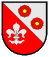
Flag
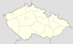
Coat of armsCoordinates: 49°31′18″N 16°32′44″E / 49.52167°N 16.54556°ECoordinates: 49°31′18″N 16°32′44″E / 49.52167°N 16.54556°E Country  Czech Republic
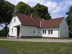
Region South Moravian District Blansko Area – Total 9.17 km2 (3.5 sq mi) Elevation 500 m (1,640 ft) Population (2006) – Total 217 – Density 23.7/km2 (61.3/sq mi) Postal code 679 72 Website http://www.nyrov.cz Nýrov is a village and municipality (obec) in Blansko District in the South Moravian Region of the Czech Republic.
The municipality covers an area of 9.17 square kilometres (3.54 sq mi), and has a population of 217 (as at 3 July 2006).
Nýrov lies approximately 19 kilometres (12 mi) north-west of Blansko, 37 km (23 mi) north of Brno, and 166 km (103 mi) east of Prague.
References
Towns, market towns and villages of Blansko District Adamov · Bedřichov · Benešov · Blansko · Borotín · Bořitov · Boskovice · Brťov-Jeneč · Bukovina · Bukovinka · Býkovice · Cetkovice · Crhov · Černá Hora · Černovice · Deštná · Dlouhá Lhota · Doubravice nad Svitavou · Drnovice · Habrůvka · Hodonín · Holštejn · Horní Poříčí · Horní Smržov · Chrudichromy · Jabloňany · Jedovnice · Kněževes · Knínice u Boskovic · Kořenec · Kotvrdovice · Kozárov · Krasová · Krhov · Křetín · Křtěnov · Křtiny · Kulířov · Kunčina Ves · Kunice · Kuničky · Kunštát · Lazinov · Lažany · Letovice · Lhota Rapotina · Lhota u Lysic · Lhota u Olešnice · Lipovec · Lipůvka · Louka · Lubě · Ludíkov · Lysice · Makov · Malá Lhota · Malá Roudka · Míchov · Milonice · Němčice · Nýrov · Obora · Okrouhlá · Olešnice · Olomučany · Ostrov u Macochy · Pamětice · Petrov · Petrovice · Prostřední Poříčí · Rájec-Jestřebí · Ráječko · Roubanina · Rozseč nad Kunštátem · Rozsíčka · Rudice · Sebranice · Senetářov · Skalice nad Svitavou · Skrchov · Sloup · Spešov · Stvolová · Sudice · Suchý · Sulíkov · Světlá · Svinošice · Svitávka · Šebetov · Šebrov-Kateřina · Šošůvka · Štěchov · Tasovice · Uhřice · Újezd u Boskovic · Újezd u Černé Hory · Úsobrno · Ústup · Valchov · Vanovice · Vavřinec · Vážany · Velenov · Velké Opatovice · Vilémovice · Vísky · Voděrady · Vranová · Vysočany · Závist · Zbraslavec · Žďár · Žďárná · Žernovník · ŽerůtkyCategories:- South Moravian Region geography stubs
- Populated places in Blansko District
- Blansko District
- Villages in the Czech Republic
Wikimedia Foundation. 2010.


