- Deštná (Blansko District)
-
Deštná — Municipality — 
Flag
Coat of arms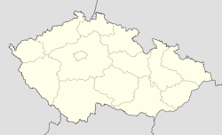
 Deštná
Coordinates: 49°37′14″N 16°33′24″E / 49.62056°N 16.55667°ECoordinates: 49°37′14″N 16°33′24″E / 49.62056°N 16.55667°E Country  Czech Republic
Region South Moravian District Blansko Area – Total 3.29 km2 (1.3 sq mi) Elevation 442 m (1,450 ft) Population (2006) – Total 225 – Density 68.4/km2 (177.1/sq mi) Postal code 679 61 Deštná is a village and municipality (obec) in Blansko District in the South Moravian Region of the Czech Republic.
The municipality covers an area of 3.29 square kilometres (1.27 sq mi), and has a population of 225 (as at 3 July 2006).
Deštná lies approximately 29 kilometres (18 mi) north of Blansko, 47 km (29 mi) north of Brno, and 162 km (101 mi) east of Prague.
References
Towns, market towns and villages of Blansko District Adamov · Bedřichov · Benešov · Blansko · Borotín · Bořitov · Boskovice · Brťov-Jeneč · Bukovina · Bukovinka · Býkovice · Cetkovice · Crhov · Černá Hora · Černovice · Deštná · Dlouhá Lhota · Doubravice nad Svitavou · Drnovice · Habrůvka · Hodonín · Holštejn · Horní Poříčí · Horní Smržov · Chrudichromy · Jabloňany · Jedovnice · Kněževes · Knínice u Boskovic · Kořenec · Kotvrdovice · Kozárov · Krasová · Krhov · Křetín · Křtěnov · Křtiny · Kulířov · Kunčina Ves · Kunice · Kuničky · Kunštát · Lazinov · Lažany · Letovice · Lhota Rapotina · Lhota u Lysic · Lhota u Olešnice · Lipovec · Lipůvka · Louka · Lubě · Ludíkov · Lysice · Makov · Malá Lhota · Malá Roudka · Míchov · Milonice · Němčice · Nýrov · Obora · Okrouhlá · Olešnice · Olomučany · Ostrov u Macochy · Pamětice · Petrov · Petrovice · Prostřední Poříčí · Rájec-Jestřebí · Ráječko · Roubanina · Rozseč nad Kunštátem · Rozsíčka · Rudice · Sebranice · Senetářov · Skalice nad Svitavou · Skrchov · Sloup · Spešov · Stvolová · Sudice · Suchý · Sulíkov · Světlá · Svinošice · Svitávka · Šebetov · Šebrov-Kateřina · Šošůvka · Štěchov · Tasovice · Uhřice · Újezd u Boskovic · Újezd u Černé Hory · Úsobrno · Ústup · Valchov · Vanovice · Vavřinec · Vážany · Velenov · Velké Opatovice · Vilémovice · Vísky · Voděrady · Vranová · Vysočany · Závist · Zbraslavec · Žďár · Žďárná · Žernovník · Žerůtky
This South Moravian Region location article is a stub. You can help Wikipedia by expanding it.


