- Novy Uoyan
-
Coordinates: 56°08′10″N 111°43′23″E / 56.136002°N 111.722923°E
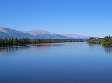
Novy Uoyan (Russian: Новый Уоян) is an urban locality (an urban-type settlement) in Severo-Baykalsky District of the Republic of Buryatia, Russia, located in the basin of the Upper Angara River, 550 kilometers (340 mi) from Ulan-Ude and 140 kilometers (87 mi) from Nizhneangarsk. Population: 3,959 (2010 Census preliminary results);[1] 4,957 (2002 Census);[2] 9,547 (1989 Census).[3]
History
It was founded in the mid-1970s in conjunction with the construction of the Baikal Amur Mainline, near the village of Uoyan on the left bank of the Upper Angara. The railway station and settlement were constructed by workers from the then Lithuanian SSR, as sections of the track were given patronage of Komsomol brigades from various parts of the Soviet Union. Urban-type settlement status was granted in 1976.
Regular traffic on the railway section between Severobaikalsk and Novaya Chara in northern Zabaykalsky Krai began in 1989. Completion of the BAM did not bring the expected economic development of the town and surrounding region, and with the economic crisis in the late 1980s, the town's population dropped from 9,547 in 1989 to 4,957 in 2002.
Economy and infrastructure
Novy Uoyan is an important station on the Baikal Amur Mainline, which presents the only real economic activity in the town. The BAM crosses the Upper Angara close to the town via a 350 meters (1,150 ft) long bridge.
There are proposals to build a 700 to 800 kilometers (430 to 500 mi) long connection between the BAM and the Trans-Siberian Railway through Buryatia, with a northern teminus at Novy Uoyan, beginning either at Novoilyinsky, or from Mogzon in Zabaykalsky Krai. This section would be mainly intended to service mining developments, such as the lead and zinc mine Ozyorninskoye, which could be reached from the south by 2012.[4]
References
- ^ Федеральная служба государственной статистики (Federal State Statistics Service) (2011). "Предварительные итоги Всероссийской переписи населения 2010 года (Preliminary results of the 2010 All-Russian Population Census)" (in Russian). Всероссийская перепись населения 2010 года (All-Russia Population Census of 2010). Federal State Statistics Service. http://www.perepis-2010.ru/results_of_the_census/results-inform.php. Retrieved 2011-04-25.
- ^ Федеральная служба государственной статистики (Federal State Statistics Service) (2004-05-21). "Численность населения России, субъектов Российской Федерации в составе федеральных округов, районов, городских поселений, сельских населённых пунктов – районных центров и сельских населённых пунктов с населением 3 тысячи и более человек (Population of Russia, its federal districts, federal subjects, districts, urban localities, rural localities—administrative centers, and rural localities with population of over 3,000)" (in Russian). Всероссийская перепись населения 2002 года (All-Russia Population Census of 2002). Federal State Statistics Service. http://www.perepis2002.ru/ct/doc/1_TOM_01_04.xls. Retrieved 2010-03-23.
- ^ "Всесоюзная перепись населения 1989 г. Численность наличного населения союзных и автономных республик, автономных областей и округов, краёв, областей, районов, городских поселений и сёл-райцентров. (All Union Population Census of 1989. Present population of union and autonomous republics, autonomous oblasts and okrugs, krais, oblasts, districts, urban settlements, and villages serving as district administrative centers.)" (in Russian). Всесоюзная перепись населения 1989 года (All-Union Population Census of 1989). Demoscope Weekly (website of the Institute of Demographics of the State University—Higher School of Economics. 1989. http://demoscope.ru/weekly/ssp/rus89_reg.php. Retrieved 2010-03-23.
- ^ Sergei Michaljow: Rudny put. In: Gudok (Newspaper of the RŽD), 16. October 2008 (Russian)
Categories:- Urban-type settlements in the Republic of Buryatia
Wikimedia Foundation. 2010.

