- Novoselitsky District
-
Novoselitsky District (English)
Новоселицкий район (Russian)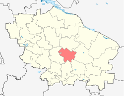
Location of Novoselitsky District on the map of Stavropol KraiAdministrative status (as of July 2011) Country Russia Federal subject Stavropol Krai[1] Administrative center selo of Novoselitskoye[2] # of selsoviets 2[2] # of rural localities 11[2] Municipal status (as of July 2011) Municipally incorporated as Novoselitsky Municipal District[3] - Representative body Council[citation needed] - # of urban settlements 0[4] - # of rural settlements 8[4] Statistics Area (administrative district) (July 2011) 1,724 km2 (666 sq mi)[2] Population (2010 Census,
preliminary)26,702 inhabitants[5] Population (2002 Census) 26,613 inhabitants[6] - Urban population 0% - Rural population 100% Density 15 /km2 (39 /sq mi)[7] Time zone MSD (UTC+04:00)[8] Novoselitsky District (Russian: Новоселицкий район) is an administrative[2] and municipal[3] district (raion), one of the 26 in Stavropol Krai, Russia. The area of the district is 1,724 square kilometers (666 sq mi).[2] Its administrative center is the rural locality (a selo) of Novoselitskoye.[2] District's population: 26,702 (2010 Census preliminary results);[5] 26,613 (2002 Census);[9] 23,021 (1989 Census).[10] Population of Novoselitskoye accounts for 32.2% of the district's population.[9]
References
Notes
- ^ Charter of Stavropol Krai, Article 19
- ^ a b c d e f Resolution #63-p, Section I
- ^ a b Law #89-kz
- ^ Law #43-kz
- ^ a b Федеральная служба государственной статистики (Federal State Statistics Service) (2011). "Предварительные итоги Всероссийской переписи населения 2010 года (Preliminary results of the 2010 All-Russian Population Census)" (in Russian). Всероссийская перепись населения 2010 года (All-Russia Population Census of 2010). Federal State Statistics Service. http://www.perepis-2010.ru/results_of_the_census/results-inform.php. Retrieved 2011-04-25.
- ^ Федеральная служба государственной статистики (Federal State Statistics Service) (2004-05-21). "Численность населения России, субъектов Российской Федерации в составе федеральных округов, районов, городских поселений, сельских населённых пунктов – районных центров и сельских населённых пунктов с населением 3 тысячи и более человек (Population of Russia, its federal districts, federal subjects, districts, urban localities, rural localities—administrative centers, and rural localities with population of over 3,000)" (in Russian). Всероссийская перепись населения 2002 года (All-Russia Population Census of 2002). Federal State Statistics Service. http://www.perepis2002.ru/ct/doc/1_TOM_01_04.xls. Retrieved 2010-03-23.
- ^ The value of density was calculated automatically by dividing the 2010 Census population by the area specified in the infobox. Please note that this value may not be accurate as the area specified in the infobox does not necessarily correspond to the area of the entity proper or is reported for the same year as the population.
- ^ Правительство Российской Федерации. Постановление №725 от 31 августа 2011 г. «О составе территорий, образующих каждую часовую зону, и порядке исчисления времени в часовых зонах, а также о признании утратившими силу отдельных Постановлений Правительства Российской Федерации». Вступил в силу по истечении 7 дней после дня официального опубликования. Опубликован: "Российская Газета", №197, 6 сентября 2011 г. (Government of the Russian Federation. Resolution #725 of August 31, 2011 On the Composition of the Territories Included into Each Time Zone and on the Procedures of Timekeeping in the Time Zones, as Well as on Abrogation of Several Resolutions of the Government of the Russian Federation. Effective as of after 7 days following the day of the official publication).
- ^ a b Федеральная служба государственной статистики (Federal State Statistics Service) (2004-05-21). "Численность населения России, субъектов Российской Федерации в составе федеральных округов, районов, городских поселений, сельских населённых пунктов – районных центров и сельских населённых пунктов с населением 3 тысячи и более человек (Population of Russia, its federal districts, federal subjects, districts, urban localities, rural localities—administrative centers, and rural localities with population of over 3,000)" (in Russian). Всероссийская перепись населения 2002 года (All-Russia Population Census of 2002). Federal State Statistics Service. http://www.perepis2002.ru/ct/doc/1_TOM_01_04.xls. Retrieved 2010-03-23.
- ^ "Всесоюзная перепись населения 1989 г. Численность наличного населения союзных и автономных республик, автономных областей и округов, краёв, областей, районов, городских поселений и сёл-райцентров. (All Union Population Census of 1989. Present population of union and autonomous republics, autonomous oblasts and okrugs, krais, oblasts, districts, urban settlements, and villages serving as district administrative centers.)" (in Russian). Всесоюзная перепись населения 1989 года (All-Union Population Census of 1989). Demoscope Weekly (website of the Institute of Demographics of the State University—Higher School of Economics. 1989. http://demoscope.ru/weekly/ssp/rus89_reg.php. Retrieved 2010-03-23.
Sources
- Государственная Дума Ставропольского края. №6-кз 12 октября 1994 г. «Устав (Основной Закон) Ставропольского края», в ред. Закона №25-кз от 7 апреля 2011 г «О поправке к Уставу (Основному Закону) Ставропольского края». Опубликован: "Ставропольская правда", №198–199, 14 октября 1994 г. (State Duma of Stavropol Krai. #6-kz October 12, 1994 Charter (Basic Law) of Stavropol Krai, as amended by the Law #25-kz of April 7, 2011 On the Amendment of the Charter (Basic Law) of Stavropol Krai. ).
- Правительство Ставропольского края. Постановление №63-п от 4 мая 2006 г. «Об утверждении реестра административно-территориальных единиц Ставропольского края», в ред. Постановления №260-п от 11 июля 2011 г «О внесении изменений в Постановление Правительства Ставропольского края от 04 мая 2006 г. №63-п "Об утверждении реестра районов и населённых пунктов Ставропольского края"». Вступил в силу с 4 мая 2006 г.. Опубликован: "Сборник законов и других правовых актов Ставропольского края", №17, ст. 5609, 10 июля 2006 г. (Government of Stavropol Krai. Resolution #63-p of May 4, 2006 On the Adoption of the Registry of the Administrative-Territorial Units of Stavropol Krai, as amended by the Resolution #260-p of July 11, 2011 On Amending the Resolution #63-p of the Government of Stavropol Krai of May 4, 2006 "On the Adoption of the Registry of the Districts and the Inhabited Localities of Stavropol Krai". Effective as of May 4, 2006).
- Государственная Дума Ставропольского края. Закон №89-кз от 4 октября 2004 г. «Об установлении границ муниципальных районов Ставропольского края», в ред. Закона №46-кз от 1 июля 2010 г «О преобразовании муниципального образования города Будённовска Ставропольского края». Вступил в силу со дня официального опубликования. Опубликован: "Ставропольская правда", №216, 6 октября 2004 г. (State Duma of Stavropol Krai. Law #89-kz of October 4, 2004 On Establishing the Borders of the Municipal Districts of Stavropol Krai, as amended by the Law #46-kz of July 1, 2010 On the Transformation of the Municipal Formation of the Town of Budyonnovsk of Stavropol Krai. Effective as of the day of the official publication).
- Государственная Дума Ставропольского края. Закон №43-кз от 8 июня 2004 г. «Об установлении границ муниципальных образований в Новоселицком районе Ставропольского края», в ред. Закона №59-кз от 7 июля 2011 г «О внесении изменений в Законы Ставропольского края об установлении границ муниципальных образований Ставропольского края». Вступил в силу со дня официального опубликования. Опубликован: "Ставропольская правда", №128 (23261), 16 июня 2004 г. (State Duma of Stavropol Krai. Law #43-kz of June 8, 2004 On Establishing the Borders of the Municipal Formations in Novoselitsky District of Stavropol Krai, as amended by the Law #59-kz of July 7, 2011 On Amending the Laws of Stavropol Krai on the Establishing the Borders of the Municipal Formations of Stavropol Krai. Effective as of the day of the official publication).
Administrative divisions of Stavropol Krai 
Cities and towns Blagodarny · Budyonnovsk · Georgiyevsk · Ipatovo · Izobilny · Kislovodsk · Lermontov · Mikhaylovsk · Mineralnye Vody · Neftekumsk · Nevinnomyssk · Novoalexandrovsk · Novopavlovsk · Pyatigorsk · Svetlograd · Yessentuki · Zelenokumsk · Zheleznovodsk
Districts Alexandrovsky · Andropovsky · Apanasenkovsky · Arzgirsky · Blagodarnensky · Budyonnovsky · Georgiyevsky · Grachyovsky · Ipatovsky · Izobilnensky · Kirovsky · Kochubeyevsky · Krasnogvardeysky · Kursky · Levokumsky · Mineralovodsky · Neftekumsky · Novoalexandrovsky · Novoselitsky · Petrovsky · Predgorny · Shpakovsky · Sovetsky · Stepnovsky · Trunovsky · TurkmenskyCategories:- Districts of Stavropol Krai

Wikimedia Foundation. 2010.