- Nottingham Woods, Illinois
-
Nottingham Woods, Illinois — Unincorporated community — 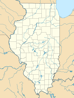
 Nottingham Woods, Illinois
Coordinates: 41°49′47″N 88°27′55″W / 41.82972°N 88.46528°WCoordinates: 41°49′47″N 88°27′55″W / 41.82972°N 88.46528°W Country United States State Illinois County Kane Elevation 732 ft (223 m) Time zone Central (CST) (UTC-6) - Summer (DST) CDT (UTC-5) Area code(s) 630 & 331 GNIS feature ID 414730[1] Nottingham Woods is an unincorporated community in Kane County, Illinois, United States. Nottingham Woods is located on Illinois Route 47 5 miles (8.0 km) north-northwest of Sugar Grove.
References
Municipalities and communities of Kane County, Illinois Cities Aurora‡ | Batavia‡ | Elgin‡ | Geneva | St. Charles‡

Villages Algonquin‡ | Barrington Hills‡ | Bartlett‡ | Big Rock | Burlington | Campton Hills | Carpentersville | East Dundee‡ | Elburn | Gilberts | Hampshire | Hoffman Estates‡ | Huntley‡ | Kaneville | Lily Lake | Maple Park‡ | Montgomery‡ | North Aurora | Pingree Grove | Sleepy Hollow | South Elgin | Sugar Grove | Virgil | Wayne‡ | West Dundee
Townships Aurora | Batavia | Big Rock | Blackberry | Burlington | Campton | Dundee | Elgin | Geneva | Hampshire | Kaneville | Plato | Rutland | St. Charles | Sugar Grove | Virgil
Unincorporated
communitiesAllens Corners | Almora | Bald Mound | Bowes | Coleman | Five Island Park | Fox River Estates | La Fox | Marywood | Meredith | Mooseheart | North Plato | Nottingham Woods | Novak Park | Plato Center | Prestbury | Rainbow Hills | Richardson | Scraper-Moecherville | South Park | Starks | Troxel | Udina | Valley View | Wasco | Wildwood Valley | Youngsdale
Ghost town Footnotes ‡This populated place also has portions in an adjacent county or counties
Categories:- Unincorporated communities in Illinois
- Populated places in Kane County, Illinois
- Chicagoland geography stubs

Wikimedia Foundation. 2010.