- Nong Han District
-
Nong Han
หนองหาน— Amphoe — Amphoe location in Udon Thani Province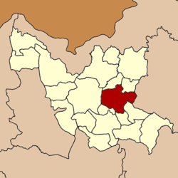
Coordinates: 17°21′38″N 103°6′20″E / 17.36056°N 103.10556°ECoordinates: 17°21′38″N 103°6′20″E / 17.36056°N 103.10556°E Country  Thailand
Province Udon Thani Seat Nong Han Area – Total 708.119 km2 (273.4 sq mi) Population (2005) – Total 114,982 – Density 162.4/km2 (420.6/sq mi) Time zone THA (UTC+7) Postal code 41130 Geocode 4106 Nong Han (Thai: หนองหาน) is a district (Amphoe) of Udon Thani Province, northeastern Thailand.
Contents
Geography
Neighboring districts are (from the south clockwise) Chai Wan, Ku Kaeo, Prachaksinlapakhom, Mueang Udon Thani, Phibun Rak and Thung Fon of Udon Thani Province, and Sawang Daen Din of Sakon Nakhon Province.
History
The archaeological site of Ban Chiang (Thai: มู่ที่ 13 ตำบล บ้านเชียง Hamlet 13 Tambon Ban Chiang) is a world heritage site since 1992. It was settled from neolithic till Iron Age times, and and then abandoned from about 300 AD until the early 19th century. It is most famous for its red painted pottery.
Mueang Nong Han was one of the four original subdivisions of Udon Thani, which were converted into Amphoe during the Monthon thesaphiban administrative reforms in 1908.[1]
Administration
The district is subdivided into 12 subdistricts (tambon), which are further subdivided into 161 villages (muban). There are three subdistrict municipalities (thesaban tambon) - Nong Han, Nong Mek and Ban Chiang each cover parts of the same-named tambon. There are further 12 Tambon administrative organizations (TAO).
No. Name Thai Villages Inh.[2] 1. Nong Han หนองหาน 17 16,902 2. Nong Mek หนองเม็ก 19 14,915 5. Phang Ngu พังงู 15 9,540 6. Sabaeng สะแบง 8 8,015 7. Soi Phrao สร้อยพร้าว 11 5,921 9. Ban Chiang บ้านเชียง 15 11,198 10. Ban Ya บ้านยา 11 5,419 11. Phon Ngam โพนงาม 20 13,381 12. Phak Top ผักตบ 13 8,297 14. Nong Phai หนองไผ่ 14 9,172 17. Don Hai Sok ดอนหายโศก 10 6,496 18. Nong Sa Pla หนองสระปลา 8 6,037 Missing numbers are tambon which now form the districts Phibun Rak and Ku Kaeo.
References
- ^ "แจ้งความกระทรวงมหาดไทย เรื่อง ให้รวมเมืองกมุทธาไส ๑ เมือง กุมภวาปี ๑ เมือง หนองหาย ๑ อำเภอ บ้านหมากแข้ง ๑ ตั้งเป็นเมืองจัตวา เรียกว่าเมืองอุดรธานีบริเวณน้ำชีให้เปลี่ยนเรียกว่าเมืองขอนแก่น บริเวณน้ำเหืองให้เปลี่ยนเรียกว่าเมืองเลย บริเวณสกลนครให้เปลี่ยน เรียกว่าเมืองสกลนคร บริเวณธาตุพนมให้เปลี่ยนเรียกว่าเมืองนครพนม ส่วนเมืองหนองคายเมืองโพนพิสัยให้คงไว้ตามเดิม" (in Thai). Royal Gazette 28 (81): 1088. 1908-01-12. http://www.ratchakitcha.soc.go.th/DATA/PDF/2450/041/1088.PDF.
- ^ "Population statistics 2008". Department of Provincial Administration. http://www.dopa.go.th/xstat/p5141_01.html.
External links
- amphoe.com (Thai)
Mueang Udon Thani · Kut Chap · Nong Wua So · Kumphawapi · Non Sa-at · Nong Han · Thung Fon · Chai Wan · Si That · Wang Sam Mo · Ban Dung · Ban Phue · Nam Som · Phen · Sang Khom · Nong Saeng · Na Yung · Phibun Rak · Ku Kaeo · Prachaksinlapakhom
Categories:- Amphoe of Udon Thani
- Isan geography stubs

Wikimedia Foundation. 2010.