- Nizhneingashsky District
-
Nizhneingashsky District (English)
Нижнеингашский район (Russian)
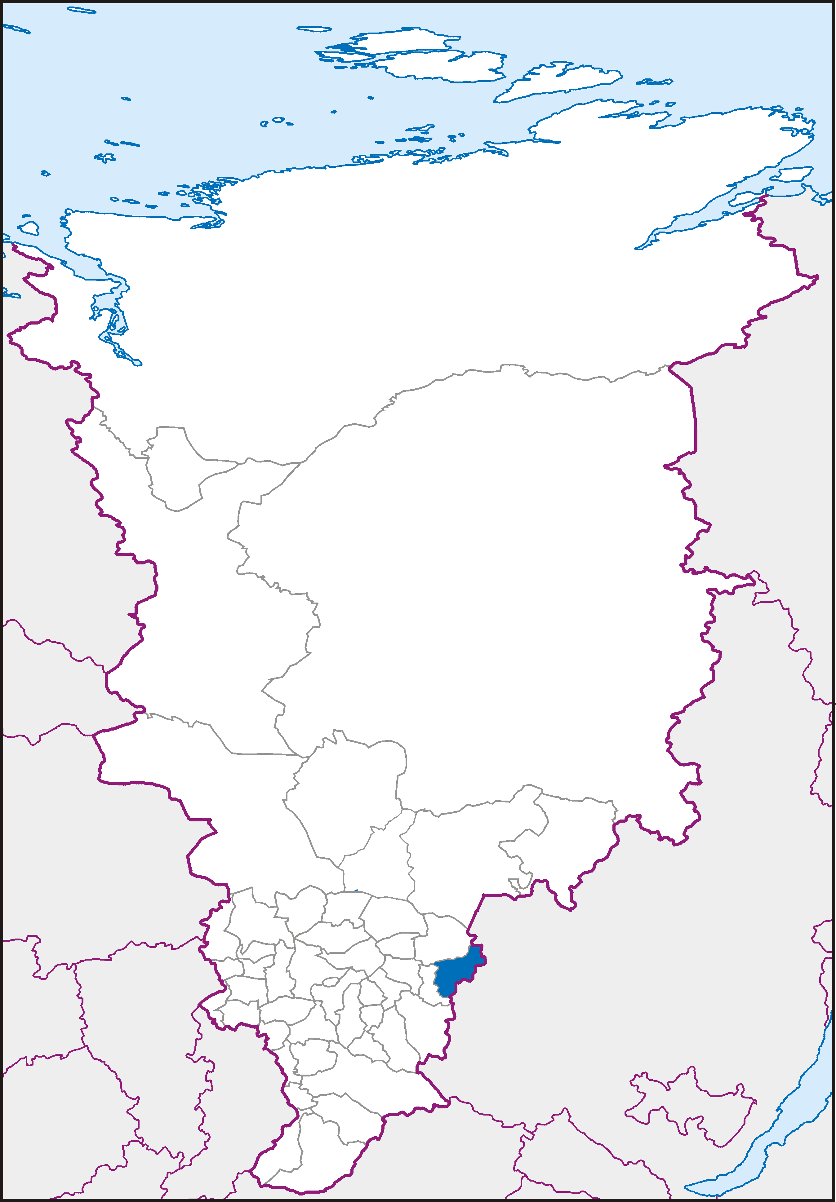
Location of Nizhneingashsky District on the map of Krasnoyarsk KraiAdministrative status (as of 2010) Country Russia Federal subject Krasnoyarsk Krai[1] Administrative center work settlement of Nizhny Ingash[1] # of urban-type settlements 4[2] # of selsoviets 12[2] # of rural localities 61[2] Municipal status (as of April 2009) Municipally incorporated as Nizhneingashsky Municipal District[3] - Head[4] Pyotr A. Malyshkin[2] - Representative body Nizhneingashsky District Council of Deputies[5] - # of urban settlements 4[6] - # of rural settlements 12[6] Statistics Area 6,143 km2 (2,372 sq mi)[2] Population (2010 Census,
preliminary)33,420 inhabitants[7] Population (2002 Census) 39,391 inhabitants[8] - Urban population 59.0% - Rural population 41.0% Density 5 /km2 (13 /sq mi)[9] Time zone KRAST (UTC+08:00)[10] Established April 4, 1924[2] District newspaper Pobeda (Victory)[11] Official website Nizhneingashsky District (Russian: Нижнеинга́шский райо́н) is an administrative and municipal district (raion), one of the forty-three in Krasnoyarsk Krai, Russia. It is located in the eastern portion of the krai and borders with Abansky District in the north, Irkutsk Oblast in the east and southeast, and Ilansky District in the south and west. The area of the district is 6,143 square kilometers (2,372 sq mi).[2] Its administrative center is the urban locality (a work settlement) of Nizhny Ingash.[1] Population: 33,420 (2010 Census preliminary results);[7] 39,391 (2002 Census);[12] 43,800 (1989 Census).[13] Population of Nizhny Ingash accounts for 22.7% of the district's population.[7]
Contents
History
The district was founded on April 4, 1924.[2]
Divisions and government
Administratively, the district is divided into twelve selsoviets, which are municipally incorporated as rural settlements, and four work settlements, which are municipally incorporated as urban settlements. The Head of the District and the Chairman of the District Council[4] is Pyotr A. Malyshkin.[14] As of 2010, the District Council consists of twenty-five deputies.[5][14]
Economy
Transport
The Trans-Siberian Railway runs through the district territory from west to east. Part of the federal highway M53 passes through the district as well.
References
- ^ a b c Государственный комитет Российской Федерации по статистике. Комитет Российской Федерации по стандартизации, метрологии и сертификации. №ОК 019-95 1 января 1997 г «Общероссийский классификатор объектов административно-территориального деления. Код 04», в ред. изменения №168/2011 от 1 октября 2011 г. (State Statistics Committee of the Russian Federation. Committee of the Russian Federation on Standardization, Metrology, and Certification. #OK 019-95 January 1, 1997 Russian Classification of Objects of Administrative Division . Code 04, as amended by the Amendment #168/2010 of October 1, 2011. ).
- ^ a b c d e f Official website of Krasnoyarsk Krai. Information about Nizhneingashsky District (Russian)
- ^ Law #12-2637, Article 2
- ^ a b Charter, Article 6.2
- ^ a b Charter, Article 6.1
- ^ Law #12-2637, Article 1
- ^ a b c Федеральная служба государственной статистики (Federal State Statistics Service) (2011). "Предварительные итоги Всероссийской переписи населения 2010 года (Preliminary results of the 2010 All-Russian Population Census)" (in Russian). Всероссийская перепись населения 2010 года (All-Russia Population Census of 2010). Federal State Statistics Service. http://www.perepis-2010.ru/results_of_the_census/results-inform.php. Retrieved 2011-04-25.
- ^ Федеральная служба государственной статистики (Federal State Statistics Service) (2004-05-21). "Численность населения России, субъектов Российской Федерации в составе федеральных округов, районов, городских поселений, сельских населённых пунктов – районных центров и сельских населённых пунктов с населением 3 тысячи и более человек (Population of Russia, its federal districts, federal subjects, districts, urban localities, rural localities—administrative centers, and rural localities with population of over 3,000)" (in Russian). Всероссийская перепись населения 2002 года (All-Russia Population Census of 2002). Federal State Statistics Service. http://www.perepis2002.ru/ct/doc/1_TOM_01_04.xls. Retrieved 2010-03-23.
- ^ The value of density was calculated automatically by dividing the 2010 Census population by the area specified in the infobox. Please note that this value may not be accurate as the area specified in the infobox does not necessarily correspond to the area of the entity proper or is reported for the same year as the population.
- ^ Правительство Российской Федерации. Постановление №725 от 31 августа 2011 г. «О составе территорий, образующих каждую часовую зону, и порядке исчисления времени в часовых зонах, а также о признании утратившими силу отдельных Постановлений Правительства Российской Федерации». Вступил в силу по истечении 7 дней после дня официального опубликования. Опубликован: "Российская Газета", №197, 6 сентября 2011 г. (Government of the Russian Federation. Resolution #725 of August 31, 2011 On the Composition of the Territories Included into Each Time Zone and on the Procedures of Timekeeping in the Time Zones, as Well as on Abrogation of Several Resolutions of the Government of the Russian Federation. Effective as of after 7 days following the day of the official publication).
- ^ Reestrsmi.info. Газета "Победа" (Russian)
- ^ Федеральная служба государственной статистики (Federal State Statistics Service) (2004-05-21). "Численность населения России, субъектов Российской Федерации в составе федеральных округов, районов, городских поселений, сельских населённых пунктов – районных центров и сельских населённых пунктов с населением 3 тысячи и более человек (Population of Russia, its federal districts, federal subjects, districts, urban localities, rural localities—administrative centers, and rural localities with population of over 3,000)" (in Russian). Всероссийская перепись населения 2002 года (All-Russia Population Census of 2002). Federal State Statistics Service. http://www.perepis2002.ru/ct/doc/1_TOM_01_04.xls. Retrieved 2010-03-23.
- ^ "Всесоюзная перепись населения 1989 г. Численность наличного населения союзных и автономных республик, автономных областей и округов, краёв, областей, районов, городских поселений и сёл-райцентров. (All Union Population Census of 1989. Present population of union and autonomous republics, autonomous oblasts and okrugs, krais, oblasts, districts, urban settlements, and villages serving as district administrative centers.)" (in Russian). Всесоюзная перепись населения 1989 года (All-Union Population Census of 1989). Demoscope Weekly (website of the Institute of Demographics of the State University—Higher School of Economics. 1989. http://demoscope.ru/weekly/ssp/rus89_reg.php. Retrieved 2010-03-23.
- ^ a b Territory of Krasnoyarsk Krai. Nizhneingashsky District (Russian)
Sources
- Законодательное собрание Красноярского края. Закон №12-2637 от 3 декабря 2004 г. «Об установлении границ и наделении соответствующим статусом муниципального образования Нижнеингашский район и находящихся в его границах иных муниципальных образований», в ред. Закона №8-3162 от 23 апреля 2009 г. «О внесении изменения в статью 1 Закона края «Об установлении границ и наделении соответствующим статусом муниципального образования Нижнеингашский район и находящихся в его границах иных муниципальных образований»». Вступил в силу через десять дней после официального опубликования. Опубликован: "Ведомости высших органов государственной власти Красноярского края", №36, 28 декабря 2004 г. (Legislative Assembly of Krasnoyarsk Krai. Law #12-2637 of December 3, 2004 On Establishing the Borders and Granting an Appropriate Status to the Municipal Formation of Nizhneingashsky District and to Other Municipal Formations Within Its Borders, as amended by the Law #8-3162 of April 23, 2009 On Amending Article 1 of the Krai Law "On Establishing the Borders and Granting an Appropriate Status to the Municipal Formation of Nizhneingashsky District and to Other Municipal Formations Within Its Borders". Effective as of ten days after the official publication).
- Нижнеингашский районный Совет депутатов. Решение №6-58 от 21 января 1998 г. «Устав муниципального образования Нижнеингашский район Красноярского края (текст в ред. от 9 февраля 2010 г.)», в ред. Решения №7-88 от 23 декабря 2010 г «О внесении изменений и дополнений в Устав муниципального образования Нижнеингашский район Красноярского края». Вступил в силу в соответствии со статьёй 59. Опубликован: "Победа", 15 апреля 1998 г. (Nizhneingashsky District Council of Deputies. Decision #6-58 of January 21, 1998 Charter of the Municipal Formation of Nizhneingashsky District of Krasnoyarsk Krai (text of rev. of February 8, 2010), as amended by the Decision #7-88 of December 23, 2010 On Amending and Supplementing the Charter of the Municipal Formation of Nizhneingashsky District of Krasnoyarsk Krai. Effective as of the date determined in accordance with the provisions of Article 59).
Cities and towns Achinsk · Bogotol · Borodino · Divnogorsk · Kansk · Lesosibirsk · Minusinsk · Nazarovo · Norilsk · Sharypovo · Sosnovoborsk · Yeniseysk · Zelenogorsk* · Zheleznogorsk*

Urban-type settlements Balakhta · Beryozovka · Bolshaya Irba · Bolshaya Murta · Chibizhek · Dubinino · Goryachegorsk · Insha · Kedrovy** · Koshurnikovo · Kozulka · Krasnokamensk · Kuragino · Motygino · Nizhny Ingash · Nizhnyaya Poyma · Novochernorechensky · Pamyati 13 Bortsov · Podgorny · Podtyosovo · Pokanayevka · Predivinsk · Rassvet · Razdolinsk · Sayansky · Severo-Yeniseysky · Shushenskoye · Snezhnogorsk · Solnechny** · Strelka · Svetlogorsk · Teya · Tinskoy · Ural · Yemelyanovo · Yuzhno-Yeniseysky · Zelyony BorAdministrative districts Abansky · Achinsky · Balakhtinsky · Beryozovsky · Birilyussky · Bogotolsky · Boguchansky · Bolshemurtinsky · Bolsheuluysky · Dzerzhinsky · Evenkiysky · Idrinsky · Ilansky · Irbeysky · Kansky · Karatuzsky · Kazachinsky · Kezhemsky · Kozulsky · Krasnoturansky · Kuraginsky · Mansky · Minusinsky · Motyginsky · Nazarovsky · Nizhneingashsky · Novosyolovsky · Partizansky · Pirovsky · Rybinsky · Sayansky · Severo-Yeniseysky · Sharypovsky · Shushensky · Sukhobuzimsky · Taseyevsky · Taymyrsky Dolgano-Nenetsky · Turukhansky · Tyukhtetsky · Uyarsky · Uzhursky · Yemelyanovsky · Yeniseysky · Yermakovsky*Closed cities and towns under the federal governance
**Closed urban-type settlements under the federal governanceCategories:- Districts of Krasnoyarsk Krai
- States and territories established in 1924
Wikimedia Foundation. 2010.