- Narrawong, Victoria
-
Narrawong
Victoria
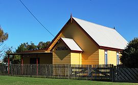
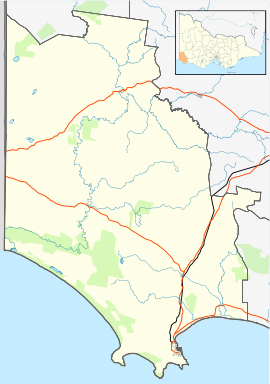
Mechanics' hall at NarrawongPopulation: 176[1] Postcode: 3285 Coordinates: Coordinates: 38°15′S 141°42′E / 38.25°S 141.7°E Location: - 344 km (214 mi) SW of Melbourne
- 18 km (11 mi) NE of Portland
- 8 km (5 mi) SW of Tyrendarra
LGA: Shire of Glenelg State District: South-West Coast Federal Division: Wannon Narrawong is a small town in south west Victoria, Australia located on the Princes Highway to the east of Portland at the mouth of the Surry River.
Narrawong Post Office opened on 1 March 1859. [2]
At the 2006 census, Narrawong and the surrounding area had a population of 176.[1]
References
- ^ a b Australian Bureau of Statistics (25 October 2007). "Narrawong (State Suburb)". 2006 Census QuickStats. http://www.censusdata.abs.gov.au/ABSNavigation/prenav/LocationSearch?collection=Census&period=2006&areacode=SSC26301&producttype=QuickStats&breadcrumb=PL&action=401. Retrieved 1008-10-17.
- ^ Premier Postal History, Post Office List, https://www.premierpostal.com/cgi-bin/wsProd.sh/Viewpocdwrapper.p?SortBy=VIC&country=, retrieved 2008-04-11
Towns in the Shire of Glenelg Categories:- Towns in Victoria (Australia)
- Victoria (Australia) geography stubs
- Coastal towns in Victoria (Australia)
Wikimedia Foundation. 2010.


