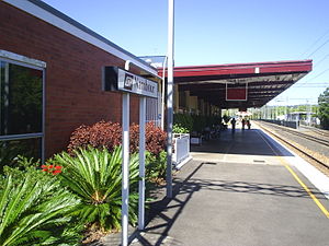
Nambour railway station

Nambour railway station
Nambour
QRNambour06.JPG
Station statistics
Address Civic Way, Nambour
Coordinates 26°37′31″S 152°57′30″E / 26.6253°S 152.9582°E / -26.6253; 152.9582Coordinates: 26°37′31″S 152°57′30″E / 26.6253°S 152.9582°E / -26.6253; 152.9582
Lines
Platforms 2 total (1 island platform)
Other information
Accessible Handicapped/disabled access
Owned by Queensland Rail
Fare zone 17 (TransLink)
Services
Preceding station   Queensland Rail   Following station
Woombye
toward Roma Street
Nambour and Gympie North Line
Yandina
toward Gympie North

Nambour Station is a railway station on the Nambour and Gympie North Line of South East Queensland, Australia. It is part of the Queensland Rail City network.

The station is in Zone 17 of the TransLink integrated public transport system.

It is the terminus for the Nambour trains, with peak-hour and limited weekend services continuing to stations further north. The station is also serviced by a number of local bus routes to Noosa, Maroochydore and Mooloolaba also included in the Translink Network. The railbus that supports the Nambour and Gympie North Line train service on week days also terminates here.

Nambour is also served by daily Traveltrain services to Bundaberg, Rockhampton, Longreach, Townsville and Cairns including the flagship QR Tilt Train.

Services by platform

Platform Line Destination Notes
1 Nambour & Gympie North
Nambour & Gympie North
Traveltrain
City
Gympie North
North & Central Qld
Express
All stations
All stops
2 Nambour & Gympie North City Express

See also

External links


Wikimedia Foundation. 2010.

Игры ⚽ Нужна курсовая?

Look at other dictionaries:

  • Nambour railway station, Queensland — Citytrain Station station name=Nambour region=Sunshine Coast servicearea1=Nambour and Gympie North IB1=Woombye OB1=Yandina street=Civic Way suburb=Nambour zone=17 distance=104.8 platforms=2 platform arch=1 island access=Civic Way trainconnect=yes …   Wikipedia

  • Cooroy railway station — Cooroy Station statistics Address Elm Street, Cooroy Coordinates …   Wikipedia

  • Northgate railway station — Northgate Station statistics Address Ridge Street, Northgate …   Wikipedia

  • Cooran railway station — Cooran Station statistics Address Railway Road, Cooran Coordinates …   Wikipedia

  • Mooloolah railway station — Mooloolah Station statistics Address Mooloolah Connection Road, Mooloolah Valley Coordinates …   Wikipedia

  • Nambour, Queensland — Nambour Sunshine Coast, Queensland Nambour s Sunshine Coast Regional Council Offices …   Wikipedia

  • Caboolture railway station, Brisbane — Citytrain Station station name=Caboolture region=Northern Region servicearea1=Nambour and Gympie North IB1=Petrie OB1=Elimbah servicearea2=Caboolture IB2=Morayfield street=Matthew Terrace suburb=Caboolture, Queensland zone=8 distance=49.57… …   Wikipedia

  • Central railway station, Brisbane — Citytrain Station station name=Central region=Brisbane Central servicearea1=Airport IB1=Roma Street OB1=Brunswick Street servicearea2=Beenleigh IB2=Brunswick Street OB2=Roma Street servicearea3=Caboolture IB3=Roma Street OB3=Brunswick Street… …   Wikipedia

  • Landsborough railway station, Queensland — Citytrain Station station name=Landsborough region=Sunshine Coast servicearea1=Nambour and Gympie North IB1=Beerwah OB1=Mooloolah street=Cribb Street suburb=Landsborough zone=13 distance=82.5 platforms=2 platform arch=2 side access=Main entrance… …   Wikipedia

  • Brunswick Street railway station, Brisbane — Citytrain Station station name=Brunswick Street region=Brisbane Central servicearea1=Airport servicearea2=Beenleigh servicearea3=Caboolture servicearea4=Cleveland servicearea5=Corinda via South Brisbane servicearea6=Doomben servicearea7=Ferny… …   Wikipedia

Share the article and excerpts

Direct link
Do a right-click on the link above
and select “Copy Link”