- Namao, Alberta
-
 NamaoFor other uses, see Namao.
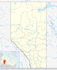
Namao is a hamlet in central Alberta, Canada within Sturgeon County.[1] It is located at the intersection of Highway 37 and Highway 28, approximately 7 kilometres (4.3 mi) north of Edmonton's city limits. It was the name sake of RCAF Station Namao, now CFB Edmonton, which is directly south of the hamlet.
Contents
Demographics
The population of Namao according to Sturgeon County's 2008 municipal census is 10.[2]
Climate
Climate data for Namao Month Jan Feb Mar Apr May Jun Jul Aug Sep Oct Nov Dec Year Record high °C (°F) 10
(50)13.9
(57.0)16.3
(61.3)29.6
(85.3)31.9
(89.4)33.9
(93.0)33.9
(93.0)33.9
(93.0)32.8
(91.0)28.4
(83.1)18.9
(66.0)10.6
(51.1)33.9
(93.0)Average high °C (°F) −7.6
(18.3)−5.3
(22.5)1.3
(34.3)10.6
(51.1)17.3
(63.1)20.5
(68.9)22.2
(72.0)21.4
(70.5)16.3
(61.3)10.5
(50.9)−0.6
(30.9)−6.2
(20.8)8.4 Average low °C (°F) −16.6
(2.1)−14.8
(5.4)−8.2
(17.2)−1.1
(30.0)4.8
(40.6)8.8
(47.8)10.8
(51.4)9.7
(49.5)4.7
(40.5)−0.7
(30.7)−9.1
(15.6)−15
(5)−2.2 Record low °C (°F) −42.2
(−44.0)−38
(−36)−35
(−31)−23.3
(−9.9)−7.2
(19.0)−1.1
(30.0)2.8
(37.0)−2
(28)−7.8
(18.0)−24.5
(−12.1)−35.4
(−31.7)−39.2
(−38.6)−42.2
(−44.0)Precipitation mm (inches) 19.7
(0.776)14
(0.55)17.3
(0.681)20.2
(0.795)44.7
(1.76)88.6
(3.488)95.7
(3.768)74.8
(2.945)39.6
(1.559)16.4
(0.646)14.3
(0.563)21
(0.83)466.3
(18.358)Source: Environment Canada[3] See also
- List of communities in Alberta
- List of hamlets in Alberta
References
- ^ Alberta Municipal Affairs (2010-04-01). "Specialized and Rural Municipalities and Their Communities". http://municipalaffairs.gov.ab.ca/documents/msb/2010-ruralmun.pdf. Retrieved 2010-07-04.
- ^ Capital Region Board. "Planning Toolkit, Module 5 – Implementation Guidelines for Growth Areas Outside of Priority Growth Areas (PGAs) and Cluster Country Residential Areas (CCRAs)". http://www.capitalregionboard.ab.ca/images/Documents/Toolkit/module5-implementationguidelinesforgrowthareasoutsideofpgasandccras.pdf. Retrieved 2010-08-30.
- ^ Environment Canada—Canadian Climate Normals 1971–2000. Retrieved 23 March 2010.
 Subdivisions of Alberta
Subdivisions Regions · Census divisions · Municipal districts (counties) · Specialized municipalities · School districts · Regional health authoritiesCommunities Cities · Towns · Villages · Summer villages · Hamlets · Indian reserves · Métis settlements · Ghost towns · Designated placesCities and Urban
Service AreasAirdrie · Brooks · Calgary · Camrose · Cold Lake · Edmonton (capital) · Fort McMurray · Fort Saskatchewan · Grande Prairie · Lacombe · Leduc · Lethbridge · Lloydminster · Medicine Hat · Red Deer · Sherwood Park · Spruce Grove · St. Albert · Wetaskiwin Category ·
  Portal ·
  WikiProject
Coordinates: 53°42′58″N 113°29′32″W / 53.71611°N 113.49222°W
Categories:- Hamlets in Alberta
- Sturgeon County, Alberta
- Central Alberta geography stubs

Wikimedia Foundation. 2010.