- Naguru, Uganda
-
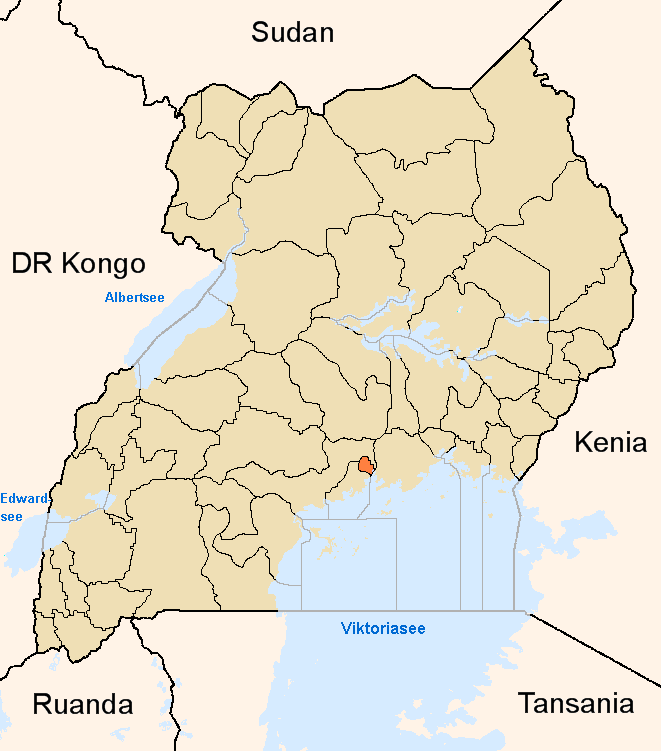
Naguru Map of Kampala showing the location of Naguru
 Naguru
Coordinates: 00°20′48″N 32°36′20″E / 0.34667°N 32.60556°E Country  Uganda
Region Central Uganda District Kampala Capital City Authority Division Nakawa Division Elevation 1,300 m (4,265 ft) Time zone EAT (UTC+3) Naguru is a hill in Kampala, the capital and largest city in Uganda.
Contents
Location
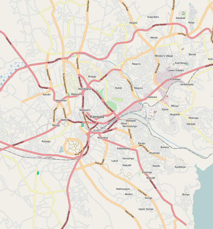
Naguru is bordered by Ntinda to the east, Nakawa to the southeast, Namuwongo to the south, Kololo to the southwest, Kamwookya to the west, Bukoto to the northwest and Kigoowa to the north. The coordinates of Naguru Hill are:00 20 48N, 32 36 20E (Latitude:0.34653331; Longitude:32.6055).
Overview
Naguru Hill rises 1,300 metres (4,300 ft) above sea level. It is the highest of all the hills in Kampala. The view from this hill is incredible; one can see the tops of most of the other hills: Kololo, Muyenga, Mbuya and Mutungo. The top of the hill houses many radio and telecommunication masts for the many communication companies in the city. The upper reaches of the hill are also the location of upscale residential mansions with manicured lawns. The well-landscaped hill also boasts of good guesthouses and recreation centers. These include:
- Lugogo Rugby Club
- Lugogo Tennis Club
- Lugogo Cricket Club
Also at the base of the hill is the Uganda Manufacturers Association (UMA) show ground, where the annual trade fairs are staged. There is also a police barracks.[1]
Landmarks
Landmarks on Naguru Hill or near the hill include:
- Naguru Police Barracks
- Naguru Sanyu Babies Home - A private orphanage administered by Sanyu Babies Homes, an NGO.
- Naguru Housing Estate - A public housing project, destined for demolition and modernization
- Naguru General Hospital - A 200 bed public hospital built with assistance of the Chinese Government and administered by the Uganda Ministry of Health.[2]
External links
See also
References
Kampala District Capital: KampalaDivisions Neighborhoods Bugoloobi · Bukoto · Busega · Butabika · Bwaise · Ggaba · Kabalagala · Kamwookya · Kansanga · Kaleerwe · Kanyanya · Kasubi · Katwe · Kawaala · Kawempe · Kibuli · Kibuye · Kigoowa · Kikaaya · Kisaasi · Kiwaatule · Kulambiro · Kololo · Kyambogo · Kyebando · Lubaga · Lungujja · Luzira · Makerere · Makindye · Mbuya · Mengo · Mpererwe · Mulago · Munyonyo · Mutundwe · Muyenga · Naakulabye · Naguru · Najjanankumbi · Nakasero · Nakawa · Namirembe · Namungoona · Namuwongo · Nateete · Ndeeba · Nsambya · Ntinda · Old Kampala · Port Bell · Wandegeya 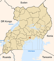
Economy Air Uganda · Aya Group · Quality Chemical Industries Limited · Mukwano Group · Ruparelia Group · Bank of Uganda · ABC Capital Bank · Bank of Africa · Bank of Baroda · Barclays Bank · DFCU Group · Cairo International Bank · Centenary Bank · Citibank · Crane Bank · DFCU Bank · Diamond Trust Bank · Ecobank · Equity Bank · Fina Bank · Global Trust Bank · Housing Finance Bank · Imperial Bank Uganda · Kenya Commercial Bank · National Bank of Commerce · Orient Bank · PostBank Uganda · Stanbic Bank · Standard Chartered Bank · Tropical Bank · United Bank for Africa · East African Development Bank · Uganda Development Bank · National Housing and Construction Company · Uganda Air Cargo · International Medical Group · National Social Security Fund · Umeme · Uganda Securities Exchange · Uganda Investment Authority · Capital Markets Authority · The Monitor · New Vision · New Vision Group · Uganda Telecom · Mercantile Credit Bank · Pride Microfinance Limited · Uganda Finance Trust Limited · Opportunity Uganda Limited · Kyagalanyi Coffee Limited · FINCA Uganda Limited · UGAFODE Microfinance LimitedNotable
landmarksBulange · Uganda Parliament Buildings · Butabika National Referral Hospital · Mulago Hospital Complex · Nsambya Hospital · Rubaga Hospital · Mengo Hospital · International Hospital Kampala · Kibuli Hospital · Kampala Capital City Authority Complex · Kampala Serena Hotel · Hotel Africana · Kampala Sheraton Hotel · Imperial Hotels Group · Imperial Royale Hotel · Grand Imperial Hotel · Hotel Equatoria · Kampala Hilton Hotel · Kampala Intercontinental Hotel · Kampala Speke Hotel · East African Development Bank Building · Bank of Uganda Building Complex · Mengo Palace · St. Paul's Cathedral Namirembe · St. Mary's Cathedral Lubaga · Makerere University Main Campus · Kibuli Mosque · Old Kampala Mosque · Kampala Airport · Uganda Museum · Uganda National Cultural Centre · Kampala Northern Bypass Highway · Kampala-Jinja Highway · Kasubi Tombs · Roman Catholic Archdiocese of KampalaEducation Makerere University · Makerere University Business School · Kampala International University · Kampala University · Kyambogo University · Law Development Centre · International Health Sciences University · International University of East Africa · Makerere College School · Rubaga Community School · Saint Lawrence University · Uganda Management Institute · Cavendish University Uganda · Victoria University Uganda · Uganda Martyrs University School of MedicineNotable people Apolo Nsibambi · Nasser Ntege Sebaggala · David Serwadda · Fred Ruhindi · John Ssebaana Kizito · Bulaimu Muwanga Kibirige · Erias Lukwago · Dr. Ian Clarke · Jennifer Musisi · Maria Kiwanuka · Laurence Sematimba · Joseph Kizito · Justinian Tamusuza · Robert Ssejjemba · Eugene Sseppuya · Phillip Ssozi · Wasswa Serwanga · Yusef Sozi · Derrick SebagalaCategories:- Neighborhoods in Kampala
- Central Region, Uganda
- Kampala District
- Kampala
- Nakawa Division
Wikimedia Foundation. 2010.