Nagambie railway station

Nagambie railway station
NagambieNagambie
Overview of the station from the Shepparton end

Station information
Code NGE
Distance from
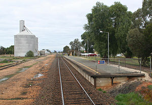
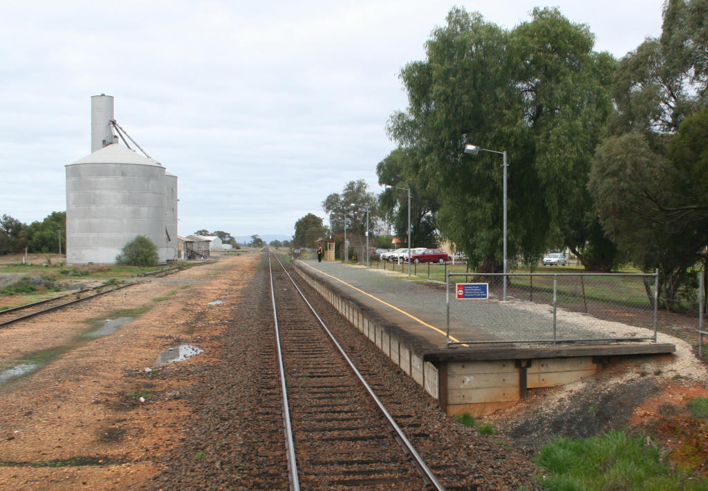
Southern Cross
126.115 km[1]
Operator V/Line
Lines Shepparton
# Platforms 1
# Tracks 1
Status Unmanned Station
Viclink profile Link
Coordinates 36°47′08″S 145°09′37″E / 36.7855°S 145.1604°E / -36.7855; 145.1604Coordinates: 36°47′08″S 145°09′37″E / 36.7855°S 145.1604°E / -36.7855; 145.1604

Nagambie is a railway station on the Goulburn Valley railway in Nagambie, Victoria, Australia. The station is served by V/Line passenger trains on the Shepparton Line.

The station opened with the railway from Mangalore to Shepparton on 13 January 1880.[2] The station is located north of the Goulburn Street level crossing. Only a small shelter is provided on the platform, with grain silos and fertiliser sheds located on a single siding that faces Shepparton.
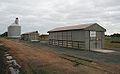
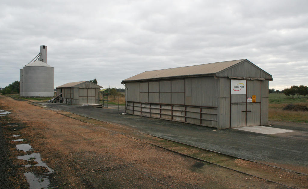
References

  1. ^ V/Line. "Seymour to Tocumwal". Network Access Information Pack. www.vline.com.au. http://www.vline.com.au/rna/rna/information_pack.html. Retrieved 13 July 2008. 
  2. ^ Bob Whitehead (2008). Tocumwal Railway Centenary. 

Tabilk was located towards Seymour, and Wahring was located towards Murchison East


Wikimedia Foundation. 2010.

Игры ⚽ Нужна курсовая?

Look at other dictionaries:

  • Nagambie railway station, Victoria — VlineRailwayStation1 NAME=Nagambie IMAGELINK=Nagambie overview.jpg CAPTION=Overview of the station from the Shepparton end CODE=NGE DISTANCE=126.115 km [cite web url=http://www.vline.com.au/rna/rna/information pack.html title=Seymour to Tocumwal… …   Wikipedia

  • Cobram railway station — Cobram Station information Line Cobram Distance from Southern Cross 249.841 km Number of platforms 1 Number of tracks 2 Station status …   Wikipedia

  • Nagambie, Victoria — Nagambie Victoria Memorial Park and main street …   Wikipedia

  • Murchison East railway station — Murchison East Present passenger shelter Station information …   Wikipedia

  • Murchison East railway station, Victoria — VlineRailwayStation1 NAME=Murchison East IMAGELINK=Murchison East passenger shelter.jpg CAPTION=Present passenger shelter CODE=MST DISTANCE=149.24 km LINES=Shepparton PLATFORMS=1 TRACKS=1 STATUS=Unmanned Station FACILITIES=… …   Wikipedia

  • Seymour railway station, Victoria — VlineRailwayStation1 NAME=Seymour IMAGELINK=Seymour station from road.jpg CAPTION=Station building and yard viewed from Station Street CODE=SEY DISTANCE=101.69 km LINES=Albury Wodonga Shepparton. PLATFORMS=3 (2 BG, 1 SG) TRACKS= STATUS=Staffed… …   Wikipedia

  • Tabilk railway station, Victoria — VictorianClosedRailwayStation NAME= Tabilk IMAGELINK=Tabilk station site.jpg CAPTION=Looking south towards the former station site, platform mound to the left LINE=Goulburn Valley DISTANCE=157.9 km PLATFORMS= 0 TRACKS= 1 STATUS=Closed OPENED=1880 …   Wikipedia

  • Shepparton railway line — Tocumwal railway line redirects here. For the closed line in New South Wales, see Tocumwal railway line, New South Wales. Shepparton railway line, Victoria Line details Opened 1860 L …   Wikipedia

  • List of regional railway stations in Victoria — This is a list of the currently operating Victorian regional railway stations serviced by V/Line operated trains. The stations make up 7 radial passenger train lines, which all operate out of Southern Cross Station in Melbourne, Australia, with 2 …   Wikipedia

  • Hume Highway — Hume Freeway Proposed …   Wikipedia

Share the article and excerpts

Direct link
Do a right-click on the link above
and select “Copy Link”