- Nador Port
-
Port Nador 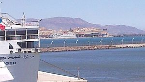
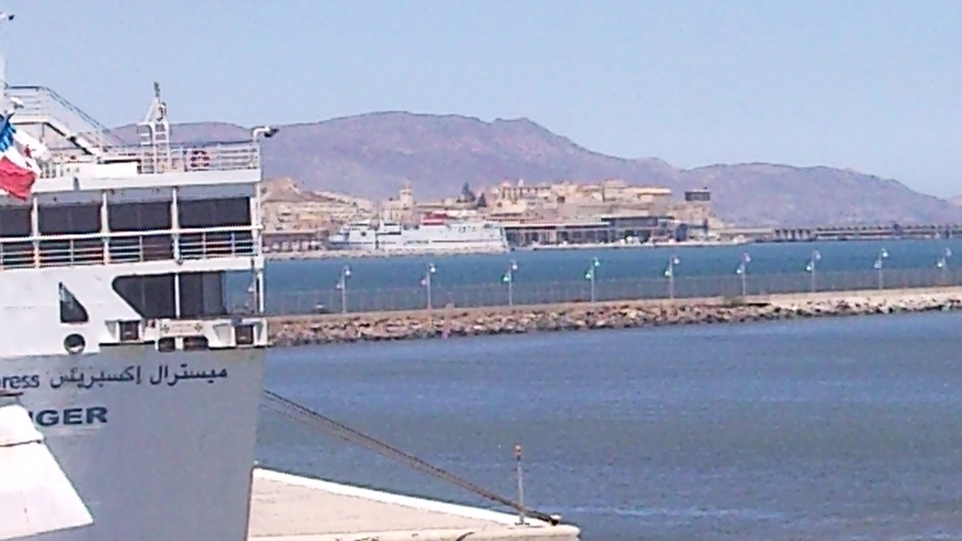
Ferry in Nador with the border pier in the background Location Country Morocco Location Bin Anşār
Nador (10 km.)Coordinates 35°10′N 2°34′W / 35.17°N 2.57°W Details Operated by Societe D'Exploitation des Ports (SODEP) Type of harbor goods, fish, ferry Piers 1000 m goods-pier, 600 m ferry, 100 m hydro-carbons Statistics Annual cargo tonnage 2,6 million tons (2007)[1]
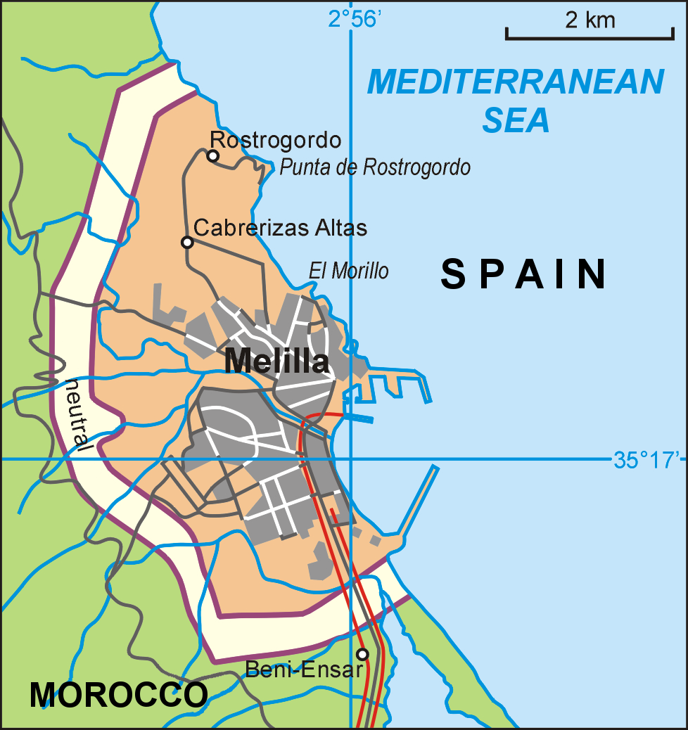
1,6 m T import, 1,0 m T export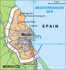 Map of Melilla showing Nador port
The port of Nador is a commercial port on the Mediterranean Sea servicing the Rif area of Northern Morocco. The port is officially in Bin Anşār (or Beni Ansar) and shares it piers and entrance with the port of the Spanish enclave Melilla. It is a semi-artificial port using the Bou Areg Lagoon[1].
Contents
Usage
The port is directly connected to the Spanish enclave Melilla: the port of Melilla uses aprox 70% of the wet area while Nador port uses the remaining 30% of the south-east area. The port offers a relative small fishing-port, 700 metres of deep-water keys (13 metre deep) and another 300 metre keys with a water-depth of 10 metres. This Terminal 2 is a bulk goods terminal receiving bulk-goods such as ore and billets for the nearby steel-mill SONASID.
There is also a 100 metre long pier for reception of hydrocarbons (waterdepth: 13 metres).
The Nador Port Ferry terminal provides with 600 metre keys for Roll-on/roll-off ferries and elevated foot-bridges for foot-passengers.
Connections
Ferry links to mainland Europe
There are several ferry-companies operating daily sailings to and from Almeria in Spain (port). The main operators are:[2][3]
- FerriMaroc
- Acciona Trasmediterranea
- Euroferries
- Comanav (Nador to Sete in France)
Rail and Road connecions in Morocco
The new railway from Taourirt to Nador doesn't terminate in Nador itself but is extended to Beni Ansar. Beni Ansar Port is the terminus station for the branch-line to Taourirt, where it connects to the East-West mainline for trips to Oujda in the east or Rabat, Casablanca and Marrakech.
By road the National road N19 gives a direct connection to the city of Nador itself (8 miles) and beyond.
Nearby airports are Melilla Airport and Nador International Airport
References
- ^ a b World Port Source about Port Nador, retrieved 31 July 2010
- ^ Ferry Maroc 2010
- ^ AFerry booking site for Ferries to Morocco
Categories:- Mediterranean port cities and towns in Morocco
- Ports and harbours of Morocco
- Nador
Wikimedia Foundation. 2010.