- Na Haeo District
-
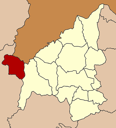
Na Haeo
นาแห้ว— Amphoe — Amphoe location in Loei Province
Coordinates: 17°29′6″N 101°4′12″E / 17.485°N 101.07°ECoordinates: 17°29′6″N 101°4′12″E / 17.485°N 101.07°E Country  Thailand
Province Loei Seat Na Haeo Tambon Muban Amphoe established Area – Total 628.0 km2 (242.5 sq mi) Population (2005) – Total 11,011 – Density 17.5/km2 (45.3/sq mi) Time zone THA (UTC+7) Postal code 42170 Geocode 4206 Na Haeo (Thai: นาแห้ว; IPA: [nāː hɛ̂w]) is the westernmost district (amphoe) of Loei Province, northeastern Thailand.
Contents
History
Na Haeo area was the rural part of Dan Sai district. For the people in Na Haeo it was inconvenient to contact to the public services due to the large distance. The government split off the two tambon Na Haeo and Na Phueng from Dan Sai district and created a minor district (King Amphoe) on February 15 1970.[1] It was upgraded to a full district on September 8 1976.[2]
Geography
Neighboring districts are (from the east clockwise) Dan Sai of Loei Province, Nakhon Thai and Chat Trakan of Phitsanulok Province. To the north is the Xaignabouli Province of Laos.
The important water resource is the Hueang River.
The Phu Suan Sai National Park is located in this district.
Administration
The district is subdivided into 5 subdistricts (tambon), which are further subdivided into 34 villages (muban). Na Haeo is a township (thesaban tambon) which covers parts of the tambon Na Haeo. There are further 4 Tambon administrative organizations (TAO).
No. Name Thai name Villages Inh. 1. Na Haeo นาแห้ว 7 2,020 2. Saeng Pha แสงภา 6 1,782 3. Na Phueng นาพึง 8 2,123 4. Na Ma La นามาลา 8 2,920 5. Lao Ko Hok เหล่ากอหก 5 2,166 References
- ^ "ประกาศกระทรวงมหาดไทย เรื่อง แบ่งท้องที่ตั้งเป็นกิ่งอำเภอ" (in Thai). Royal Gazette 87 (17 ง): 854. March 3 1970. http://www.ratchakitcha.soc.go.th/DATA/PDF/2513/D/017/854.PDF.
- ^ "พระราชกฤษฎีกาตั้งอำเภอเลาขวัญ อำเภอคำม่วง อำเภอพิปูน อำเภอศรีเทพ อำเภอนาแห้ว อำเภอส่องดาว อำเภอควนกาหลง อำเภอค่ายบางระจัน อำเภอบ้านตาขุน และอำเภอกุดจับ พ.ศ. ๒๕๑๙" (in Thai). Royal Gazette 93 (109 ก special): 31–34. September 8 1976. http://www.ratchakitcha.soc.go.th/DATA/PDF/2519/A/109/31.PDF.
External links
Mueang Loei · Na Duang · Chiang Khan · Pak Chom · Dan Sai · Na Haeo · Phu Ruea · Tha Li · Wang Saphung · Phu Kradueng · Phu Luang · Pha Khao · Erawan · Nong Hin
Categories:- Amphoe of Loei
- Isan geography stubs
Wikimedia Foundation. 2010.