- NOAA Hurricane Hunters
-

The NOAA Hurricane Hunters work under the Aircraft Operations Center (AOC), located on MacDill Air Force Base in Tampa, Florida. The Aircraft Operations Center is under the Office of Marine and Aviation Operations (OMAO), which is a branch of the National Oceanic and Atmospheric Administration (NOAA). NOAA is part of the Department of Commerce. The AOC has resided at MacDill AFB since January 1993.
Contents
About
The NOAA Hurricane Hunters conduct research using special aircraft in order to support NOAA's mission of predicting changes in the Earth's environment and managing coastal and marine resources. AOC crews fly through hurricanes to help forecasters and scientists gather both operational and research data. In addition, the crews do a number of other research projects - including ocean wind studies, winter storm research, thunderstorm research, coastal erosion, and air chemistry flights to name a few.
Currently, AOC staff members are working to bring all of their post flight data collected during missions to the World Wide Web. When the website is completed it will be posted here.
Mission
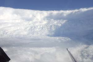
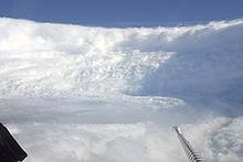 NOAA P-3 inside the eye of Hurricane Katrina
The OMAO mission states:
"To safely and efficiently operate NOAA ships and aircraft, incorporate emerging data acquisition technologies, and provide a specialized professional team responsive to NOAA programs."
The OMAO vision states:
"To be the best in class for sea and air operations and data acquisition for NOAA and the Nation."
Aircraft
NOAA uses the Lockheed WP-3D Orion and Gulfstream IV-SP for most of its weather-related missions; however NOAA also uses light aircraft for some of its research. In conjunction with Jim Henson Productions, NOAA has two P-3s nicknamed 'Kermit' (NOAA42) and 'Miss Piggy' (NOAA43). The G-IV (NOAA49) is nicknamed 'Gonzo'. The Air Force Reserve Command's 53d Weather Reconnaissance Squadron Hurricane Hunters use the Lockheed WC-130J for their hurricane missions. The 53rd WRS Hurricane Hunters are located at Keesler Air Force Base in Biloxi, Mississippi.
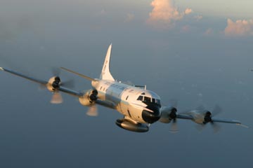
P-3
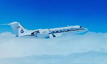
 NOAA's Lockheed WP-3D Orion
The P-3s were designed to tolerate large amounts of damage since they are the aircraft that actually fly into the eye of hurricanes.[1] The P-3 can be thought of as a flying research lab as it is equipped to take atmospheric measurements. One of the most distinct parts of the P-3 is the giant circular black belly radar.
A normal hurricane reconnaissance or research mission can last from 9–10 hours, while a surveillance mission will typically last 8 hours. Most often, the scientists and crew aboard the aircraft deploy dropsondes with GPS which collect and transmit data as it descends toward the ocean. Once this data is received and QC'd by the crew, it is sent to the NOAA National Hurricane Center for analysis. Other data is collected and transmitted by request. Personnel on board include pilots, navigators, engineers, technicians, and flight meteorologists (Flight Directors).
Projects in the past have included a low level jet experiment over South America, a bow echo and mesoscale convective study in the Midwest, and ocean wind satellite verification missions over the Northern Atlantic and Pacific.
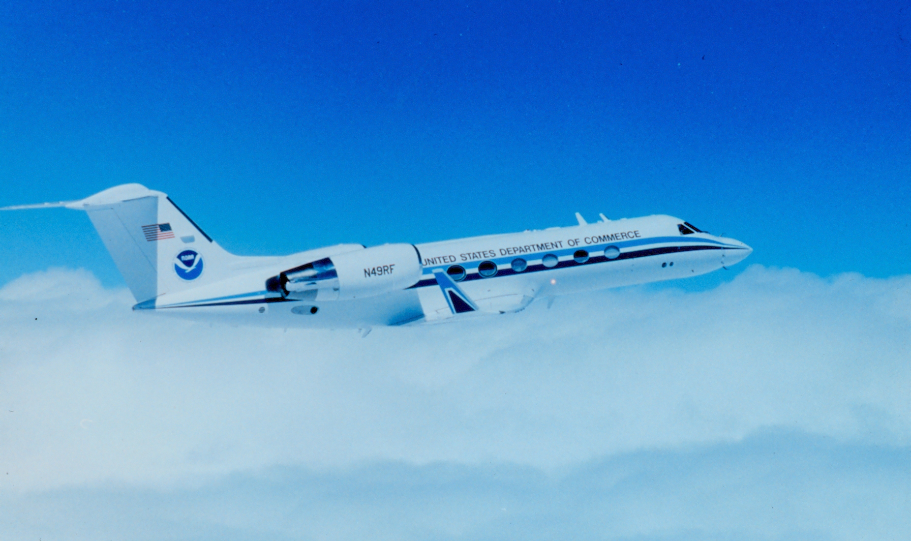
G-IV
 NOAA's Gulfstream IV-SP
The G-IV is a high altitude jet that can fly up to 45,000 feet. The G-IV has a similar crew to the P-3 with pilots, engineers, technicians, and a flight meteorologist (Flight Director)
The G-IV flies around the periphery of both tropical and winter storms, including hurricanes, and drops sondes in order to gather data about the surrounding environment. This information is used to help predict the path of hurricanes. The dropsonde message is collected and QC'd by an on-board Flight Director, who then transmits the message to the National Centers for Environmental Prediction (NCEP) and the National Hurricane Center (NHC) for analysis.
The G-IV serves the NCEP Winter Storm Reconnaissance program every year in order to better predict the location and intensity of winter storms that head for the United States. The program was started by NCEP (National Center for Environmental Prediction). During the winter storm reconnaissance, air chemistry measurements are also taken from the upper troposphere. These flights are typically flown from Honolulu, Anchorage, or Yokota AB, Japan.
References
- ^ Hunting Hugo - first-hand account of near-disastrous flight into the eye of Hurricane Hugo in 1989
External links
- The NOAA Hurricane Hunters Flight Science Homepage
- Aircraft Operations Center
- Office of Marine and Aviation Operations
- National Oceanic and Atmospheric Administration
- Department of Commerce
Categories: National Oceanic and Atmospheric Administration | United States Department of Commerce agencies
Wikimedia Foundation. 2010.