- New Jersey Route 163
-
Route 163
Route information Maintained by New Jersey Department of Transportation Length: 0.30 mi[1] (0.48 km) Existed: 1953 – present Major junctions South end:  US 46 in Delaware
North end: Dead end in Delaware Highway system New Jersey State Highway Routes
Interstate and US←  Route 162
Route 164  →
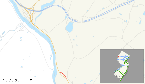
→Route 163 is a short 0.30-mile (0.48 km) long state highway in the county of Warren in New Jersey. The route, which is currently a stub, used to be the approach to the destroyed Delaware Bridge, which was a road bridge over the Delaware River, connecting the settlement of Delaware, New Jersey with Portland, Pennsylvania. Until 1953, the bridge carried U.S. Route 46 over the river. The bridge has been destroyed, but the approaches are still state-maintained. A still-existing bridge carries an abandoned ex-Delaware, Lackawanna and Western Railroad line across the river just north of the former road crossing. The unsigned Route 163 runs from US 46 north to a dead end on the east side of US 46, all in Knowlton Township, New Jersey. From the dead end, the bridge approach continued northwest and west over US 46 to the bridge.
Contents
Route description
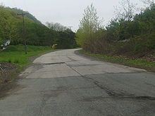 NJ 163 in Knowlton Township with its original pavement
New Jersey Route 163 begins at an intersection with U.S. Route 46 and Roy Ace Road in the community of Delaware. The highway heads to the north along Lackawanna Road. Route 163 passes several residences to the north and a short stretch of homes to the south. There is a short intersection with an unnamed local road. After that intersection, Route 163 passes a truck stop that is visible on both Route 46, which parallels to the south, and the short state highway. There is another short truck stop before an intersection with a return ramp to Route 46. Route 163 officially terminates at a barricaded dead-end near Hemlock Hill Road.[2]
History
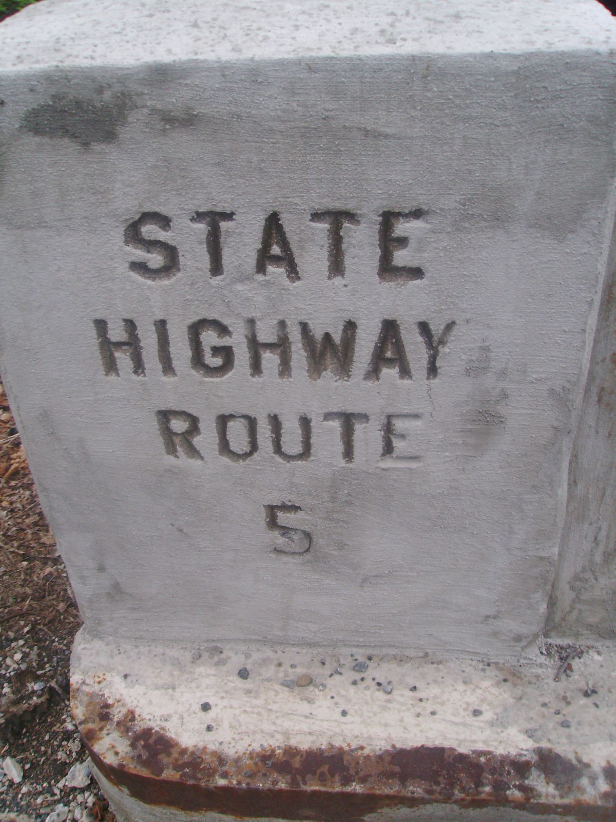
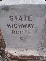 Bridge stamp for pre-1927 Route 5 along Route 163See also: Darlington's Bridge at Delaware Station
New Jersey Route 163 originated as an alignment of U.S. Route 46 (co-signed with New Jersey State Highway Route 6).[3] The alignment of 6 and 46 went along the alignment of the original State Highway Route 5 from the early 1920s, stretching from Newark to the bridge over the Delaware River at Delaware.[4] The route was decommissioned when the 1927 renumbering occurred.[5] After that renumbering, the route became State Highway Route 6, a co-designation to U.S. Route 46,[5] which had been assigned the prior year.[6] The two highway designations remained intact until the 1953 renumbering, when Route 6 was decommissioned in favor of using the U.S. 46 designation.[7] U.S. Route 46 was realigned once again when the Portland-Columbia Toll Bridge opened in 1953,[8] when the alignment of the highway was changed to head along former State Highway Route 8[3] (mostly New Jersey Route 94), where it ended at U.S. Route 611 and NJ 94, where its current terminus is located.[9] After the realigning of the Delaware Bridge alignment, the route was renumbered to New Jersey Route 163.[9][10] Two years later, the Delaware Bridge was swept away in floods caused by Hurricane Connie and Diane in 1955, which took out several other bridges over the Delaware.[8]
Major intersections
The entire route is in Delaware, Warren County.
Mile[1] Destinations Notes 0.00 US 460.30 Dead of the highway near railroad bridge 1.000 mi = 1.609 km; 1.000 km = 0.621 mi See also
 U.S. Roads portal
 New Jersey portal
References
- ^ a b New Jersey Department of Transportation. "Route 163 straight line diagram". http://www.state.nj.us/transportation/refdata/sldiag/00000163__-.pdf. Retrieved March 26, 2007.
- ^ Yahoo Maps (2009). Overview map of NJ Route 163 (Map). Cartography by NAVTEQ Incorporated. http://maps.yahoo.com/#mvt=m&lat=40.89195&lon=-75.063229&zoom=16&q1=40.89607%2C-75.068379&q2=40.898827%2C-75.071769. Retrieved June 23, 2009.
- ^ a b New Jersey Highway Department (1927). Sketch Map Showing Approximate Locations of State Highway Routes (Map). http://www.jimmyandsharonwilliams.com/njroads/1920s/route05.htm. Retrieved June 23, 2009.
- ^ New Jersey Highway Department (1925). State Highway Route map (Map). http://www.jimmyandsharonwilliams.com/njroads/1920s/route05.htm. Retrieved June 23, 2009.
- ^ a b State of New Jersey, Laws of 1927, Chapter 319.
- ^ Bureau of Public Roads, United States System of Highways, November 11, 1926
- ^ 1953 renumbering. New Jersey Department of Highways. http://en.wikisource.org/wiki/1953_New_Jersey_state_highway_renumbering. Retrieved July 31, 2009
- ^ a b Dale, Frank T. (2003). Bridges Over The Delaware River: A History of Crossings. Rutgers University Press. ISBN 9780813532134. http://books.google.com/?id=dDDDUlaQUYgC&pg=PA141&lpg=PA141&dq=Shohola+-+Barryville+Bridge. Retrieved June 23, 2009.
- ^ a b New Jersey Department of Transportation (2007). New Jersey Official Road Map (Map). Cartography by New Jersey Department of Transportation.
- ^ New Jersey Department of Transportation (1988). New Jersey Official Road Map (Map). Cartography by New Jersey Department of Transportation.
External links
Categories:- State highways in New Jersey
- Transportation in Warren County, New Jersey


Wikimedia Foundation. 2010.