Muddy River (Washington)

Muddy River (Washington)
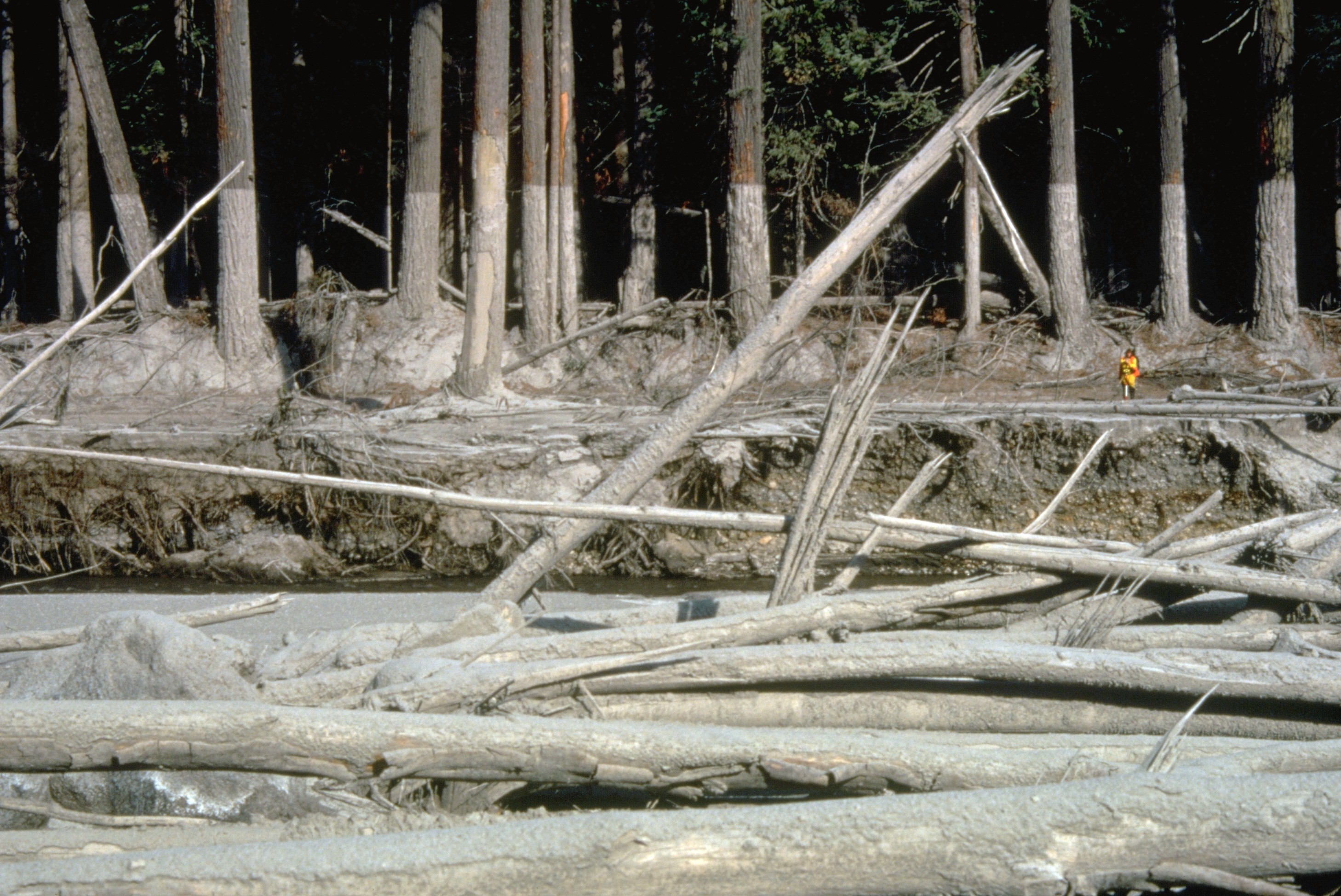
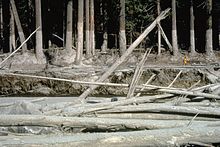
Mudline left behind on the trees on the banks of the Muddy River show how high the lahars from the 1980 eruption reached here

The Muddy River is a river to the southeast of Mount St. Helens in Washington, USA. The Muddy River flows south-south east and joins the Lewis River just above the Swift Reservoir. The Lewis River flows west and is a tributary to the Columbia River. The east flank of Mount St. Helens is within the watershed of Muddy Creek.[1]

During the 1980 eruption of Mount St. Helens, lahars (volcanically-induced mud and debris flows) swept through its channel.[2]

References

  1. ^ Mount St. Helens, Washington Major Hydrologic Features USGS map
  2. ^ Brantley; Power (1985). "Debris Flows, Mudflows, Jökulhlaups, and Lahars: Lahar Section". US Geological Survey Cascades Volcano Observatory. http://vulcan.wr.usgs.gov/Glossary/Lahars/description_lahars.html. Retrieved 2 September 2010. 

External links


Wikimedia Foundation. 2010.

Игры ⚽ Нужна курсовая?

Look at other dictionaries:

  • Muddy River (disambiguation) — There are several places named Muddy River: Muddy River, a river in Nevada Muddy River, Massachusetts Muddy River (Washington), a river in the state of Washington This disambiguation page lists articles associated with the same title. If an …   Wikipedia

  • Big Muddy River — The Big Muddy River is located in Illinois. It joins the Mississippi River south of Murphysboro, Illinois. The Big Muddy has been dammed near Benton, Illinois, forming Rend Lake.The Big Muddy has a mud bottom for most of its length. This is… …   Wikipedia

  • Little Muddy River (Illinois) — The Little Muddy River is a major tributary of the Big Muddy River in Illinois. It forms the boundary between Franklin and Perry Counties, Illinois.Cities and countiesThe following cities and towns are drained by the Little Muddy: *Ashley… …   Wikipedia

  • Muddy Branch — is a tributary stream of the Potomac River in Montgomery County, Maryland, located about 14 miles (23 km) northwest of Washington, D.C. The headwaters of the stream originate in Gaithersburg, and the stream flows southwest for 11.9 miles (19 …   Wikipedia

  • Potomac River — Coordinates: 37°59′57″N 76°14′59″W / 37.99917°N 76.24972°W / 37.99917; 76.24972 …   Wikipedia

  • Liste der Flüsse in Washington — Diese Liste der Flüsse in Washington nennt die Flüsse in diesem Bundesstaat der Vereinigten Staaten nach Einzugsgebieten und in alphabetischer Reihenfolge geordnet. Inhaltsverzeichnis 1 Nach Einzugsgebieten 1.1 Straße von Georgia 1.2 Puget Sound …   Deutsch Wikipedia

  • List of rivers of Washington — This is a list of rivers in the U.S. state of Washington.By Drainage BasinThis list is arranged by drainage basin, with respective tributaries indented under each larger stream s name.Strait of Georgia* Fraser River (BC) **Chilliwack River… …   Wikipedia

  • Monongahela River — For other uses, see Monongahela (disambiguation). Coordinates: 40°26′30″N 80°00′58″W / 40.44167°N 80.01611°W / 40.44167; 80.01611 …   Wikipedia

  • Charles River Dam — Charles River Dam. Pump building is on the left, locks are in the middle. Note colored chimes on railing …   Wikipedia

  • Ohanapecosh River — Coordinates: 46°40′40″N 121°35′4″W / 46.67778°N 121.58444°W / 46.67778; 121.58444 …   Wikipedia

Share the article and excerpts

Direct link
Do a right-click on the link above
and select “Copy Link”