- Mount Whitney Trail
-
Mount Whitney Trail 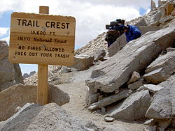
Trail Crest, at 13,600 feet (4,150 m) Length 22 miles (35.4 km) Location Inyo National Forest, Inyo County, California, USA Trailheads Whitney Portal [1] Use Hiking Elevation Change Over 6,100 feet (1,860 m) Highest point Mount Whitney 14,505 feet (4,421 m) Lowest point Whitney Portal 8,360 feet (2,548 m) Trail difficulty Strenuous Months Peak season is May to November The Mount Whitney Trail is a trail that climbs Mount Whitney. It starts at Whitney Portal, 13 miles (21 km) west of the town of Lone Pine, California. The hike is about 22 miles (35 km) round trip, with an elevation gain of over 6,100 feet (1,860 m). It is an extremely popular trail, and its access is restricted by quotas from May to October.[2]
Contents
History
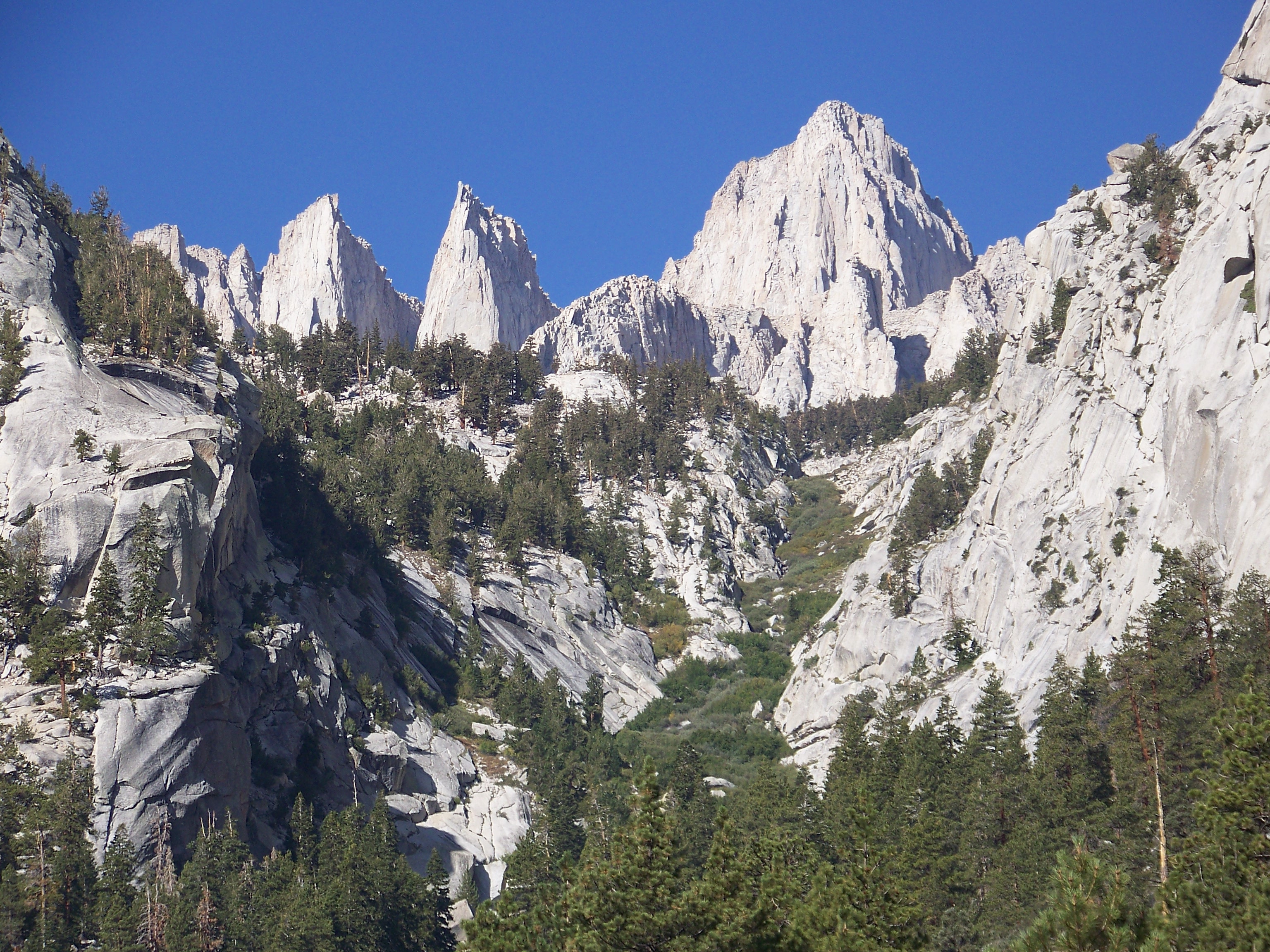
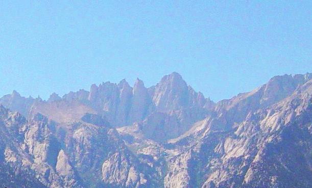
 View of the summit from Whitney Portal, where the Mount Whitney Trail begins.
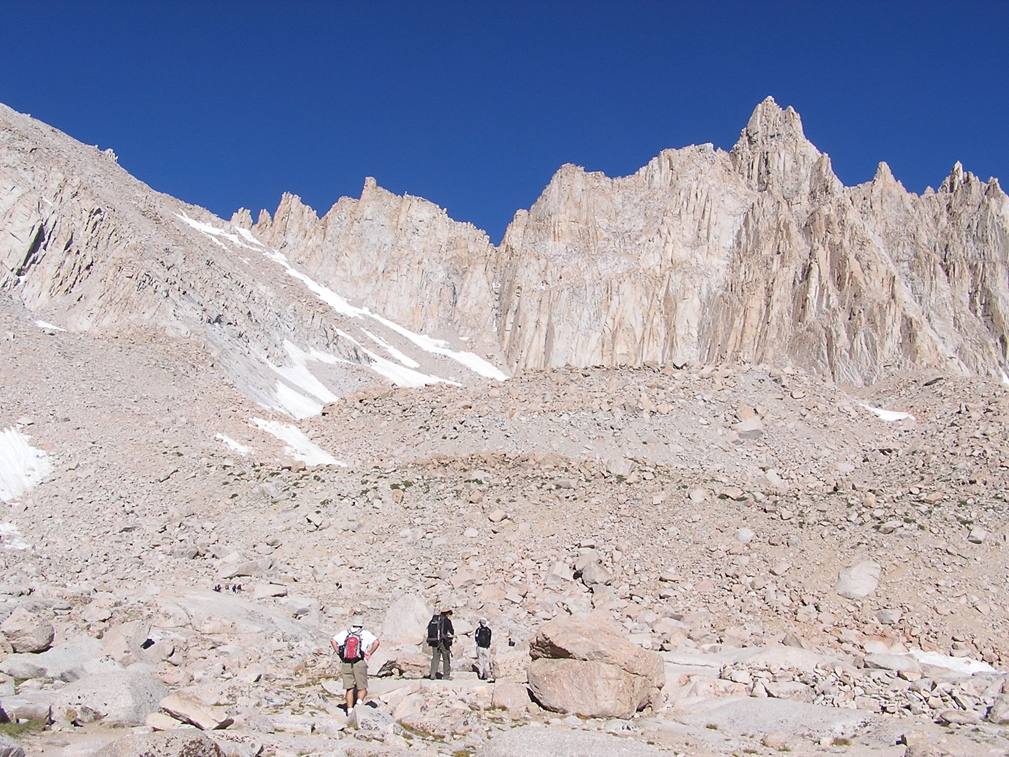
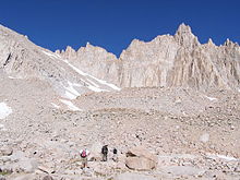 The start of the switchbacks near Trail Camp. Mount Muir is in the background
 Some of the 99 switchbacks approaching Trail Crest. Trail Camp is adjacent to the small lake to the left.
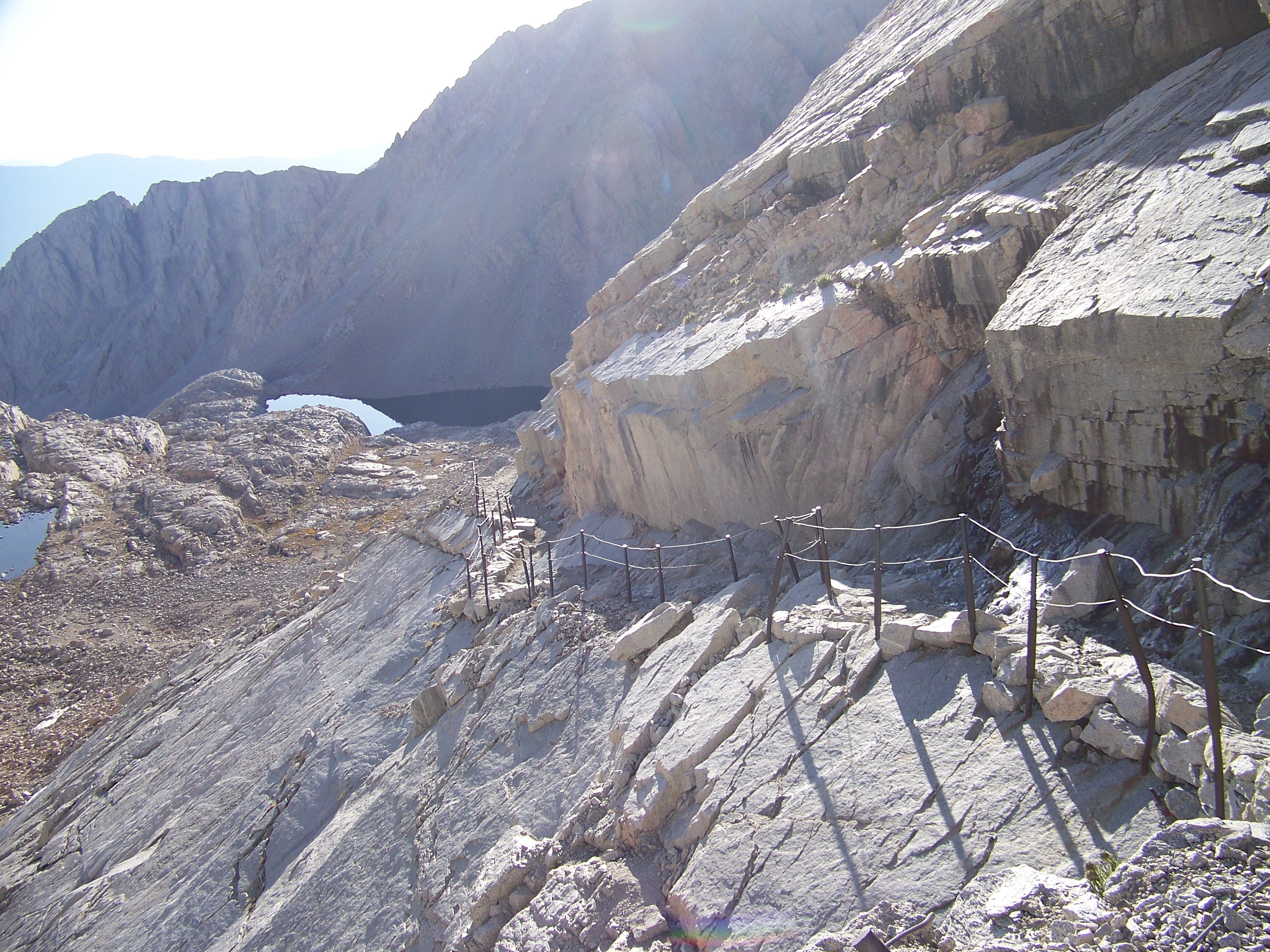
 One steep section of the Mount Whitney Trail is protected by cable handrails
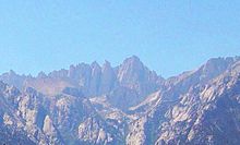 Mount Whitney from the Alabama Hills
The original pack trail from Lone Pine to the summit of Mount Whitney was designed by local engineer Gustave Marsh. This original trail, opened on July 22, 1904, was the basis for most of today's Mount Whitney Trail.[3]
Route
The Mount Whitney Trail starts at Whitney Portal. Almost anyone in good physical shape with a desire to succeed has a good chance of hiking to the summit.[4] The trail does not head up the direct route to the summit by the North Fork of Lone Pine Creek, as this is a very steep route used by mountaineers. Instead, it follows the gentler main branch of Lone Pine Creek to its source, and then climbs by 99 switchbacks to the Sierra crest about 2-1/2 miles south of the summit. The trail then travels very close to the crest of the range until reaching the summit plateau. This longer "dogleg" route makes possible a standard hiking trail. During peak season the trail is well-maintained and easy to follow.[5] Once the mountain clears of snow and ice, usually in early to mid summer, it requires no mountaineering or winter gear. Beyond Trail Crest the trail loses a small amount of elevation that is gained on the return. In this final stretch of the trail, on the west side of Whitney's needle-like south ridge, some sections of the trail must be rebuilt after each winter. The views here of the interior High Sierra can be extraordinary, due in part to the precipitous exposure. The crowning views are had on the summit of Whitney, where the trail ends at the Smithsonian Institution Shelter.[6]
A single day hike of the trail usually starts between 2 and 4 AM. Most day hikers will complete the trip in between 10 and 20 hours. Because of the length, distance and high altitude of the trail, hiking it in a single day requires some fitness and endurance.
Management
The Mount Whitney Trail, from above Lone Pine Lake to Trail Crest, lies within the special Mount Whitney Zone of the Inyo National Forest. Due to the high volume of trail users, the Forest Service enforces special regulations here to preserve Whitney's wild character. Wilderness permits are always required to use the trail, and between May 1 and November 1, a quota permits only 60 overnight users and 100 day users per day.[2]
Camping
Camping is allowed along most of the trail, more than 100 feet (30 m) from water, but level ground that meets that description is extremely limited, so most backpackers congregate in two camps. Outpost Camp, the lower of the two camps, is 3.8 miles (6.1 km) by trail from Whitney Portal, at 10,365 feet (3,159 m). It is sheltered by trees, near a waterfall and Bighorn Meadow. Trail Camp, is 6.3 miles (10.1 km) from the trail head at 12,000 feet (3,700 m), in a rocky, often windy, alpine basin. This is also the last place where there is a reliable water source. The lake at the trail camp has algae from the human waste deposits and is usually purified before drinking. A water pump, or purifying and neutralizing tablets, work well. Depending on conditions, clean water may be found in springs on the switchbacks. Most overnight backpackers will take between 2 and 4 days to complete this trip.
Human waste
Human waste management was a major problem at Mount Whitney, and in 2006 the Inyo National Forest instituted a mandatory "pack it out" program. The Forest Service removed the solar latrines at Outpost Camp and Trail Camp, and instead issue "WAG Bags" to trail users for human waste. Used bags must be deposited in special containers for that purpose located at the Whitney Portal trailhead.[7]
Bear canisters
From May 25 to October 31, backpackers are required to carry a bear-resistant canister;[2] these can be rented at the Interagency Visitors Center south of Lone Pine or the Whitney Portal Store for a nominal fee. Black bears are common along the Mount Whitney Trail. Night sightings of these bears are not unusual. When traveling at night, hikers are advised to wield a bright headlight and a shrill whistle; making many strange, loud noises will alert the bears to human presence. If possible, hikers should travel in a larger group as bears are much less likely to approach a group than a single person.
Weather
The High Sierra, including Mount Whitney, has unpredictable weather patterns. Lightning is a frequent occurrence at the peak on summer afternoons.
References
- ^ "Mount Whitney Trail". Geographic Names Information System, U.S. Geological Survey. http://geonames.usgs.gov/pls/gnispublic/f?p=gnispq:3:::NO::P3_FID:267036. Retrieved 2009-01-15.
- ^ a b c "Recreational Activities - Mount Whitney Zone Map". Inyo National Forest website. http://www.fs.fed.us/r5/inyo/recreation/wild/zonelarge.shtml. Retrieved 2009-02-12.
- ^ "Mt. Whitney's Early Days". Mount Whitney History. Lone Pine Chamber of Commerce. http://www.lonepinechamber.org/history/whitneyhist2.html. Retrieved 2009-02-01.
- ^ Richins, Jr., Paul (2001). Mount Whitney: The Complete Trailhead-to-Summit Hiking Guide. Seattle: The Mountaineers Books. pp. pages 113–121. ISBN 0-89886-766-5.
- ^ Croft, Peter; Wynne Benti (2008). "Chapter 5". Climbing Mt. Whitney: The Complete Hiking & Climbing Guide (3rd edition ed.). Bishop, CA: Spotted Dog Press. pp. pages 73–76. ISBN 1-893343-14-6.
- ^ Wenk, Elizabeth, One Best Hike: Mt. Whitney (Wilderness Press, Berkeley, 2008) ISBN 978-0-89997-464-4
- ^ "Managing Your Human Waste While Visiting Mt. Whitney". Inyo National Forest. United States Forest Service. http://www.fs.fed.us/r5/inyo/recreation/wild/packitout.shtml. Retrieved 2007-08-12.
External links
Coordinates: 36°33′56″N 118°15′59″W / 36.56556°N 118.26639°W
Categories:- Hiking trails in California
- Sierra Nevada (U.S.)
- Protected areas of Inyo County, California
- Inyo National Forest


Wikimedia Foundation. 2010.