- Mount Unabetsu
-
Mount Unabetsu 海別岳 Location of Mount Unabetsu in Japan.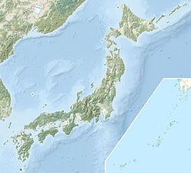
 Mount Unabetsu
Elevation 1,419.3 m (4,656 ft) [1] Prominence 910 [1] Parent peak Mount Rausu Listing List of mountains and hills of Japan by height Pronunciation Japanese: [unabetsudake] Location Location Hokkaido, Japan Range Shiretoko Peninsula Coordinates 43°52′25″N 144°51′56″E / 43.87361°N 144.86556°ECoordinates: 43°52′25″N 144°51′56″E / 43.87361°N 144.86556°E[1] Topo map Geospatial Information Authority 25000:1 海別岳
25000:1 朱円
50000:1 斜里Geology Type Stratovolcano Age of rock Quaternary Volcanic arc/belt Kurile arc Last eruption ca. 0.5 million years ago Mount Unabetsu (海別岳 Unabetsu-dake) is a quaternary stratovolcano[2]. Its summit is 1,419.3 metres (4,656 ft)[1]. It is located on Hokkaido's Shiretoko Peninsula on the border of Shari in Shari District, Abashiri and Shibetsu in Shibetsu District, Nemuro.
Geology
The mountain is made mainly of andesite and basalt.[2]
References
- ^ a b c d "地図閲覧サービス 2万5千分1地形図名: 海別岳(斜里)" (in Japanese). 25000:1 Topographical maps. Geographical Survey Institute. http://watchizu.gsi.go.jp/watchizu.aspx?b=435236&l=1445236. Retrieved 14 January 2010.
- ^ a b "UNABETSU-DAKE". Quaternary Volcanoes in Japan. Geological Survey of Japan, AIST.. 2006. http://riodb02.ibase.aist.go.jp/strata/VOL_JP/EN/vol/223.htm. Retrieved 14 January 2010.
Categories:- Stratovolcanoes
- Volcanoes of Hokkaidō
- Mountains of Hokkaidō

Wikimedia Foundation. 2010.