- Mount Rosa (Colorado)
-
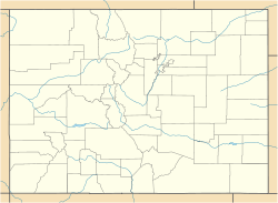
Mount Rosa Teller County, Colorado, USA Elevation 11,499 ft (3,505 m) [1] Prominence 499 ft (152 m) [1] Location Range Front Range Coordinates 38°45′15″N 104°56′53″W / 38.75417°N 104.94806°WCoordinates: 38°45′15″N 104°56′53″W / 38.75417°N 104.94806°W[2] Mont Rosa is a mountain in the Front Range of the Rocky Mountains, 9 mi (14 km) southwest of downtown Colorado Springs, Colorado, in Teller County in the United States of America.[3] Mt. Rosa is part of the Pikes Peak Massif, standing at 11,499 ft (3,505 m) above sea level. Mt. Rosa rises 5,475 ft (1,669 m) above downtown Colorado Springs and is among the taller summits on the city's skyline.[4]
Hikers may access Mt. Rosa and its summit by way of several hiking trails in the area. The most common route is the Frosty Park Route, and may accessed by taking Old Stage/Gold Camp Road (which begins in the Broadmoor neighborhood) about 12.5 miles west until Forest Road 379 is reached. FR 379 is a rough 4wd road and should only be driven using a vehicle that has both 4wd and high clearance, (there's one stream crossing near the beginning of the road which may have a substantial amount of water in it, depending on the season). Take FR 379 for about 1.5 miles until you reach a large clearing on the western flank on Mt. Rosa. Park here, and hike along the unnamed trail to the right of the clearing until you reach trail 672. Follow trail 672 up the western flank of Mt. Rosa until it tops out on the windswept, north ridge. Take the trail that follows the ridge up and south to Mt. Rosa's summit, (if you continue, you'll head down the eastern flank of Mt. Rosa and into Buffalo Canyon). Follow this trail for about half a mile until you reach the summit of Mt. Rosa.[5]
References
- ^ a b "Mount Rosa, Colorado". Peakbagger.com. http://www.peakbagger.com/peak.aspx?pid=28460. Retrieved 2011-11-11.
- ^ "Mount Rosa". Geographic Names Information System, U.S. Geological Survey. http://geonames.usgs.gov/pls/gnispublic/f?p=gnispq:3:::NO::P3_FID:193407. Retrieved 2011-11-11.
- ^ "Mount Rosa Summit". mountainzone.com. http://www.mountainzone.com/mountains/detail.asp?fid=1258156. Retrieved 2011-11-11.
- ^ "HAPPY TRAILS MOUNT ROSA, the hard way". findarticles.com. http://findarticles.com/p/articles/mi_qn4191/is_20041112/ai_n10042126/. Retrieved 2011-11-11.
- ^ "Mount Rosa". summitpost.org. http://www.summitpost.org/mount-rosa/152698. Retrieved 2011-11-11.
Categories:- Mountains of Colorado
Wikimedia Foundation. 2010.

