- Nyamuragira
-
Nyamuragira 
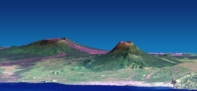
Nyamuragira (left) and Nyiragongo (right). Vertical scale exaggerated (1.5x).Elevation 3,058 m (10,033 ft) [1] Location Nord-Kivu, Democratic Republic of the Congo
 Nyamuragira
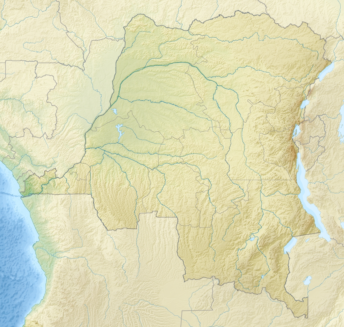
Range Virunga Mountains Coordinates 1°25′S 29°12′E / 1.408°S 29.2°ECoordinates: 1°25′S 29°12′E / 1.408°S 29.2°E[1] Geology Type Shield volcano Last eruption 8 November 2011 Nyamuragira (Derived from the Kinyarwanda verb 'Kuragira inka', meaning to herd cows; Inka means cow or cows) is an active volcano in the Virunga Mountains of the Democratic Republic of the Congo, situated about 25 km north of Lake Kivu.
It has been described as Africa's most active volcano and has erupted over 40 times since 1885.[2] As well as eruptions from the summit, there have been numerous eruptions from the flanks of the volcano, creating new smaller volcanoes that have lasted only for a short time (e.g. Murara from late 1976 to 1977).
It erupted in 2010 and on 8 November 2011.
Contents
Geography and geology
Nyamuragira volcano is an active volcano in the Virunga Mountains of the Democratic Republic of the Congo, situated about 25 km north of Lake Kivu. It is in the Province of Nord-Kivu. (It is 13 km north-north-west of Nyiragongo, the volcano which caused extensive damage to the city of Goma in its 2002 eruption.)
Nyamuragira has a volume of 500 cubic km, and covers an area of 1,500 km2. It has a low shield profile, and contrasts with adjacent steep-sided Nyiragongo volcano.
Sulphur Dioxide
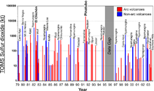 Sulfur dioxide emissions by volcanoes, 1979-2003.
Nyamuragira volcano is responsible for a large portion of the sulfur dioxide released into the atmosphere by volcanoes.
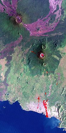 Lava flows from Nyamuragira (upper left) extend to Lake Kivu.
2010 eruption
At dawn on 2 January 2010, Nyamuragira began spewing out lava flows. There are no settlements close to the volcano, but wildlife officials feared that the eruption may threaten the chimpanzees in the area. Another danger was that the lava could have flowed into the southern sector of Virunga National Park, where there are settlements and villages.[3]
Extensive lava flows from the 2010 eruption can be seen on satellite photographs[4] reaching 25 km south-west to Lake Kivu, about 22 km north-west and 35 km north-north-east.
2011 eruption
The volcano erupted again on 8 November 2011.[5]
See also
References
- ^ a b "Nyamuragira". Global Volcanism Program, Smithsonian Institution. http://www.volcano.si.edu/world/volcano.cfm?vnum=0203-02=. Retrieved 22 August 2006.
- ^ "Volcano erupts in Congo". CNN. 2 January 2010. http://articles.cnn.com/2010-01-02/world/congo.volcano_1_lava-volcano-eruption?_s=PM:WORLD. Retrieved 13 February 2011.
- ^ "DR Congo Volcano Eruption Threatens Rare Chimpanzees". BBC News. 2 January 2010. http://news.bbc.co.uk/2/hi/africa/8437742.stm. Retrieved 2 January 2010.
- ^ Google Earth shows the crater and lava flows very clearly at coordinates -1.408333, 29.200000
- ^ "Congo Volcano Erupts: Video". The Guardian. 8 November 2011. http://www.guardian.co.uk/world/video/2011/nov/08/congo-volcano-erupts-video. Retrieved 8 November 2011.
External links
Categories:- Shield volcanoes
- Active volcanoes
- Virunga Mountains
- Volcanoes of the Great Rift Valley
- Mountains of the Democratic Republic of the Congo
- Volcanoes of the Democratic Republic of the Congo
- Lake Kivu


Wikimedia Foundation. 2010.