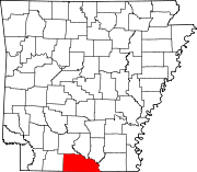
Mount Holly — ist der Name mehrerer Orte in den Vereinigten Staaten: Mount Holly (Arkansas) Mount Holly (North Carolina) Mount Holly (South Carolina) Mount Holly (New Jersey) Mount Holly (Ohio) Mount Holly (Vermont) Mount Holly Township (New Jersey) Diese Sei … Deutsch Wikipedia
Mount Holly Cemetery — U.S. National Register of Historic Places … Wikipedia
Mount Holly — is the name of several places in the United States (by state) Mount Holly Cemetery, Little Rock, AR, listed on the NRHP in Arkansas Mount Holly Mausoleum, Little Rock, AR, listed on the NRHP in Arkansas Mount Holly Ski Area, Holly, Michigan Mount … Wikipedia
Mount Holly Mausoleum — Coordinates: 34°44′19.91″N 92°16′44.23″W / 34.7388639°N 92.2789528°W / 34.7388639; 92.2789528 … Wikipedia
Arkansas locations by per capita income — Arkansas is the forty eighth richest state in the United States of America, with a per capita income of $16,904 (2000). Arkansas Places Ranked by Per Capita Income # Morrison Bluff, Arkansas ndash; $56,436 # Prairie Creek, Arkansas ndash; $37,355 … Wikipedia
National Register of Historic Places listings in Little Rock, Arkansas — Location of Little Rock in Arkansas This is a list of the National Register of Historic Places listings in Little Rock, Arkansas. This is intended to be a complete list of the properties and districts on the National Register of Historic Places… … Wikipedia
List of high schools in Arkansas — This is a list of high schools in the state of Arkansas.Arkansas County*DeWitt High School, DeWitt *Gillett High School, Gillett *Humphrey High School, Humphrey *Stuttgart High School, StuttgartAshley County*Crossett High School, Crossett… … Wikipedia
Quapaw Quarter, Little Rock, Arkansas — The Quapaw Quarter of Little Rock, Arkansas is a section of the city including its oldest and most historic business and residential neighborhoods. The name of the area was first given in 1961, honoring the Quapaw Indians who once lived in the… … Wikipedia
National Register of Historic Places listings in Union County, Arkansas — Location of Union County in Arkansas This is a list of the National Register of Historic Places listings in Union County, Arkansas. This is intended to be a complete list of the properties and districts on the National Register of Historic Places … Wikipedia
Union County (Arkansas) — Das Union County Courthouse in El Dorado, seit 1983 im NRHP gelistet[1] Verwaltun … Deutsch Wikipedia


