- Goode Mountain
-
Goode Mountain 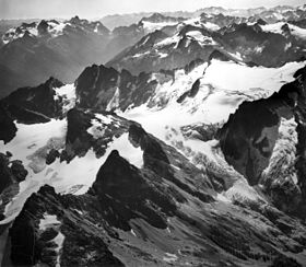
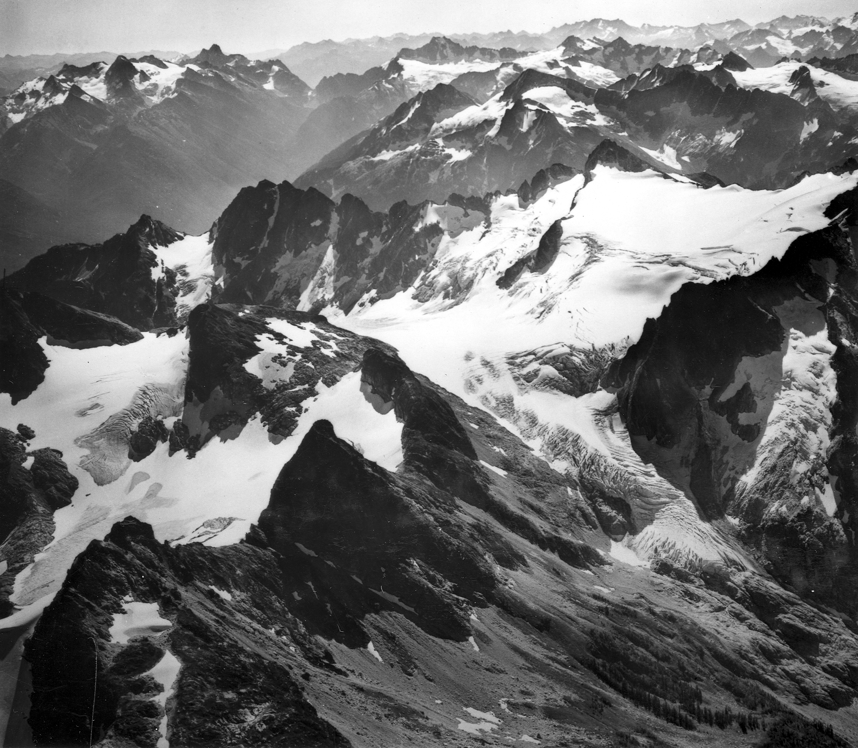
Goode Mountain is to the left of the pass in the backgroundElevation 9,220+ ft (2,810+ m) [1] Prominence 3,808 ft (1,161 m) [1] Location Location Chelan County, Washington, USA Range Cascade Range, North Cascades Coordinates 48°28′58″N 120°54′39″W / 48.4829083°N 120.9109427°WCoordinates: 48°28′58″N 120°54′39″W / 48.4829083°N 120.9109427°W[2] Topo map USGS Goode Mountain Climbing First ascent July 5, 1936 by Wolf Bauer, Philip Dickett, Joe Halwax, Jack Hossack, George MacGowan [3] Easiest route Southwest Couloir (Simple climb, with exposure, class 4) Goode Mountain is one of the major peaks of the North Cascades in Washington state. Named for topographer Richard U. Goode of the USGS,[4] it is the highest peak located in North Cascades National Park,[5] between the Skagit River and Lake Chelan. It is the fourth highest non-volcanic peak in Washington, and the twelfth highest summit overall.[6]
Goode Mountain is a massive mountain, rising over 6,000 feet (1,800 m) from its footings. On the northeast side it accomplishes this rise in only 1.6 horizontal miles (2.6 km). However, due to its isolated location in the rugged North Cascades, it is not visible from any major road.[7]
The mountain was first climbed in 1936 via the Southwest Couloir/Southeast Ridge Route, which is still the least technical route. More popular now is the Northeast Buttress, pioneered by well-known climber Fred Beckey and Tom Stewart on August 6, 1966. It involves some snow, possible ice, and rock climbing up to class 5.5.[3]
Routes
- Southwest Couloir/Southeast Ridge: first ascent July 5, 1936 by Wolf Bauer, Philip Dickett, Joe Halwax, Jack Hossack, George MacGowan
- Northeast Buttress IV 5.5: first ascent August 6, 1966 by Fred Beckey and Tom Stewart.
- Megalodon Ridge IV+ 5.10: first ascent September 6, 2007 by Blake Herrington and Sol Wertkin[8]
References
- ^ a b "Goode Mountain, Washington". Peakbagger.com. http://www.peakbagger.com/peak.aspx?pid=1836. Retrieved 2009-01-20.
- ^ "Goode Mountain". Geographic Names Information System, U.S. Geological Survey. http://geonames.usgs.gov/pls/gnispublic/f?p=gnispq:3:::NO::P3_FID:1520128. Retrieved 2009-01-20.
- ^ a b Beckey, Fred W. (1996). Cascade Alpine Guide: climbing and high routes, Vol. 2, Stevens Pass to Rainy Pass (2nd ed.). Mountaineers Books. ISBN 978-0898868388.
- ^ Majors, Harry M. (1975). Exploring Washington. Van Winkle Publishing Co. p. 45. ISBN 9780918664006. http://books.google.com/books?id=CoWrPQAACAAJ.
- ^ "U.S. National Park High Points". Peakbagger.com. http://www.peakbagger.com/list.aspx?lid=1821.
- ^ "Washington 100 Highest Peaks". Jeff Howbert.
- ^ "Goode Mountain". SummitPost.org. http://www.summitpost.org/page/151448.
- ^ Herrington, Blacke (September 22, 2007). "Massive Ridge Climbed in North Cascades". Alpinist. Alpinist Magazine. http://www.alpinist.com/doc/web07f/newswire-goode-megalodon-ridge. Retrieved 2008-08-17.
External links
- "Goode Mountain". Peakware.com. http://www.peakware.com/peaks.html?pk=2929.
Categories:- Landforms of Chelan County, Washington
- Mountains of Washington (state)
- United States National Park high points
- North Cascades of Washington (state)
- North Cascades National Park
Wikimedia Foundation. 2010.