- Cougar Mountain Regional Wildland Park
-
Cougar Mountain Regional Wildland Park IUCN Category IV (Habitat/Species Management Area)

Location Washington, USA Nearest city Seattle Coordinates 47°31′15″N 122°05′29″W / 47.52083°N 122.09139°WCoordinates: 47°31′15″N 122°05′29″W / 47.52083°N 122.09139°W Area 3,098 acres (12.54 km2) Established January 1985 Governing body King County Parks and Recreation Division Cougar Mountain Regional Wildland Park is a regional park in King County, Washington, near the towns of Bellevue and Issaquah. The park was established in June 1983 to protect the central core of Cougar Mountain. With 36 miles (58 km) of hiking trails and 12 miles (19 km) of equestrian trails providing a true wilderness experience on Seattle's very doorstep, the park has grown piecemeal to 3,098 acres (12.54 km2), becoming the largest urban wildland in the United States.
Outside the official boundaries of the park are many more miles of trails in city greenbelts or on swaths of private land too steep to patrol for errant hikers, let alone develop. Additionally, King County Parks has attempted, by obscuring connections with main trails, to "erase" a network of trails in the southeast quadrant of Cougar Mountain to create a Designated Wildlife Corridor connecting to the rest of the Issaquah Alps. After a decade of neglect, most of these trails are still in good condition once the hiker has negotiated through the brushy endpoints.
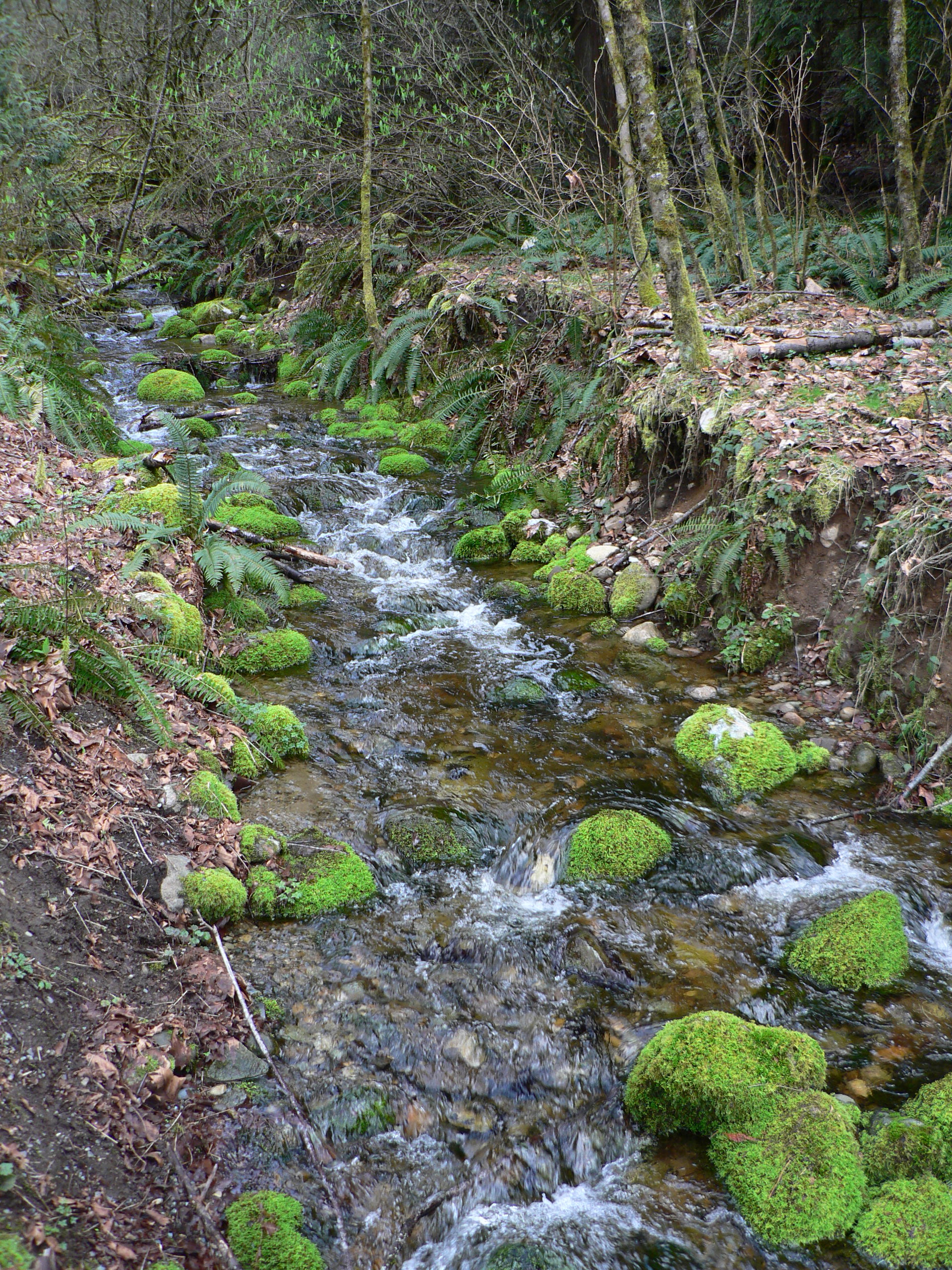
 Coal Creek.
Contents
Access
There are five major trailheads giving access to the parks.
- Wilderness Creek Trailhead (SR 900/Renton-Issaquah Road SE): This small parking area, located on the east side of Cougar Mountain, provides access to the Cougar Mountain Regional Wildland Park trail system via the Wilderness Creek Trail.
- Anti-Aircraft Peak Trailhead (SE Cougar Mountain Drive): This graveled parking area is located close to the top of Cougar Mountain and provides wonderful views to the north (sometimes one can catch a glimpse of Mt. Baker). Many of the wildland park's trails are accessed from this trailhead.
- Sky Country Trailhead (166th Way SE): Just before the gate on Clay Pit road, this lot includes space for horse trailers. The road continues as a gravel road to the Clay Pit. There are eventual plans to close this road off when the contract for clay removal is completed
- Red Town Trailhead (Lakemont Blvd. SE/Newcastle Coal Creek Rd.): Red Town Trailhead has a graveled parking area that provides access to the trails around the historic Red Town mining area and to the wildland park's entire trail system.
- Shangri La Trailhead in a housing development. Take SR 900 to Talus Drive, turn right on to Shangri La Road, the trailhead is up Mountain Vista Lane. Parking is available along Shangri La Road or Lingering Pine Drive. There is no real parking on Mountain Vista Lane.
Wilderness Creek, Anti-Aircraft and Red Town trailheads provide maps and there are directional signs at each trail intersection.
Geography
Environs
The park is bordered on the north by the city of Bellevue (primarily Eastgate) and on the northeast by the city of Issaquah. State Route 900 forms the eastern border. Neighboring Squak Mountain looms to the southeast and the farms of May Creek valley lie to the south. To the southwest is the city of Renton. The city of Newcastle, ranging over the Newport Hills, occupies the western portion of Cougar Mountain. To the northwest the deep gully of Coal Creek, with its own separate park, divides Newcastle from Bellevue and Factoria.
Summits
- AA Peak - 1,480 feet (450 m). This peak overlooks Radar Park, a former Cold War military installation. Excellent views to the north of Lake Sammamish and Mt. Baker are obtained here. The only summit reachable by car.
- Claypit Peak - 1,560 feet (480 m). Separated from Wilderness Peak by a saddle, Claypit Peak looms above a 150-acre (0.61 km2) source of clay for bricks, leased by Mutual Materials in Newcastle.
- Deceiver Ridge - 1,220 feet (370 m). A broad plateau bristling with second-growth fir.
- Long View Peak - 1,445 feet (440 m). This summit has a horse hitch, a bench, and a view to the south.
- Marshall's Hill - 1,120 feet (340 m). Dominating the Renton side of Cougar Mountain, the top of Marshall's Hill is reached by switchbacks from the De Leo Wall.
- Reichert's Hill - 1,420 feet (430 m). Also known as Radio Hill or Goat Hill, this is the site of many radio and television station broadcast antennas.
- Ring Road Peak - 1,245 feet (379 m). On the shoulder of Long View Peak. The summit is outside the Park, on private property.
- Wilderness Peak - 1,595 feet (486 m). There is no view owing to a stand of old growth timber, but Wilderness Peak is the highest elevation in the park. There is a summit register.
Hydrography
Creeks
The hilltops of Cougar Mountain form a rough horseshoe-shape around the Klondike Marsh headwaters of Coal Creek, which runs northwest to Lake Washington through Coal Creek Park. Long Marsh Creek, Far Country Creek, Cabbage Creek, and Wilderness Creek are tributaries of May Creek, draining the south side of Cougar Mountain to Lake Washington. Deeply etching the sandstone precipice on the north and east side, Lewis Creek, Kline Creek, AA Creek, West Tibbets Creek, and Claypit Creek carry their water to Lake Sammamish.
Marshes
 Northern Red-legged Frog along the Klondike Swamp Trail.
- Blackwater Pond - In the highlands between Wilderness Peak and Claypit Peak, drains east to Tibbets Creek.
- Jerry's Duck Pond - A quiet wooded man-made pond near the summit of Claypit Peak.
- Klondike Marsh - A former reservoir providing water for coal-car steam hoists.
- Lake Boren - A separate park in Newcastle, Lake Boren is the largest body of water in the highlands.
- Long Marsh - Large swamp between the Wildside Trail and Indian Trail.
- Shy Bear Marsh - The source of Cabbage Creek in the most remote part of the park.
- Tibbett's Marsh - The source of West Tibbett's Creek, crossed by a massive downed cedar log.
- Trog Swamp - Wetland along the Far Country Trail.
Waterfalls
There are five named waterfalls within Cougar Mountain Regional Wildland Park.
- Coal Creek Falls 25 feet (7.6 m), seasonal flow. At Coal Creek near the Quarry Trail.
- Doughty Falls - At Cabbage Creek on the Deceiver Trail.
- Far Country Falls - At Far Country Creek on the Indian Trail.
- North Fork Falls - 20 feet (6.1 m), year-round flow. Near the Red Town Trailhead.
- Sandstone Falls - On the Primrose Trail in Coal Creek Park.
Official Trails
North side
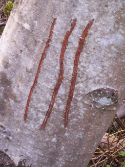
 Possible bear or cougar clawmarks on a tree along the AA Ridge Trail
- N1: Coal Creek Trail - Trail begins at the trailhead where Coal Creek Parkway dips to cross the creek and is soon joined on the north by a trail leading to the Bellevue system of open spaces. Scenic Brickyard Creek joins from the south in a steep descent. At a Y the Primrose Trail (N11) peels off to tour the creek at its most scenic reach in a canyon where Sandstone Falls is found. The main line tours the relics of an old farm and is joined by the Primrose Trail again further on. Strange hummocks are found in this area which were debris piles created during coal mining operations more than a century ago. A steep road leaves the trail to the site of the Cinder Mine. The last 0.75-mile (1.21 km) of the trail gently ascends to the Red Town trailhead with North Fork Falls and many coal-mining relics found along the way.
- N2: Military Road Trail - Trail begins at Red Town trailhead and ascends the old U.S. Army route (originally running to Issaquah) to the gate which marks the beginning of the Clay Pit Road. This is the only part of the Military Road that is accessed by an official trail. The route of the old road runs over Radio Hill and through private land, and it enters the park again above the Precipice Bottom Trail in a section informally called Harvey's Magic Quarter Mile.
- N3: Radio Peak Trail - Trail forks from the Coyote Creek Trail along the western edge of the Klondike Marsh and steadily ascends a rather narrow ridge populated with a fine stand of Douglas Fir. At the summit the trail arrives at a large cluster of radio transmitters and a service road that can take you down to Cougar Mountain Drive, but officially the trail ends here.
- N4: Coyote Creek Trail - Trail begins where Cougar Mountain Drive changes from blacktop to gravel. Also known as "Bill's Trail" (because Bill Culbert preferred to use this route to transit the area during high rains), the path meanders along the western edge of Klondike Swamp, crosses a clearing, and intersects the Claypit Road directly across from the terminus of the Cave Hole Trail.
- N5: Klondike Swamp Trail - Trail forks from the Coyote Creek Trail and passes along the base of Anti-Aircraft Peak where it meets the Klondike Swamp. An old woods road, the trail is relatively flat and straight, offering a quick route into the heart of Cougar Mountain. It passes a large vine maple that forms a canopy before ending at the Cougar Pass Trail.
- N6: Lost Beagle Trail - Trail ascends from the Klondike Swamp Trail through cool forest, switchbacking east to the summit area of Anti-Aircraft Peak. Radar Park has interpretive signs and the concrete foundations of a military installation that has long been abandoned. In World War II this was the site of anti-aircraft gun emplacements for possible Japanese attack. Later, Nike missiles were installed nearby, directed by personnel stationed here.[1]
- N7: AA Ridge Trail - Trail begins near the summit of Anti-Aircraft Peak and runs south down the gentle spine of the peak through a mixed coniferous and deciduous forest, reaching Cougar Pass which divides the watersheds of Coal Creek and West Tibbetts Creek.
- N8: Cougar Pass Trail - Trail connects the Klondike Swamp Trail with the Tibbetts Marsh Trail, striking the AA Ridge Trail at the highest point. It provides an alternative to the Clay Pit Road which parallels it just to the south.
- N9: Tibbett's Marsh Trail - Trail begins at Radar Park and provides the most direct route to the Claypit area, crossing the mile-wide saddle between AA and Claypit Peaks. It spans the marsh on a giant fallen cedar which has been converted into an ad hoc bridge with many axe strokes.
- N10: Peggy's Trail - Trail begins where a private gravel drive meets Cougar Mountain Drive a short distance from Radar Park. It strikes due north and descends the slope steeply, but inaction on the part of King County permitted the last link (a single lot just before the trail reaches 60th Street) to be developed, making this important route effectively a dead end trail. Hikers must now backtrack and use public roads to reach the Lewis Creek Canyon system of trails.
East side
- E1: Shangri-La Trail - Trail begins at the Radar Park trailhead and descends the eastern flanks of Cougar Mountain to the Talus development. Wide and gently sloping, the former logging road parallels the Surprise Creek Trail. The forest has not yet grown again sufficiently to permit this trail to lose its character as a road.
- E2: Surprise Creek Trail - Trail begins at the Shangri-La Trail and provides a more scenic route down to the Issaquah Reservoir. It accesses the Powerline Trail at two points.
- E3: Bear Ridge Trail - Trail begins in a small three-car alcove 0.9 miles (1.4 km) south of Newport Way on State Route 900 and forks left. Paralleling West Tibbetts Creek on a narrow ridge high above it, the trail passes a section corner marker and enormous firs before reaching the Fantastic Erratic, a fern covered boulder about the size of a two-car garage deposited here during the ice age by the Canadian glacier. The Trail switchbacks up to an undissected plateau of knee-high ferns dotted with islands of oak, maple, alder, and young fir (The country is so open here a person with a compass or GPS could strike off cross country and easily reach the Clay Pit). After crossing two creeks the trail bends north to intersect the Shangri-La Trail.
- E4: Wilderness Peak Trail - Trail climbs steeply from Shy Bear pass to the highest point on Cougar Mountain, where trees rise at least another 100 feet (30 m) but block any view. This is the uppermost edge of a large forest of virgin Douglas Firs that drapes the east ridge of the peak almost all the way down to the highway.
- E5: Wilderness Cliffs Trail - Trail begins at Boulder Junction on the Wilderness Creek mainline and ascends to a cliff-top view of Squak Mountain and soon after another view of Mount Rainier. Wilderness Creek is far, far below. The trail mounts to the beautiful forest of second growth Douglas Fir and salal underbrush on the rounded southern bulk of Wilderness Peak, passes a pond called Wilderness "Lake", and attains the summit, where one may leave a message in the register.
- E6: Wilderness Creek Trail - Trail begins at the Wilderness Creek trailhead on State Route 900, about a mile from May Valley Road. With many switchbacks it ascends the creek to Boulders Junction, does a hairpin turn and mounts a ridge on the right bank. A view back down to the tiny people on the bridge below surprises hikers with how high they've come. The trail passes Cougar Mountain Cave formed by talus fallen from the clifftops high above and reaches Shy Bear Pass.
- E7: Powerline Trail - Trail begins along the Surprise Creek trail, reaches a power line right-of-way, and drops straight down toward Goode's Corner, making only one bend into the woods to switchback through a zone of steep rocks. From this trail it is possible to leave the Park Boundaries and explore the northern Precipice.
- E8: No Name Trail - Trail is a relatively short connector between the Shangri-La Trail and Surprise Creek Trail. It links the northern and southern halves of the Precipice Trail.
- E9: Protector Trail - Trail begins along Tibbett's Marsh Trail and runs to an indistinct spur of AA Peak that forms a wall containing the wetland. Originally this ridge was not in the Park, and Harvey Manning feared it would be developed. Now it is deep inside the Park and the trail links to the Shangri-La Trail.
- E10: Upper West Tibbetts Creek Trail - Trail begins along the Tibbetts Marsh Trail, where a sign with an arrow stands right in the middle of the intersection. The trail descends gently along a shallow ravine of the creek until it meets the Bear Ridge Trail.
South side
- S1: Far Country Trail - Trail begins on the Indian Trail and gently switchbacks up through a beautiful glade to a clearing called Far Country Lookout, with views toward Renton and Tukwila. Harvey Manning named this area the Far Country because ice-age glaciers had eroded a south-flowing watershed where he expected to find a containing ridge and headwaters on his first exploration. He felt he had somehow crossed into a magical country far from home.
- S2: Shy Bear Trail - Trail begins at Far Country Lookout (indeed it is merely the continuation of the Far Country Trail), crosses a shoulder of Deceiver Ridge and drops to Shy Bear Marsh, which it crosses on a series of boardwalks. At this point a hiker is as far as anyone can get from a trailhead, this is the most remote part of Cougar Mountain. From the swamp the trail ascends to Shy Bear Pass, where a number of trails all come together in a small area.
- S3: Deceiver Trail - Trail forks off from Shy Bear Trail with a steel artifact of the logging days lying nearby. It ascends to the broad summit of Deceiver Ridge and drops to Cabbage Creek, just above Doughty Falls. The trail then switchbacks up to the summit of Long View Peak with an excellent window through the trees south.
- S4: Long View Peak Trail - Trail begins at the summit of Long View Peak and drops to Shy Bear Pass. It is really just a continuation of the Deceiver Trail.
- S5: Ring Road Trail - Trail begins along the Long View Peak Trail and crosses a saddle to reach a dirt road near the summit of Ring Road Peak (which actually lies outside of the park). Soon after this, at a view of Mount Rainier, private property is reached, marking the end of the trail.
- S6: Licorice Fern Trail: - Trail begins near the Indian Trail trailhead and forks left behind a row of houses, following a ravine of Far Country Creek to Licorice Fern Way. The trail resumes on the other side of the road, soon passing Trog Swamp and Surprise Wall. The trail resembles the Coal Creek Trail as it passes through a century-old forest, sometimes along the creek, sometimes high on the wall, to the lower trailhead on Licorice Fern Way where a homeowner has dedicated a permanent easement.
Central basins
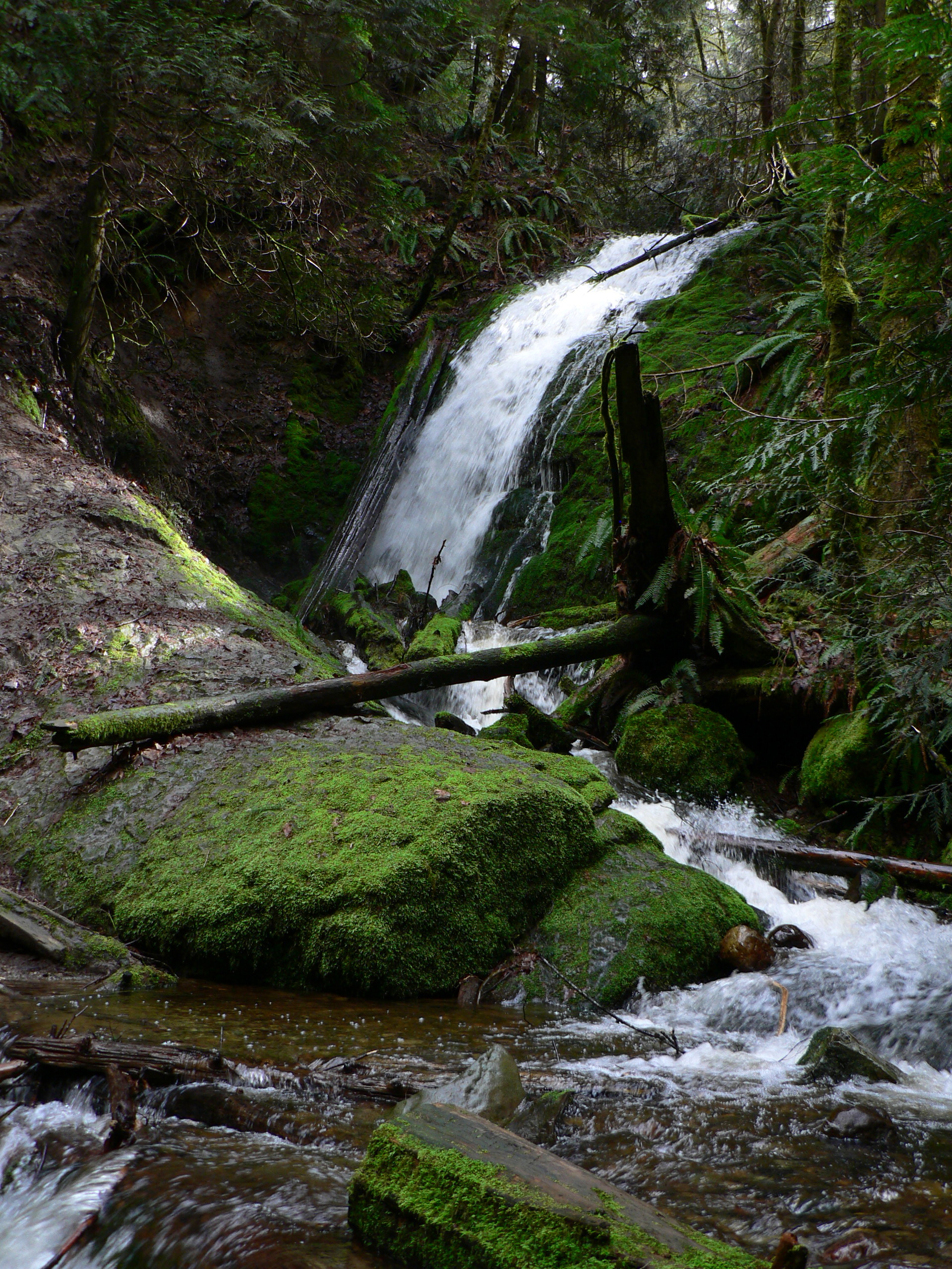
 Coal Creek Falls
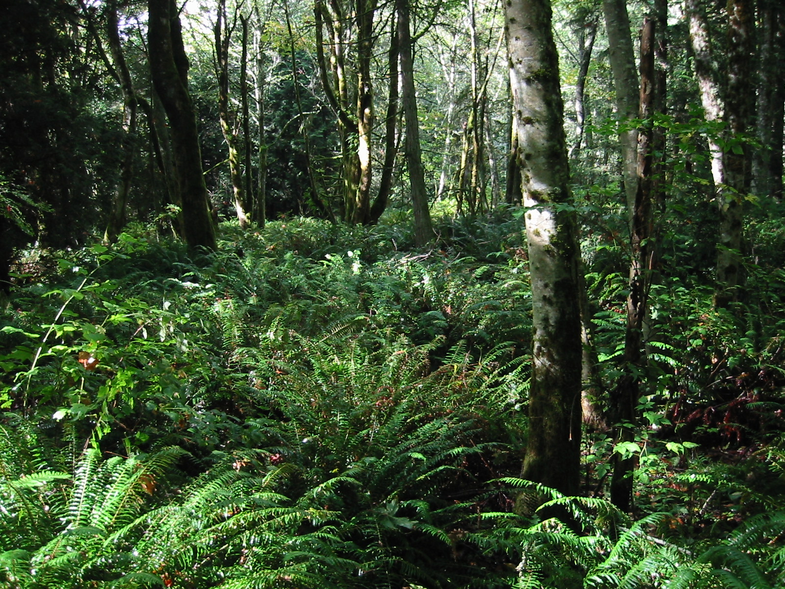
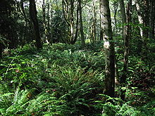 Red Alder forest near Sky Country Trailhead
- C1: Clay Pit Road - An extension of 166th Avenue, this gravel road extends from the gate all the way to the Clay Pit, which is leased by Mutual Materials to obtain raw material for bricks. The company rarely uses the road, so it is effectively just another route for horses and boots. It provides access to a meadow at Nike Park, where Nike anti-aircraft missiles were set up to defend against Soviet bombers in the Cold War. There is an ample parking area and trailhead facilities at the Sky Country Trailhead here.
- C2: Red Town Creek Trail - Trail connects the Cave Hole Trail to the Military Road Trail and provides access to the Red Town Creek Dam. Water from the lake which existed here before the dam silted up was used to provide steam for hauling the coal cars out of the mine shafts.
- C3: Cave Hole Trail - Trail begins on the Red Town Trail and provides the main route from the Red Town area to the higher elevations of Cougar Mountain. The former wagon road to the Klondike Dam, it passes some rather large holes which were formed by earth collapsing into coal seams as they were mined.
- C4: Coal Creek Falls Trail - Trail forks off from the Cave Hole Trail and runs more-or-less level south to a 25-foot (7.6 m) cataract on Coal Creek which is one of the most popular destinations in the Park, especially during periods of heavy runoff. Thereafter the trail ascends to meet the Quarry Trail.
- C6: Quarry Trail - Trail begins on the Indian Trail near a stone quarry and ascends the ravine of Shy Bear Creek (the old route ascended the ridge between this creek and Coal Creek). It intercepts Fred's Railroad Trail very near the terminus of that trail with the Shy Bear Trail.
- C7: Fred's Railroad Trail - Trail begins at the Clay Pit Road across the street from the Cougar Pass Trail endpoint. It runs along a former railroad bed and therefore has no sharp turns or steep inclines. Many logging structures can be seen along the sides of the trail as it runs south to meet the Shy Bear Trail.
- C8: East Fork Trail - Trail begins on Fred's Railroad Trail and ascends the east branch of Coal Creek all the way to its source. It passes along the serene waters of Jerry's Duckpond before arriving at the lip of the Clay Pit on a shoulder of Clay Pit Peak.
- C9: Bypass Trail - Trail begins at the intersection of Fred's Railroad Trail and Clay Pit Road and drops to the Cave Hole Trail. It provides a way to transit the area without using the road.
- C10: Mine Shaft Trail - Trail begins at Jerry's Duckpond and runs to a large, deep mineshaft covered with a grid of rebar. It is possible to safely stand on this grate over the middle of the hole. The shaft is slightly inclined and actually goes below sea level. After the mine shaft the trail intersects the road.
West side
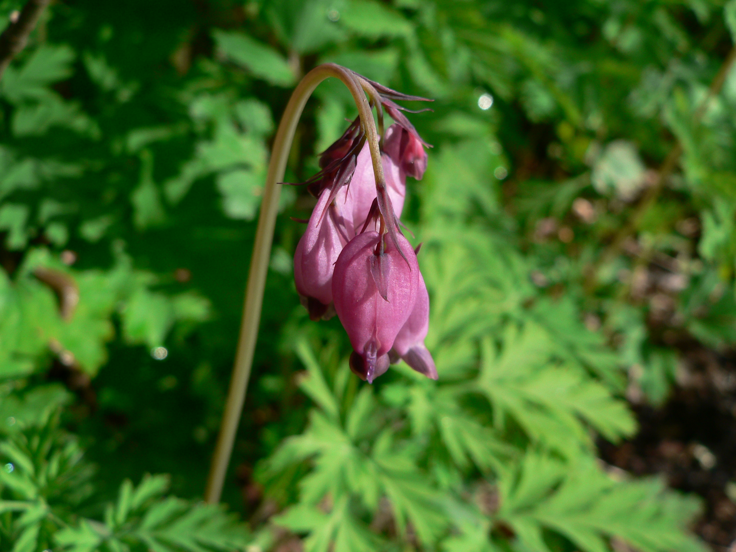
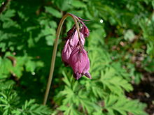 Western Bleeding Heart along Wildside Trail
- W1: Wildside Trail - Trail begins at the Rainbow Town Trail and runs along the western side of the valley of Coal Creek. Ironically, development has pressed close to this trail at some points and reduced its wild character. After crossing Marshall's Hill trail it skirts Long Marsh to an intersection with the Deleo Wall Trail.
- W2: Red Town Trail - Trail begins at the Red Town trailhead and runs along the eastern side of the valley of Coal Creek to the Ballpark Meadow restoration project.
- W3: Rainbow Town Trail - Trail begins along the Red Town Trail and passes the Ford Slope coal mining exhibit, which includes pictures of the Red Town area at the height of the coal-mining times. The visitor is struck by how thoroughly nature has reclaimed the area.
- W4: Steam Hoist Trail - Trail begins along the Wildside Trail and after crossing the creek loops back to the Rainbow Town Trail, touring many artifacts of the coal-mining days, including an intact concrete dam and the massive concrete foundation for the old steam hoist, which would almost be mistaken for a natural feature but for all the right angles.
- W5: China Creek Trail - Trail begins at the Red Town trailhead and runs to the edge of the Park, providing access to the Rainbow Town Trail. In the days before the landfill became a golf course this trail provided access to the network of trails in the saddle between Marshall's Hill and Mt. Trashmore.
- W6: Marshall's Hill Trail - Trail begins on the Wildside Trail and ascends to a view of the Coal Creek basin with the rest of Cougar Mountain looming behind it. It continues on to the Deleo Wall Trail and a water tower access road which descends to a neighborhood cul-de-sac that can serve as a trailhead for the western trail system.
- W7: Indian Trail - Trail begins at a cul-de-sac on 171st Avenue where King County owns two vacant lots to ensure access. This is believed to be part of the route used by the Duwamish tribe and others to go between Coal Creek and May Creek. It provides access to Far Country Falls and terminates at the Ballfield.
- W9: Deleo Wall Trail - Trail begins along the Indian Trail and passes an unnamed wetland before ascending steadily to the top of Deleo Wall, a 600-foot (180 m) cliff looking out over May Valley to Mount Rainier. From the viewpoint a series of well-constructed switchbacks ascends to the summit of Marshall's Hill, where Picture Buttress looks down to a forest glade. The trail intersects a water tower access road and the Marshall's Hill Trail, with a remarkable view of downtown Seattle.
- W10: Bagley Seam Trail - Trail begins at Red Town trailhead and descends a gully which has collapsed into a formerly coal-bearing seam before linking to the Red Town Trail.
Unofficial Trails
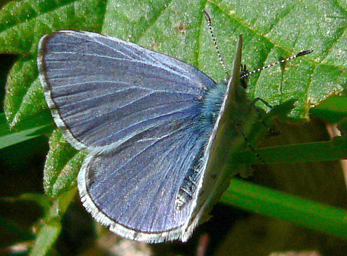
 Spring Azure (Celastrina ladon) butterflies may be seen occasionally.
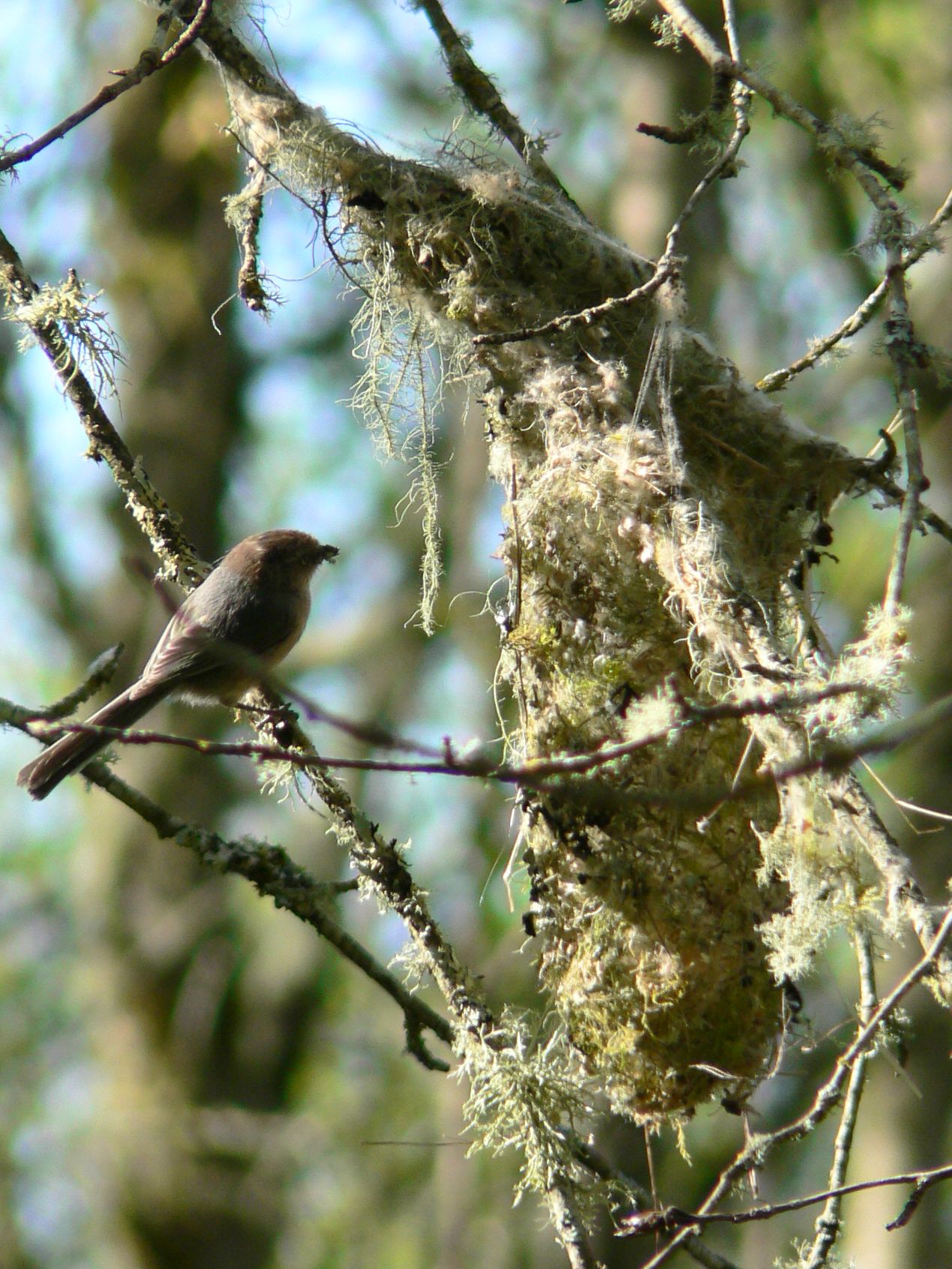
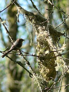 Bushtits (Psaltriparus minimus) nest in the park.
With the aim of leaving a section of the park totally wild for the peace of mind of cougars and bears and other wildlife, King County Parks has withdrawn official recognition from some of the trails described below, and the Issaquah Alps Trails Club no longer performs trail maintenance, nor even describes the trails in new editions of guidebooks. But using the trails is not expressly forbidden. In fact, letting such a large portion of the park go fallow enhances its value as an urban wildland. Some individuals have even adopted the trails and maintain them in their interior. Additionally, there is a system of trails between the "official" ones in the higher elevations and the developed properties below that lace a belt of very steep terrain called the Precipice. Most of this system lies on private property, but the propensity of the land to slide when it gets wet makes it quite safe from ever being developed.
- Blackwater Trail - Trail begins on the "Penultimate Plateau" just a few feet below the summit of the highest point on Cougar Mountain and strikes north, dropping to the saddle between Wilderness Peak and Claypit Peak in a forest of rather large Douglas Firs. The trail forks: a sign cut into tree bark is clearly legible. The west branch drops gradually, eventually intersecting with the East Fork Trail. The east branch descends steeply to Blackwater Pond (marked by an ancient sign). The trail then follows a large trench-like structure, contouring around Claypit Peak until it reaches the eastern end of the clay pit.
- Gorgeous Gorges - Trail begins at the Summerhill trailhead off Newport Way NW and signed "Ralph's Hi Line" it proceeds along the Precipice between AA Gorge and Kline Road. The route is incised by an unnamed gulch just before a high rocky outcrop (with an enormous view) negotiated by a rope. Following in succession are Jackstraw Gulch, Nurselog Gulch, Schneider Creek Gorge, Stormwater Creek Gorge, and Hairpin Gulch.
- Lower West Tibbetts Creek Trail - Trail begins at the three-car parking area for the Bear Ridge Trail (striking right instead of left) and follows the intricate bed of the beautiful creek up to an intersection with the West Tibbetts Creek Connector. The well-maintained route is marred by the intrusion of the Talus development at one point.
- Newcastle-Queen Mine Trail - Trail begins at a gate just a bit south of the Bear Ridge/West Tibbetts Creek trailhead. A woods road, Newcastle-Queen ascends to the area of an old coal mine with an air vent and other relics still evident. The road continues up through the airy forest on the eastern flank of Claypit Peak. An attempt to erase the route by planting trees in the middle of the road has failed, the trees did not flourish. After crossing the intersection with the South Precipice Trail it becomes very steep and deeply rutted, and seems to end at a cul-de-sac. However, to the northeast a hidden connector trail switchbacks down to the South Precipice Trail, and to the west the mine road continues as an excellent trail rising gently through salmonberries all the way to the Clay Pit.
- Precipice Bottom Trail - Trail begins at the Summerhill trailhead and follows Anti-Aircraft Creek back to a crossing. This entire area contains a maze of small game trails and trails made by neighborhood kids. The PB trail ascends Harvey's Mud Slide (assisted by a rope) and contours to Big Tree Ridge and Little Big Tree Ridge. It is easy to lose the trail in this area due to blowdowns and a 1998 clearcut that is only now coming back in, but distinctive IATC trail signs are found here and there to assure the hiker they are not lost. After Military Creek and Extra Creek there is a rather treacherous crossing of Stagecoach Creek before the intersection with the Telephone Trail is reached.
- South Precipice - Trail begins in a grove hidden behind the low ridge immediately south of the Fantastic Erratic (a little bushwhacking is required to begin), and steeply ascends knife-sharp Elegant Ridge to a beautiful area of deeply etched sandstone ridges and gulches that come one after the other until the trail straightens out and intersects the Newcastle-Queen Mine road. However, the Issaquah Alps Trails Club does not maintain this trail, so there are many blown-down trees one must either crawl under or over, which makes for slow going.
- West Tibbetts Creek Connector - Trail begins east of the Fantastic Erratic allowing a transfer from the Bear Ridge Trail north to West Tibbetts Creek where it emerges from its canyon and tumbles over sandstone, sculpting potholes. As a continuation of the South Precipice Trail, it ascends some poorly-constructed switchbacks (that are difficult to manage in wet weather) through the wildest section of West Tibbetts Creek and after passing a nurse log and an excellent view to the east it intersects the upper portion of the Bear Ridge Trail.
Pre-park History
WWII Anti-Aircraft Gun Base
Information needed.
Cold War Nike Missile Base
Now an open field, "Radar Park" was an anti-aircraft Nike missile installation during the Cold War used to protect the region from nuclear attack by Soviet long range strategic bombers. All that is left is a few concrete pads, landscaping features and an interpretive sign. Current amenities include restrooms, picnic tables, a playfield, wildlife interpretive signs, and access to a great trail system.[2]
Newcastle Mining Town Second Location
Information needed.
References
- ^ Thelen, Edward (1999 - February 2004). "Locations of Former NIKE MISSILE SITES". http://www.ed-thelen.org/loc-w.html#S-20. Retrieved 2007-06-10.
- ^ "Radar Park" at Anti-Aircraft Peak
Sources
- Manning, Harvey & Owen, Ralph. Hiking and Strolling the Trails of Cougar Mountain, Issaquah Alps Trails Club, Issaquah, 1991.
- McCrone, Charles. The Authoritative Guide to the Hiking Trails of Cougar Mountain Regional Wildland Park and Surrounds, Issaquah Alps Trails Club, Issaquah, 2000.
External links and maps
Categories:- IUCN Category IV
- Cascade Range
- Parks in King County, Washington


Wikimedia Foundation. 2010.