- Mount Clarence King
-
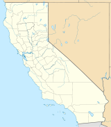
Mount Clarence King Fresno County, California, USA Elevation 12,861 ft (3,920 m) [1] Prominence 1,149 ft (350 m) [1] Parent peak Black Mountain [2] Listing SPS Emblem peak [3] Location Range Sierra Nevada Coordinates 36°50′00″N 118°26′47″W / 36.8332691°N 118.4464872°WCoordinates: 36°50′00″N 118°26′47″W / 36.8332691°N 118.4464872°W[4] Topo map USGS Mount Clarence King Climbing First ascent 1896 by Bolton C. Brown [5] Easiest route Technical, class 5.4 [6] Mount Clarence King, located in the Kings Canyon National Park, is named for Clarence King, who worked on the Whitney Survey, the first geological survey of California. King later became the first chief of the United States Geological Survey.[5]
The Peak is located along King Spur, a sub-range of the California's Sierra Nevada. It is north of Mount Cotter, northeast of Gardiner Basin, and west of Sixty Lakes Basin and the John Muir Trail.[7]
References
- ^ a b "Mount Clarence King, California". Peakbagger.com. http://www.peakbagger.com/peak.aspx?pid=2759. Retrieved 2008-12-29.
- ^ "Whitney V. P1000s, California Mountain Atlas". Peaklist.org. http://www.PeakList.org/CAmtnatlas/P1000/tables/Whitney5.html. Retrieved 2009-01-18.
- ^ "Sierra Peaks Section List". Angeles Chapter, Sierra Club. http://angeles.sierraclub.org/sps/spslist.pdf. Retrieved 2009-08-05.
- ^ "Mount Clarence King". Geographic Names Information System, U.S. Geological Survey. http://geonames.usgs.gov/pls/gnispublic/f?p=gnispq:3:::NO::P3_FID:258396. Retrieved 2008-12-29.
- ^ a b Browning, Peter (1986). Place Names of the Sierra Nevada. Berkley: Wilderness Press. p. 40. ISBN 978-0-89997-119-3.
- ^ Roper, Steve (1976). The Climber's Guide to the High Sierra. San Francisco: Sierra Club Books. p. 256. ISBN 0-87156-147-6.
- ^ USGS. Mount Clarence King quadrangle, CA (Map). 1:24000. 7.5 Minute Topographic. http://mapper.acme.com/?ll=36.833269,-118.446487&z=14&t=T&marker0=36.833269,-118.446487,Mount%20Clarence%20King.
Categories:- Mountains of Kings Canyon National Park
- Mountains of Fresno County, California
- Tulare County, California geography stubs
Wikimedia Foundation. 2010.

