- Mound Township, Bates County, Missouri
-
Mound Township — Township — Location in Bates County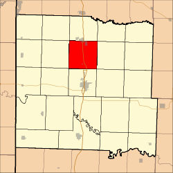
Coordinates: 38°21′28″N 94°20′25″W / 38.35778°N 94.34028°WCoordinates: 38°21′28″N 94°20′25″W / 38.35778°N 94.34028°W Country  United States
State  Missouri
County Bates Area – Total 36.23 sq mi (93.82 km2) – Land 36.13 sq mi (93.59 km2) – Water 0.09 sq mi (0.23 km2) 0.25% Elevation 869 ft (265 m) Population (2000) – Total 819 – Density 22.7/sq mi (8.8/km2) Time zone CST (UTC-6) – Summer (DST) CDT (UTC-5) ZIP codes 64720, 64730 GNIS feature ID 0766300 Mound Township is one of twenty-four townships in Bates County, Missouri, USA. As of the 2000 census, its population was 819.[1]
Contents
Geography
According to the United States Census Bureau, Mound Township covers an area of 36.23 square miles (93.82 square kilometers); of this, 36.13 square miles (93.59 square kilometers, 99.75 percent) is land and 0.09 square miles (0.23 square kilometers, 0.25 percent) is water.
Cities, towns, villages
Adjacent townships
- Deer Creek Township (north)
- Grand River Township (northeast)
- Shawnee Township (east)
- Summit Township (southeast)
- Mount Pleasant Township (south)
- Charlotte Township (southwest)
- Elkhart Township (west)
- East Boone Township (northwest)
Major highways
Landmarks
- City Park
- Grove Street
School districts
- Adrian County R-III
- Butler R-V School District
Political districts
- Missouri's 4th congressional district
- State House District 125
- State Senate District 31
References
- United States Census Bureau 2008 TIGER/Line Shapefiles
- United States Board on Geographic Names (GNIS)
- United States National Atlas
External links

East Boone Township Deer Creek Township Grand River Township Elkhart Township 
Shawnee Township  Mound Township

Charlotte Township Mount Pleasant Township Summit Township Municipalities and communities of Bates County, Missouri Cities 
Villages Townships Charlotte | Deepwater | Deer Creek | East Boone | Elkhart | Grand River | Homer | Howard | Hudson | Lone Oak | Mingo | Mound | Mount Pleasant | New Home | Osage | Pleasant Gap | Prairie | Rockville | Shawnee | Spruce | Summit | Walnut | West Boone | West Point
Footnotes ‡This populated place also has portions in an adjacent county or counties
Categories:- Townships in Bates County, Missouri
- Missouri geography stubs


Wikimedia Foundation. 2010.