- Deer Creek Township, Bates County, Missouri
-
Deer Creek Township — Township — Location in Bates County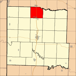
Coordinates: 38°24′16″N 94°20′49″W / 38.40444°N 94.34694°WCoordinates: 38°24′16″N 94°20′49″W / 38.40444°N 94.34694°W Country  United States
State  Missouri
County Bates Area – Total 31.71 sq mi (82.12 km2) – Land 31.67 sq mi (82.03 km2) – Water 0.03 sq mi (0.08 km2) 0.1% Elevation 846 ft (258 m) Population (2000) – Total 2,162 – Density 68.3/sq mi (26.4/km2) Time zone CST (UTC-6) – Summer (DST) CDT (UTC-5) ZIP codes 64720, 64725 GNIS feature ID 0766291 Deer Creek Township is one of twenty-four townships in Bates County, Missouri, USA. As of the 2000 census, its population was 2,162.[1]
Contents
Geography
According to the United States Census Bureau, Deer Creek Township covers an area of 31.71 square miles (82.12 square kilometers); of this, 31.67 square miles (82.03 square kilometers, 99.89 percent) is land and 0.03 square miles (0.08 square kilometers, 0.1 percent) is water.
Cities, towns, villages
- Adrian (partial)
Unincorporated towns
- Coleville at 38°24′56″N 94°18′08″W / 38.4155731°N 94.3021699°W
- Crescent Hill at 38°25′56″N 94°20′51″W / 38.4322389°N 94.3474487°W
(This list is based on USGS data and may include former settlements.)
Adjacent townships
- Austin Township, Cass County (north)
- Grand River Township (east)
- Shawnee Township (southeast)
- Mound Township (south)
- Elkhart Township (southwest)
- East Boone Township (west)
Cemeteries
The township contains Crescent Hill Cemetery.
Major highways
Rivers
- South Grand River
School districts
- Adrian County R-III
- Cass County R-V
Political districts
- Missouri's 4th congressional district
- State House District 120
- State House District 125
- State Senate District 31
References
- United States Census Bureau 2008 TIGER/Line Shapefiles
- United States Board on Geographic Names (GNIS)
- United States National Atlas
External links

Austin Township, Cass County East Boone Township 
Grand River Township  Deer Creek Township

Elkhart Township Mound Township Shawnee Township Municipalities and communities of Bates County, Missouri Cities 
Villages Townships Footnotes ‡This populated place also has portions in an adjacent county or counties
Categories:- Townships in Bates County, Missouri


Wikimedia Foundation. 2010.