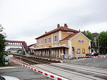
- Moret–Lyon railway
-
Moret–Lyon railway
Feurs railway stationOverview System SNCF Status Operational Locale France (Île-de-France, Centre
Burgundy, Auvergne, Rhône-Alpes)Termini Gare de Moret-Veneux-les-Sablons
Gare de Lyon-PerracheStations 61 Operation Opened 1828-1861 Owner RFF Operator(s) SNCF Technical Line length 492 km (306 mi) No. of tracks Double track[1] Track gauge 1,435 mm (4 ft 8 1⁄2 in) Standard gauge Electrification 1.5 kV DC Moret–Montargis, St-Étienne–Lyon;
25 kV 50 Hz Montargis–St-Germain-d-F;
St-Germain-d-F–St-Étienne not electrified[2]Route map Legend
Line to Paris 

66.8 Moret-Veneux-les-Sablons 


Line to Marseille 


75.0 Montigny-sur-Loing 
78.5 Bourron-Marlotte-Grez 


79.1 to Malesherbes 
86.3 Nemours-Saint-Pierre 
90.7 Bagneaux-sur-Loing 
96.8 Souppes-Château-Landon 
101.3 Dordives 
107.3 Ferrières-Fontenay 


116.9 from Malesherbes 
117.7 Montargis 


118.1 to Triguères 
123.6 1.5 kV DC to 25 kV 50 Hz 
135.1 Nogent-sur-Vernisson 
154.3 Gien 
164.0 Briare 
195.1 Cosne-sur-Loire 
204.7 Tracy-Sancerre 
214.0 Pouilly-sur-Loire 
219.9 Mesves-Bulcy 
227.0 La Charité 
231.7 La Marche 
235.0 Tronsanges 
240.1 Pougues-les-Eaux 
244.0 Garchizy 
246.6 Fourchambault 
250.9 Vauzelles 


251.9 Lines from Chagny and Clamecy 
253.0 Nevers 
253.7 River Loire 


262.9 Line to Vierzon 


263.6 Saincaize 
280.7 Saint-Pierre-le-Moûtier 
289.9 Chantenay-Saint-Imbert 
299.6 Villeneuve-sur-Allier 
313.1 Moulins-sur-Allier 


313.3 to Montluçon 


313.4 Line to Paray-le-Monial and Mâcon 


326.5 Bessay 


332.7 to Saint-Pourçain-sur-Sioule 
341.4 Varennes-sur-Allier 
347.8 Créchy 
351.1 Billy-Marcenat 
354.4 Saint-Germain-des-Fossés 


from Clermont-Ferrand via Gannat 


354.8 


to Clermont-Ferrand via Vichy 


end of electrification 
371.7 Lapalisse-Saint-Prix 
378.5 Arfeuilles-Le Breuil 
388.5 Saint-Martin-Sail-les-Bains 
397.5 La Pacaudière 
407.7 Saint-Germain-Lespinasse 
420.5 Roanne 
422.3 River Loire 
423.1 Le Coteau 


423.2 Line to Saint-Germain-au-Mont-d'Or 


430.5 Saint-Cyr-de-Favières 
441.7 Saint-Jodard 
452.1 Balbigny 
461.4 Feurs 
472.6 Montrond-les-Bains 
482.2 Saint-Galmier-Veauche 
487.3 Bouthéon 
start of electrification 1.5 kV DC 


489.5 Line from Clermont-Ferrand 


492.7 La Fouillouse 
496.8 Villars 
499.2 Saint-Étienne-La Terrasse 


501.8 from Le Puy-en-Velay 
502.1 Saint-Étienne-Châteaucreux 


513.5 Saint-Chamond 
518.1 La Grand-Croix 
523.1 Rive-de-Gier 
537.8 Givors-Ville 


from Nîmes (right Rhône bank) 


539.3 Givors-Canal 


to Chasse-sur-Rhône (left Rhône bank) 


to Tassin 
541.7 Grigny-le-Sablon 
546.1 Vernaison 
553.6 Pierre-Bénite 
555.1 Oullins 
556.7 River Saône 


Line from Marseille and Lyon-Part-Dieu 
558.8 Lyon-Perrache 

559.1 River Saône 
Line to Paris The railway from Moret-Veneux-les-Sablons to Lyon is a French 492-kilometre long railway line, that connects the Paris region to the city Lyon via Nevers and Saint-Étienne. The railway was opened in several stages between 1828 and 1861. The section between Saint-Étienne and Saint-Just-sur-Loire was the first railway line in France.[3] It has functioned as an alternative (but longer) line for the Paris–Marseille railway between Paris and Lyon. Its main use, besides local traffic, is now for the connection between Paris and Clermont-Ferrand.
Contents
Route
The line branches off the Paris–Marseille railway at the Gare de Moret-Veneux-les-Sablons, and leaves in a southwestern direction. It follows the river Loing upstream, turning south near Nemours and passing through Montargis, where it leaves the Loing. At Gien it starts following the river Loire upstream along its right bank, in a generally southern direction. It passes through Cosne-sur-Loire, and the railway junction Nevers, where it crosses the Loire. At Saincaize the line to Bourges branches off.
From Saincaize, the line follows the right Allier bank south. It passes through Moulins. At Saint-Germain-des-Fossés two lines to Clermont-Ferrand (one via Gannat, one via Vichy) branch off. The Moret–Lyon railway leaves the Allier and turns east. It passes through the Monts de la Madeleine, northern foothills of the Massif Central. It crosses the Loire between Roanne and Le Coteau, where the shorter line to Lyon via Tarare branches off.
This is where the oldest section of the line starts. It continues south, parallel to the Loire, passing through Feurs and along Andrézieux-Bouthéon, where it meets the line from Clermont-Ferrand via Montbrison. At Saint-Étienne the line from Le Puy-en-Velay joins, and the line continues northeast through Saint-Chamond and Rive-de-Gier. At Givors on the river Rhône it turns north, finally arriving in Lyon after 492 km.
Main stations
The main stations on the Moret–Lyon railway are:
- Gare de Moret-Veneux-les-Sablons
- Gare de Nevers
- Gare de Roanne
- Gare de Saint-Étienne-Châteaucreux
- Gare de Lyon-Perrache
History
The first railways that were opened in France were primarily meant for freight traffic in the mining area around the industrial city Saint-Étienne. These railways were united in the Compagnie du chemin de fer Grand-Central de France in 1853, and at the dissolution of that company in 1857 the eastern part of the Grand-Central network was bought by the Chemins de fer de Paris à Lyon et à la Méditerranée.[4]
The first section of the Moret–Lyon railway that was opened in 1828 led from Saint-Étienne to Saint-Just-sur-Loire. Saint-Étienne and Lyon were connected between 1830 and 1833. In 1834 the line was extended in northern direction from Saint-Just to Le Coteau, near Roanne. In 1850 a line from Nevers to Saincaize was built. This section was extended south to Varennes-sur-Allier in 1853, to Saint-Germain-des-Fossés in 1854 and to Lapalisse in 1857. Lapalisse and Le Coteau were connected in 1858. In the north, Moret-Veneux-les-Sablons on the Paris–Marseille railway was connected to Montargis in 1860. Finally in 1861 the section from Montargis to Nevers was opened.[3]
Services
The Moret–Lyon railway is used by the following passenger services:
- TGV on the section between Saint-Étienne and Lyon
- Intercités from Paris to Nevers (on the section between Moret-Veneux-les-Sablons and Nevers), from Bordeaux to Lyon (section between Saint-Germain-des-Fossés and Le Coteau) and from Nantes to Lyon (section between Saincaize and Le Coteau)
- Téoz from Paris to Clermont-Ferrand (on the section between Moret-Veneux-les-Sablons and Saint-Germain-des-Fossés)
- TER Bourgogne, TER Auvergne and TER Rhône-Alpes regional services on the section between Cosne-sur-Loire and Lyon
- Transilien regional services on the section between Moret-Veneux-les-Sablons and Montargis
References
- ^ RFF - Network mapPDF
- ^ RFF - Map of electrified railway linesPDF
- ^ a b Direction Générale des Ponts et Chaussées et des Chemins de Fer (1869) (in French). Statistique centrale des chemins de fer. Chemins de fer français. Situation au 31 décembre 1869. Paris: Ministère des Travaux Publics. pp. 146–160.
- ^ Joanne, Adolphe (1859) (in French). Atlas historique et statistique des chemins de fer français. Paris: L. Hachette. p. 39.
Categories:- Railway lines in France
Wikimedia Foundation. 2010.

