- Mooroopna
-
Mooroopna
Victoria
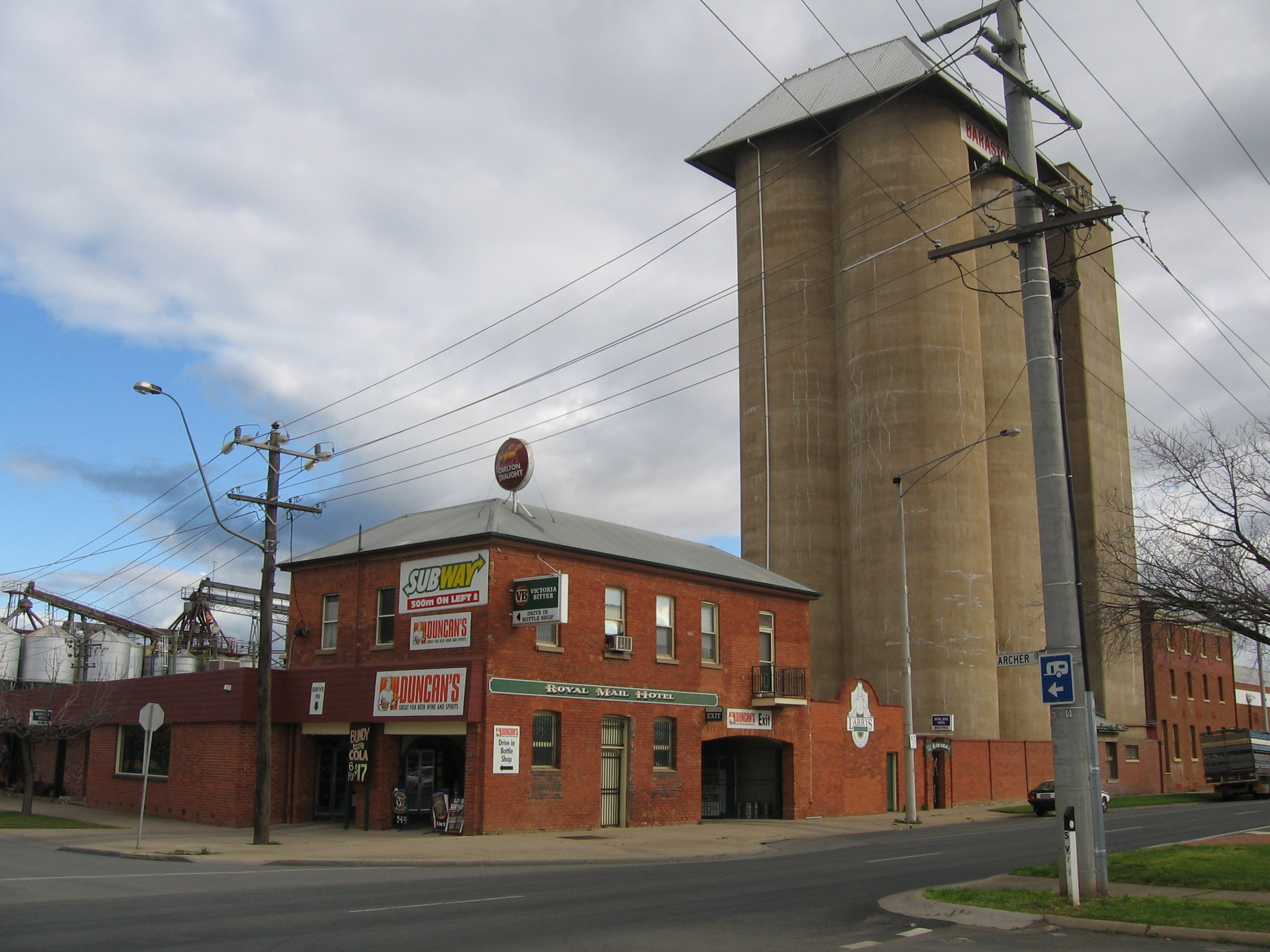
Royal Mail Hotel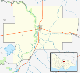
 Mooroopna
Population: 7,203[1] Postcode: 3629 Location: - 181 km (112 mi) N of Melbourne
- 4 km (2 mi) W of Shepparton
LGA: City of Greater Shepparton State District: Rodney, Shepparton Federal Division: Murray Mooroopna (
 /məˈruːpnə/)[2] is a rural town located 181 kilometres (112 mi) north of Melbourne, Victoria, Australia. It is on the banks of the Goulburn River opposite the larger town of Shepparton. The Midland Highway crosses the river between the two towns. At the 2006 census, Mooroopna had a population of 7,203.[1]
Contents
History
The name Mooroopna was used by the original Kaieltheban tribe living in the area and meant 'deep water hole'. This refers to a very deep part of the Goulburn River behind the old Mooroopna Hall. The Kaielthebans (population 50 in 1841) were part of the Bangerang race living in the region before the arrival of Europeans.
Two entrepreneurs, Joseph Hawdon and Charles Bonney, camped on the edge of Gemmill's Swamp, close to Mooroopna, in January 1838. They were overlanding large herds of cattle and sheep from an area close to modern Seymour to Adelaide, about 1200 km by bullock dray along the Goulburn and Murray Rivers. Three years later, squatters settled in surrounding areas running sheep on the well-grassed plains. The first settler in the town was William Simmonds Archer who purchased land in 1860 and built his home/hotel in McLennan Street, overlooking the river. He was followed by W. H. Morrell who selected most of the remaining township. Early commerce flowed from revenue gained by punt owners at Shepparton and in Mooroopna, who exploited the traffic from gold fields in Bendigo to those in Beechworth. The Post Office opened on 19 April 1873.[3]
Thirty years later, the population had reached 812 and the town then prospered, hindered often by droughts and damaging floods. It is now the second largest urban area in the Goulburn Valley.[citation needed]
Mooroopna became a centre for local commerce especially after the beginning of irrigation from the early 1880s. The first school was opened in 1874, the first bank in the same year, the punt in 1875, the Mooroopna Hospital in 1876 and the railway from Seymour in 1880.[4] Like other country towns, Mooroopna became infested with hotels and churches, the influence and numbers of both having declined since the Second World War. Also, like other towns, Mooroopna lost young men to wars in South Africa, Europe and in Asia and has several memorials recording their names.
The Historical Society of Mooroopna was established in 1983 and exists to collect, collate and display items and material relevant to the history of Mooroopna and the surrounding district.
Government
Mooroopna was originally part of the Shire of Waranga, proclaimed in 1865. With boundary changes it became a riding of the Shire of Rodney in 1886.
Separated only by the Goulburn River from Shepparton, the town resisted many moves for amalgamation, but was forced into union with its larger neighbour in 1994 with the creation of the City of Greater Shepparton. The total population is about 60,403 (30 June 2004), and is expected to increase to 81,378 by 2031.[5] The first councillors were elected in 1997.
Mooroopna is within the Victorian state electoral district of Shepparton and the Federal Division of Murray.
Industry
In the beginning, industry revolved around the processing of grains and fruit but, in the past 30 years, Mooroopna has become a desirable residential area for nearby Shepparton.
The town now consists of mainly residential areas, many parks and gardens and some factories. It is home to the Mooroopna site of SPC Ardmona, Ridley AgriProducts, and ED Parsons. It is a major player in 'The Food Bowl of Australia' and will have a critical place in the proposed freight and logistics centre, planned for Toolamba Road, south of the town.
Transport
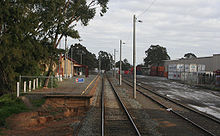 Railway station and container terminal
V/Line services on the Shepparton line stop at the local railway station, which is also served by Pacific National operated container freight services for Patrick PortLink.
Schools
Primary Schools Mooroopna Primary School Mooroopna Park Primary School St Mary's Primary School
Secondary Schools Mooroopna Secondary College
Community
Westside Performing Arts Centre, the home of many school productions by schools throughout the Shepparton area, as well as outside performers, adjoins Mooroopna Secondary.
Mooroopna HUB was recently built in the centre of the town. Offering a free library, and rooms to cater for group/club meetings. Mooroopna HUB is a wheelchair friendly environment.
Located one kilometre away is SPC Ardmona Kidstown, a playground as big as the MCG, Kidstown offers a relaxed environment for adults and a perfect day out for the kids, with play equipment being made on site with the help of local groups, clubs and businesses.[citation needed]
Sport
During the football season, locals support the Mooroopna Football Netball Club (MFNC CATS), located at the John Gray Oval and competing in the Goulburn Valley Football League.[6] . Team colours are Navy Blue and White. Mooroopna basketball team "The Cats" wear black and red and play in the Greater Shepparton Basketball Association.
Golfers play at the course of the Mooroopna Golf Club.[7]
Notes
- ^ a b Australian Bureau of Statistics (25 October 2007). "Mooroopna (State Suburb)". 2006 Census QuickStats. http://www.censusdata.abs.gov.au/ABSNavigation/prenav/LocationSearch?collection=Census&period=2006&areacode=SSC26205&producttype=QuickStats&breadcrumb=PL&action=401. Retrieved 2007-08-05.
- ^ Macquarie Dictionary, Fourth Edition (2005). Melbourne, The Macquarie Library Pty Ltd. ISBN 1-876429-14-3
- ^ Premier Postal History, Post Office List, https://www.premierpostal.com/cgi-bin/wsProd.sh/Viewpocdwrapper.p?SortBy=VIC&country=, retrieved 2008-04-11
- ^ Sid Brown (March 1990), "Tracks Across the State", Newsrail (Australian Railway Historical Society (Victorian Division)): pages 71–76.
- ^ City of Greater Shepparton
- ^ Full Points Footy, Mooroopna, http://www.fullpointsfooty.net/mooroopna.htm, retrieved 2008-07-25[dead link]
- ^ Golf Select, Mooroopna, http://www.golfselect.com.au/armchair/courseView.aspx?course_id=299, retrieved 2009-05-11
External links
Coordinates: 36°23′0″S 145°21′0″E / 36.383333°S 145.35°E
Towns in the City of Greater Shepparton Arcadia • Congupna • Dookie • Grahamvale • Katandra West • Kialla • Lancaster • Lemnos • Merrigum • Mooroopna • Murchison • Orrvale • Shepparton • Shepparton East • Tallygaroopna • Tatura • Toolamba • Undera •
Categories:- Towns in Victoria (Australia)
- Australian Aboriginal placenames


Wikimedia Foundation. 2010.