- Montemor-o-Velho Municipality
-
Montemor-o-Velho — Municipality — 
Flag
Coat of armsLocation in Portugal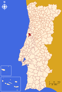
Country  Portugal
Region Centro Subregion Baixo Mondego District/A.R. Coimbra Government – Mayor Luís Manuel Barbosa Marques Leal (PSD) Area – Total 228.62 km2 (88.3 sq mi) Population – Total 25,516 – Density 165.5/km2 (428.6/sq mi) Parishes (no.) 14 Municipal holiday
8 SeptemberWebsite http://www.cm-montemorvelho.pt/ Montemor-o-Velho (Portuguese pronunciation: [mõtɨˈmɔɾ u ˈvɛʎu]) is a town and municipality of the Coimbra District, in Portugal. It has roughly 30,000 inhabitants.
Contents
Demographics
Population Montemor-o-Velho Municipality (1801–2006) 1801 1849 1900 1930 1960 1981 1991 2001 2004 2006 9528 6345 22361 25162 27925 27274 26375 25478 25082 24950 Parishes
- Abrunheira
- Arazede
- Carapinheira
- Ereira
- Gatões
- Liceia
- Meãs do Campo
- Montemor-o-Velho
- Pereira
- Santo Varão
- Seixo de Gatões
- Tentúgal
- Verride
- Vila Nova da Barca
Sports
Montemor-o-Velho has one of the only international sized 2 km rowing lakes in Portugal. The lake hosted its first rowing race in 2002 (the Coupe de la Jeunesse), before it was completed. During the competition, FISA judges noted that the lake was not wide enough to meet international standards. After then, it was rebuilt to meet these standards. It hosted the 2010 European Rowing Championships[1]
Famous people
- Sesnando Davides, 11th century Mozarab nobleman and general born in Tentúgal, Montemor-o-Velho, who would become governor of the County of Coimbra
- Fernão Mendes Pinto (1509? – 1583), Portuguese explorer and writer
References
- ^ 2010 European Rowing Championships Re-confirmed for Montemor-o-Velho, Portugal worldrowing.com accessed 14 June 2010
External links
Arganil · Cantanhede · Coimbra · Condeixa-a-Nova · Figueira da Foz · Góis · Lousã · Mira · Miranda do Corvo
Montemor-o-Velho · Oliveira do Hospital · Pampilhosa da Serra · Penacova · Penela · Soure · Tábua · Vila Nova de Poiares Categories:
- Portugal geography stubs
- Montemor-o-Velho
- Municipalities of Portugal

Wikimedia Foundation. 2010.