- Oliveira do Hospital Municipality, Portugal
-
Oliveira do Hospital Municipality (Concelho) 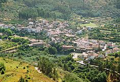 The civil parish of Avô, on the southern frontier of the municipality of Oliveira do Hospital
 Flag
Flag Coat of arms
Official name: Concelho de Oliveira do Hospital Country  Portugal
Region Centro District Coimbra Municipality Sintra Civil Parishes Aldeia das Dez, Alvoco das Várzeas, Avô, Bobadela, Ervedal, Lagares, Lagos da Beira, Lajeosa, Lourosa, Meruge, Nogueira do Cravo, Oliveira do Hospital, Penalva de Alva, Santa Ovaia, São Gião, São Paio de Gramaços, São Sebastião da Feira, Seixo da Beira, Travanca de Lagos, Vila Franca da Beira, Vila Pouca da Beira Rivers Alva, Alvoco Center Travanca de Lagos - elevation 428 m (1,404 ft) - coordinates 40°22′44.47″N 7°52′11.91″W / 40.3790194°N 7.869975°W Length 25.93 km (16 mi), Southwest-Northeast Width 14.38 km (9 mi), Northwest-Southeast Area 234.51 km2 (91 sq mi) Population 20,919 (2011  )
)Density 89.20 / km2 (231 / sq mi) LAU Concelho/Câmara Municipal - location Largo Conselheiro Cabral Metello, Oliveira do Hospital - elevation 490 m (1,608 ft) - coordinates 40°21′32.29″N 7°51′44.92″W / 40.3589694°N 7.8624778°W President José Carlos Alexandrino Mendes (PS) Municipal Chair António dos Santos Lopes (PS) Timezone WET (UTC0) - summer (DST) WEST (UTC+1) ISO 3166-2 code PT- Postal Zone 3400-062 Oliveira do Hospital Area Code & Prefix (+351) 238 XX XX XX Municipal Address Largo Conselheiro Cabral Metello
3400-062 Oliveira do Hospital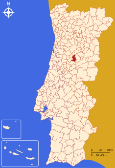 Location of the municipality of Oliveira do Hospital in continental Portugal
Wikimedia Commons: Oliveira do Hospital Statistics: Instituto Nacional de Estatística[1] Website: http://www.cm-oliveiradohospital.pt Geographic detail from CAOP (2010)[2] produced by Instituto Geográfico Português (IGP) Oliveira do Hospital (Portuguese pronunciation: [oliˈvɐjɾɐ ðu ɔʃpiˈtaɫ]) is a municipality in the old district of Coimbra, in the central part of continental Portugal.
Contents
History
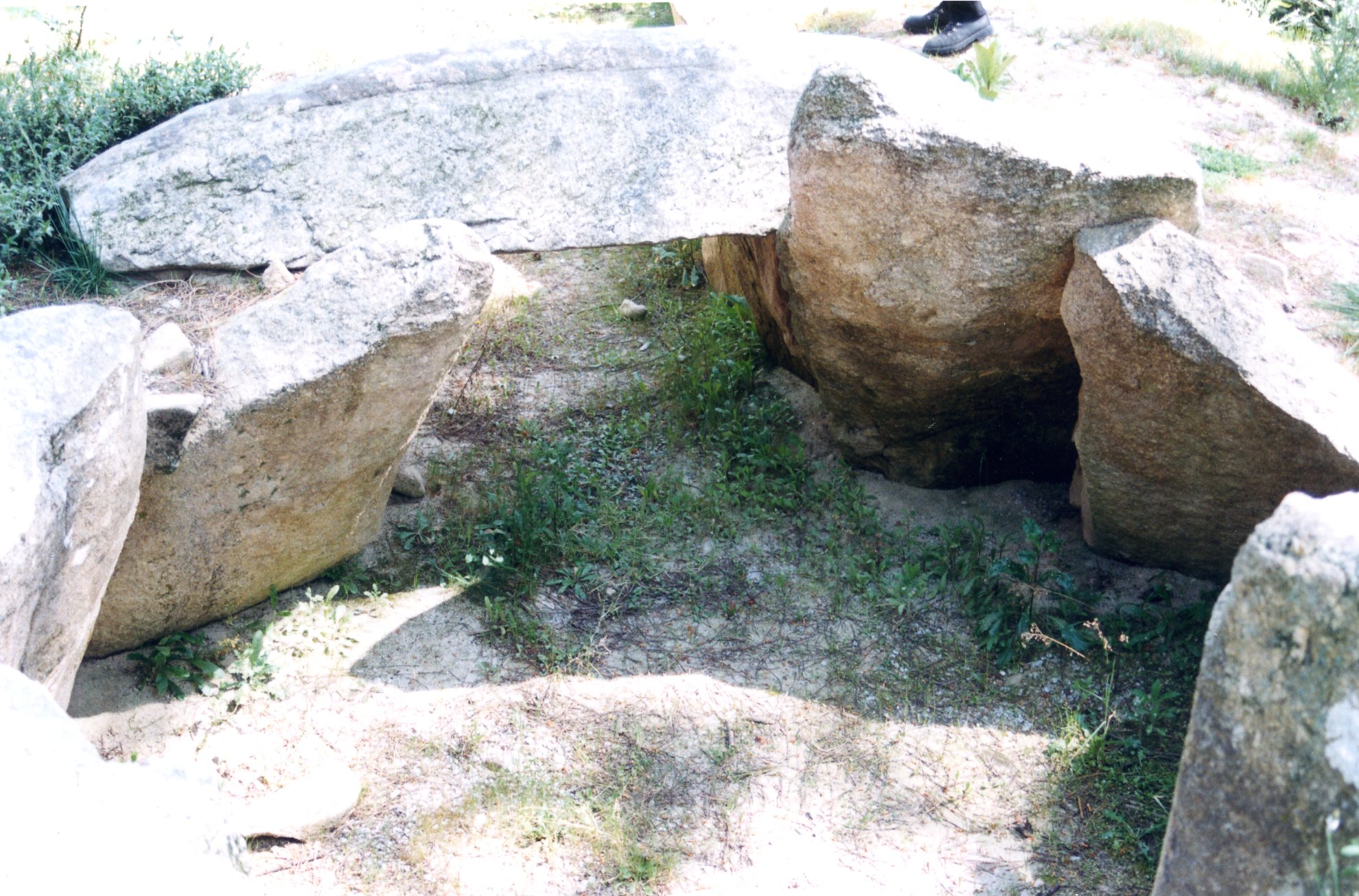
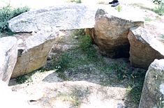 Oliveira do Hospital has seen human occupation dating back to the Neolithic, as seen from this example: the Dolmen of Pinheiro dos Abraços
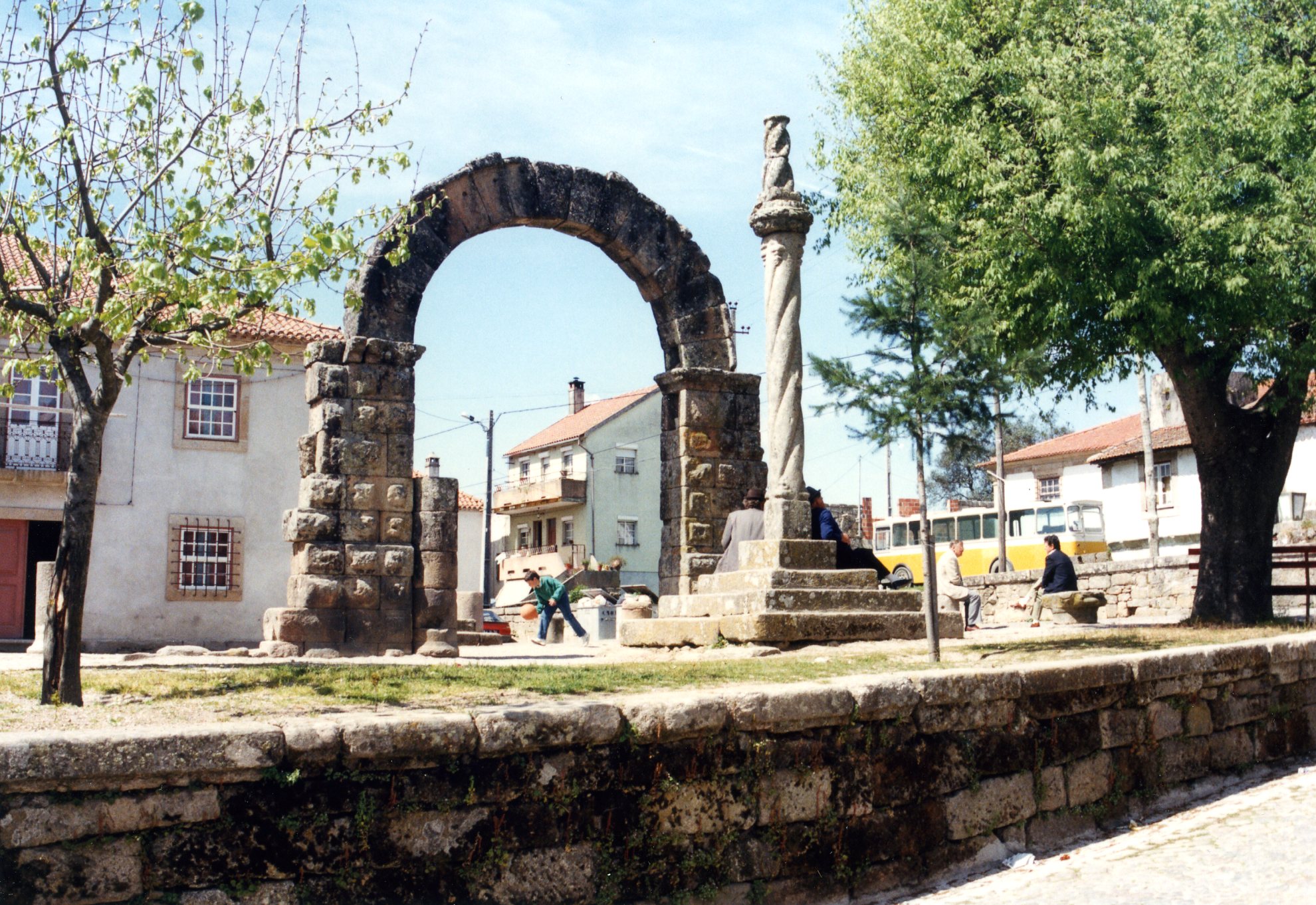
 The Roman ruins in the civil parish of Bobadela
Inhabited by ancient civilizations, Oliveira do Hospital has Roman settlements, Visigothic relics, noble Gothic mansions as well as ancient villages built of slate. One can find Neolithic and Bronze Age burial grounds and genuine religious and rural relics such as the large granite outcroppings used as threshing floors, the Holy Cross Church and the Ferreiros Chapel, a Roman Gothic style temple dating to the 13th century and the Church of Sao Gião, known as the cathedral of its region due to its richly carved and painted 18th century Baroque interior.
Geography
It is located at the northern edge of the district of Coimbra in the foothills of the Serra da Estrela Mountains, bisected by the Alva and Alvoco River valleys.
- Aldeia das Dez
- Alvoco das Várzeas
- Avô
- Bobadela
- Ervedal
- Lagares
- Lagos da Beira
- Lajeosa
- Lourosa
- Meruge
- Nogueira do Cravo
- Oliveira do Hospital
- Penalva de Alva
- Santa Ovaia
- São Gião
- São Paio de Gramaços
- São Sebastião da Feira
- Seixo da Beira
- Travanca de Lagos
- Vila Franca da Beira
- Vila Pouca da Beira
Economy
Its fertile geographic position favors agriculture, which is the dominant activity of the region with wine and cheeses being its most important products. Regarding its business sector, confections, machine tools, packaging and toys are the most important. Oliveira do Hospital is known not only for its natural beauty but its cuisine, arts and crafts.
Transport
Although Oliveira do Hospital is well within the interior of the country, transportation services are quite adequate and have been increasing as befits a growing region. There are a number of roads to the coast and other cities, the best known being the scenic Estrada da Beira.
Notable citizens
- Brás Garcia de Mascarenhas
- Dulce Pássaro
- Carlos Martins
References
- Notes
- ^ INE, ed. (2010) (in Portuguese), Censos 2011 - Resultadas Preliminares [2011 Census - Preliminary Results], Lisbon, Portugal: Instituto Nacional de Estatística, http://www.ine.pt/xportal/xmain?xpid=INE&xpgid=ine_publicacoes&PUBLICACOESpub_boui=122114780&PUBLICACOESmodo=2, retrieved 1 July 2011
- ^ IGP, ed. (2010) (in Portuguese), Carta Administrativa Oficial de Portugal, Lisbon, Portugal: Instituto Geográfico Português, http://www.igeo.pt/produtos/cadastro/caop/download/Areas_Freg_Mun_Dist_CAOP2010.zip, retrieved 1 July 2011
External links
Arganil · Cantanhede · Coimbra · Condeixa-a-Nova · Figueira da Foz · Góis · Lousã · Mira · Miranda do Corvo
Montemor-o-Velho · Oliveira do Hospital · Pampilhosa da Serra · Penacova · Penela · Soure · Tábua · Vila Nova de Poiares Categories:
- Cities in Portugal
- Municipalities of Portugal
- Coimbra District


Wikimedia Foundation. 2010.