- Moei Wadi District
-
Moei Wadi
เมยวดี— Amphoe — Amphoe location in Roi Et Province
Coordinates: 16°23′21″N 104°9′27″E / 16.38917°N 104.1575°ECoordinates: 16°23′21″N 104°9′27″E / 16.38917°N 104.1575°E Country  Thailand
Province Roi Et Seat Tambon Muban Amphoe established Area – Total 180.59 km2 (69.7 sq mi) Population (2005) – Total 22,463 – Density 124.4/km2 (322.2/sq mi) Time zone THA (UTC+7) Postal code 45250 Geocode 4515 Moei Wadi (Thai: เมยวดี) is a district (Amphoe) in the northern part of Roi Et Province, northeastern Thailand.
Contents
Geography
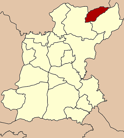
Neighboring districts are (from the east clockwise) Nong Phok and Phon Thong of Roi Et Province, Kuchinarai of Kalasin Province and Nong Sung of Mukdahan Province.
History
The minor district (King Amphoe) Moei Wadi was established on April 1 1978, when the two tambon Moei Wadi and Chumphon were split off from Phon Thong district.[1] It was upgraded to a full district on November 3 1993.[2]
Administration
The district is subdivided into 4 subdistricts (tambon), which are further subdivided into 43 villages (muban). There are no municipal (thesaban) areas, and 4 Tambon administrative organizations (TAO).
No. Name Thai name Villages Inh. 1. Moei Wadi เมยวดี 11 5,609 2. Chumphon ชุมพร 14 7,823 3. Bung Loet บุ่งเลิศ 9 4,852 4. Chom Sa-at ชมสะอาด 9 4,179 References
- ^ "ประกาศกระทรวงมหาดไทย เรื่อง แบ่งท้องที่อำเภอโพนทอง จังหวัดร้อยเอ็ด ตั้งเป็นกิ่งอำเภอเมยวดี" (in Thai). Royal Gazette 95 (42 ง): 1124. April 18 1978. http://www.ratchakitcha.soc.go.th/DATA/PDF/2521/D/042/1124.PDF.
- ^ "พระราชกฤษฎีกาตั้งอำเภอลำทับ อำเภอร่องคำ อำเภอเวียงแหง อำเภอนาโยง อำเภอแก้งสนามนาง อำเภอโนนแดง อำเภอบ้านหลวง อำเภอกะพ้อ อำเภอศรีบรรพต อำเภอแก่งกระจาน อำเภอหนองสูง อำเภอสบเมย อำเภอเมยวดี อำเภอโคกเจริญ อำเภอทุ่งหัวช้าง อำเภอผาขาว อำเภอวังหิน อำเภอดอนพุด อำเภอบึงโขงหลง และอำเภอห้วยคต พ.ศ. ๒๕๓๖" (in Thai). Royal Gazette 110 (179 ก special): 1–3. November 3 1993. http://www.ratchakitcha.soc.go.th/DATA/PDF/2536/A/179/1.PDF.
External links
- amphoe.com (Thai)
Mueang Roi Et · Kaset Wisai · Pathum Rat · Chaturaphak Phiman · Thawat Buri · Phanom Phrai · Phon Thong · Pho Chai · Nong Phok · Selaphum · Suwannaphum · Mueang Suang · Phon Sai · At Samat · Moei Wadi · Si Somdet · Changhan · Chiang Khwan · Nong Hi · Thung Khao Luang
Categories:- Amphoe of Roi Et
- Isan geography stubs
Wikimedia Foundation. 2010.