Mount Usu

Mount Usu
Mount Usu
有珠山 Usuzan
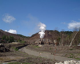
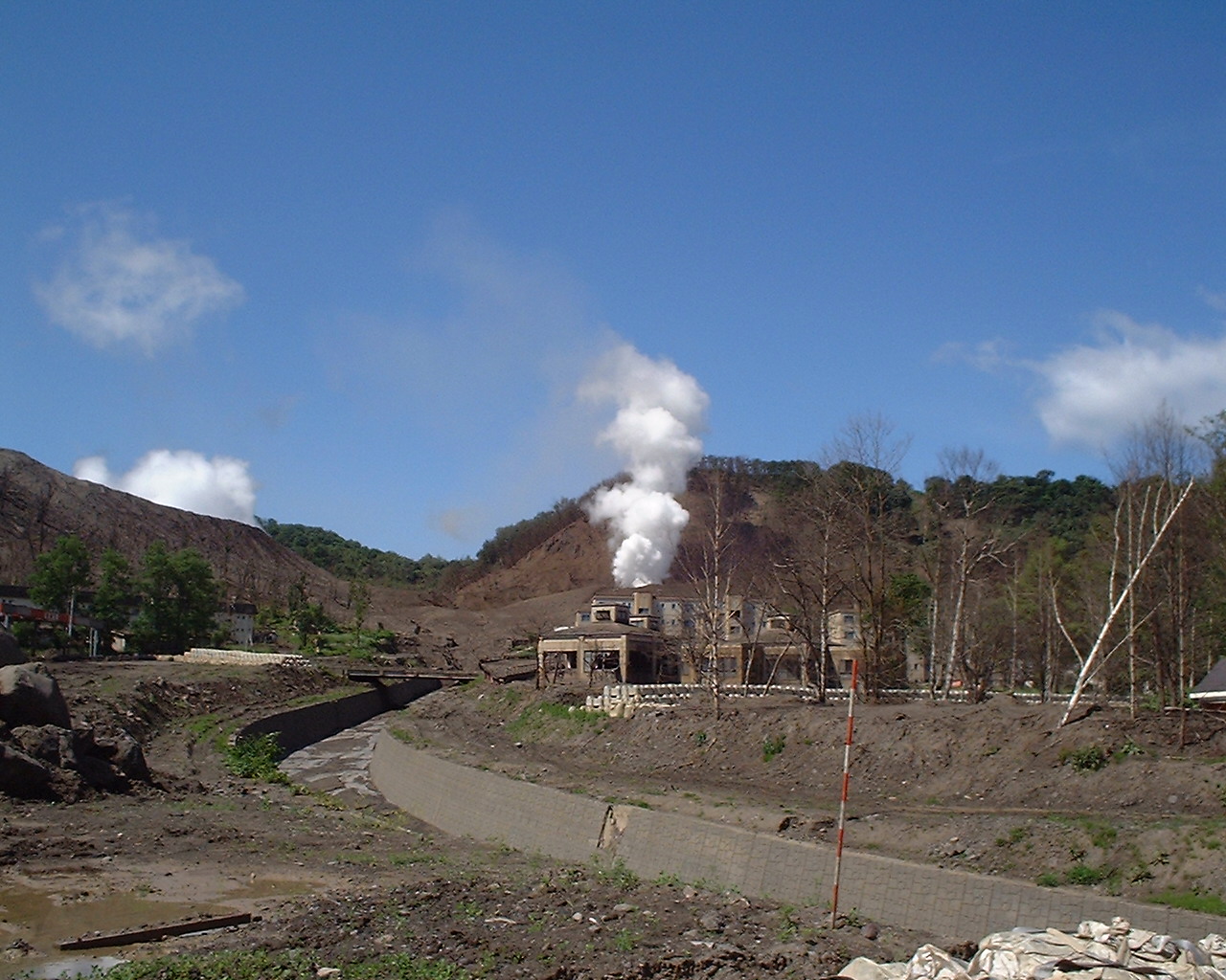
Mount Usu (2007)
Elevation 733 m (2,405 ft) [1]
Location
Location Hokkaidō, Japan
Range Nasu Volcanic Zone
Coordinates 42°32′28″N 140°50′35″E / 42.541°N 140.843°E / 42.541; 140.843
Topo map Geographical Survey Institute 25000:1 壮瞥, 50000:1 虻田
Geology
Type Stratovolcano
Volcanic arc/belt Northeast Japan Arc
Last eruption 2001

Mount Usu (有珠山 Usuzan?) is an active stratovolcano in the Shikotsu-Toya National Park, Hokkaidō, Japan. It has erupted four times since 1900: in 1910, 1944–45 (which created Showashinzan), August 7, 1977[2], and on March 31, 2000. To the north lies Lake Toya. Mount Usu formed on the southern rim of the caldera containing the lake.

Mount Usu and Showashinzan are major tourist attractions in the Shikotsu-Toya National Park. A ropeway on Mount Usu takes visitors to viewing platforms overlooking Showashinzan. The 1977 eruption is mentioned in passing in Alan Booth's classic travelogue, The Roads to Sata. The 2008 G8 Summit was held near Mount Usu at Lake Toya.[3]

See also

References

  1. ^ Geographical Survey Institute topographic map 壮瞥, last access 28 May 2008
  2. ^ [1], last access 28 October 2010
  3. ^ Japan's Selects Hokkaido for 2008 Summit, last access 28 May 2008

External links


Wikimedia Foundation. 2010.

Игры ⚽ Нужно решить контрольную?

Look at other dictionaries:

  • Usu (Vulkan) — Usu Bild gesucht  BWf1 Höhe 731  …   Deutsch Wikipedia

  • Mount Sapo — This article is about the fictional mountain in Italy. For the real mountains in Bolivia and Panama, see Cerro Sapo (Bolivia) and Cerro Sapo (Panama). Mount Sapo is a fictional mountain supposed to exist somewhere near Rome, presumably in Italy.… …   Wikipedia

  • Liste der Berge oder Erhebungen in Japan — Die Liste der Berge oder Erhebungen in Japan enthält die 20 höchsten Gipfel Japans sowie weitere Erhebungen einiger Präfekturen und Inseln. Inhaltsverzeichnis 1 Legende 2 Gipfel 3 Weitere Erhebungen 4 …   Deutsch Wikipedia

  • Kanagawa Prefecture — Infobox Prefecture Japan Name = Kanagawa JapaneseName = 神奈川県 Rōmaji = Kanagawa ken Symbol = PrefSymbol Kanagawa.png Capital = Yokohama Region = Kantō Island = Honshū TotalArea = 2,415.42 AreaRank = 43rd PCWater = 2.3 PopDate = September 1, 2007… …   Wikipedia

  • Showashinzan — Infobox Mountain Name= Showashinzan 昭和新山 Photo= Showashinsan 2005 08.jpg Caption= Showashinzan. Note the volcanic steam on the left. (August 2005) Elevation= Convert|398|m|ft|0|abbr=on [ [http://www.gsi.go.jp/ENGLISH/index.html Geographical… …   Wikipedia

  • Usuzan Ropeway — The nihongo|Usuzan Ropeway|有珠山ロープウェイ|Usuzan Rōpuwei is Japanese aerial lift line in Sōbetsu, Hokkaidō, operated by nihongo|Wakasa Resort|ワカサリゾート. Opened in 1965, the line climbs Mount Usu, the active volcano in Shikotsu Tōya National Park. The… …   Wikipedia

  • Hokkaidō — ) or Ezogashima. The Ezo mainly relied upon hunting and fishing and obtained rice and iron through trade with the Japanese.During the Muromachi period, the Japanese created a settlement at the south of the Oshima peninsula. As more people moved… …   Wikipedia

  • Shikotsu-Tōya National Park — Infobox protected area | name = Shikotsu Tōya National Park 支笏洞爺国立公園 iucn category = II caption = Lake Toya (October 2007) locator x = locator y = location = Hokkaidō, Japan nearest city = lat degrees = lat minutes = lat seconds = lat direction …   Wikipedia

  • Hokkaido — For the dog breed, see Hokkaido (dog). Hokkaido Japanese transcription(s)  – Japanese 北海道  – Rōmaji Hokkaidō …   Wikipedia

  • Date, Hokkaidō — Date 伊達   City   Location of Date in Hokkaidō (Iburi …   Wikipedia

Share the article and excerpts

Direct link
Do a right-click on the link above
and select “Copy Link”