- Okrika
-
Okrika
Kirike se
Wakirike se— LGA and town — Nickname(s): Oknas Coordinates: 4°44′23″N 7°4′58″E / 4.73972°N 7.08278°E Country  Nigeria
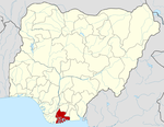
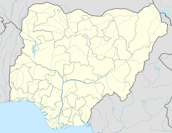
State Rivers State Time zone WAT (UTC+1) Okrika is a port town in Rivers State, Nigeria, capital of the Local Government Area of the same name. The town is situated on a small island just south of Port Harcourt, making it a suburb of the much larger city.
The average elevation of Okrika is 452 metres. It lies on the north of the Bonny River and on Okrika Island, 35 miles (56 km) upstream from the Bight of Biafra. The town can be reached by vessels of a draft of 29 feet (9 metres) or less.
Formerly a small fishing village of the Ijo (Ijaw) people in the mangrove swamps of the eastern Niger River delta, Okrika became the capital of the Okrika kingdom in the early 17th century and actively dealt in slaves. It served as a port for the exportation of palm oil after the abolition of the slave trade in the 1830s, but it was a less significant port facility than either Bonny (18 miles [46 km] south) or Opobo (32 miles [81 km] east-southeast). By 1912, Okrika had been completely eclipsed by Port Harcourt, and it was not revived as a commercial port until 1965, when the nearby Alesa-Eleme oil refinery was completed and pipelines were built to a jetty on Okrika Island.It also has a major gas plant facility (Alakiri gas plant)that supplies to the refinery and others.
Refined petroleum products are Okrika’s only significant exports. The town has considerable local trade in fish, oil palm produce, locally processed salt, cassava (manioc), taro, plantains, and yams. The 2006 census determined the population of the Wakirike Local Government Area of the Rivers State of Nigeria was 222,026. An estimated 145,000 Okrika natives live elsewhere around the world, mostly in the United Kingdom and the United States.
The local Kirike language is part of the ljoid group.[1]
References
- ^ "About Rivers State". Rivers State Government. http://www.riversstatenigeria.net/index.php?option=com_content&view=article&id=276&Itemid=168. Retrieved 2009-10-17.>
Coordinates: 4°44′24″N 7°04′59″E / 4.74°N 7.083°E
Abua/Odual · Ahoada East · Ahoada West · Akuku-Toru · Andoni · Asari-Toru · Bonny · Degema · Eleme · Emohua · Etche · Gokana · Ikwerre · Khana · Obio-Akpor · Ogba/Egbema/Ndoni · Ogu/Bolo · Okrika · Omuma · Opobo/Nkoro · Oyigbo · Port Harcourt · Tai
 Categories:
- Populated places in Rivers State
- Local Government Areas in Rivers State
- Nigeria geography stubs
Wikimedia Foundation. 2010.

