- McKay Reservoir
-
McKay Reservoir 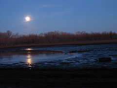
Dusk on a south shore Location Umatilla County, Oregon Coordinates 45°36′19″N 118°47′54″W / 45.6054079°N 118.7983183°WCoordinates: 45°36′19″N 118°47′54″W / 45.6054079°N 118.7983183°W[1] Lake type reservoir Primary inflows McKay Creek Primary outflows McKay Creek Basin countries United States Max. length 2.2 miles (3.5 km) Max. width 0.5 miles (800 m) Water volume 65,534 acre·ft (80,835,000 m3) Surface elevation 1,240 feet (380 m) McKay Reservoir is a reservoir in Umatilla County of the U.S. state of Oregon. It is an impoundment of McKay Creek, a tributary of the Umatilla River. The reservoir is located 6 miles (9.7 km) south of Pendleton on U.S. Route 395. The reservoir has a capacity of 65,534 acre feet (80,835,000 m3) of water.[2] The reservoir and land that immediately surrounds it are designated as the McKay Creek National Wildlife Refuge.
Contents
Natural history
The reservoir is jointly managed by the Bureau of Reclamation and the McKay Creek National Wildlife Refuge for irrigation water and a habitat for a variety wildlife including osprey, bald eagles, and an abundance of waterfowl. Fishing is permitted between March thorough September.[3] McKay’s shallow water marshes and wetlands are also productive for warmwater fish such as rainbow trout, crappie, largemouth bass, sunfish[disambiguation needed
 ], and yellow perch, as well as brown bullhead catfish, and lesser numbers of largemouth and smallmouth bass.[4]
Hydrology
The McKay Reservoir was built between 1923–1927 and furnishes supplementary water to Stanfield and Westland Irrigation Districts. The reservoir has an active capacity of 71,534 acre feet (88,236,000 m3), of which 6,000 acre feet (7,400,000 m3) is used for exclusive flood control.[2] The Mckay reservoir is an impoundment of McKay Creek, a tributary of the Umatilla River and has an earth-fill dam.
The spillway section of the McKay Dam was modified 1978 through 1979 to increase the capacity from 10,000 to 27,000 cubic feet per second.
See also
References
- ^ "McKay Reservoir". Geographic Names Information System, U.S. Geological Survey. http://geonames.usgs.gov/pls/gnispublic/f?p=gnispq:3:::NO::P3_FID:1132097. Retrieved 2009-03-13.
- ^ a b The Bureau of Reclamation Reclamation Increases Flows from McKay Reservoir (2003). Accessed 5 Jan 2009.
- ^ Featured Waterbody - McKay Reservoir Oregon Department of Fish and Wildlife. Accessed 5 Jan 2009
- ^ Oregon Public Lands McKay Reservoir BigGame Hunt.net - Accessed 5 Jan 2009
External links
- Oregon Water Quality Index Report for the Umatilla Basin Oregon Department of Environmental Quality
- McKay Creek National Wildlife Refuge U.S. Fish & Wildlife Service
Categories:- Reservoirs in Oregon
- Landforms of Umatilla County, Oregon
- Buildings and structures in Umatilla County, Oregon

Wikimedia Foundation. 2010.