- Maze Park Nature Reserve
-
Maze Park 
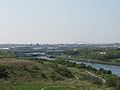
The north eastern end of Maze Park Nature Reserve from the viewing hillLocation within England

Type Local nature reserve Location Middlesbrough, England Coordinates 54°33′58″N 1°16′38″W / 54.56611°N 1.27722°WCoordinates: 54°33′58″N 1°16′38″W / 54.56611°N 1.27722°W Area 42 acres (17 ha) Operated by Tees Valley Wildlife Trust Website http://www.teeswildlife.org/ Maze Park is a 42-acre (17 ha) urban nature reserve in Middlesbrough, England on the south bank of the Tees on former railway marshalling yards.[1] It was created by the Teesside Development Corporation[2] and is owned and run by the Tees Valley Wildlife Trust.[3][4] The reserve is a narrow triangle of land bounded by the River Tees, the old river Tees, and the Thornaby rail marshalling yards.[4][5][6]
Contents
Facilities
The area is rough grassland, supporting herbs and broad-leaved plants and has three landscaped viewing mounds[1][7] giving panoramic views of the Green Blue Heart of the Tees Corridor. Passing through the reserve along the side of the River Tees is the Teesdale Way footpath and cycle route and there are butterfly styled metal cycle racks to park bicycles for those cyclists wishing to stop and take a closer look.[8] An interpretation panel is present for the interested visitor and others are planned. The western end of the nature reserve is close to and accessible from the Tees Barrage. Portrack Marsh Nature Reserve is located on the opposite bank of the River Tees.
Flora and fauna
Maze Park Nature Reserve supports a range of plants, insects and birds. The area has a slag-based soil and is ideal for plants that grow in limestone and chalk meadows.[9] Plants in the reserve include bird's foot trefoil, common centaury, rocket, St John's wort and yellow-wort[2] and there was a school project to plant further wild plants such as viper's bugloss, greater knapweed, salad burnet and selfheal.[9] Insects to be found include damselfly, dingy skipper, grasshopper, grayling, ringlet, six-spot burnet moth and small copper.[2][7][10][11]
The birds which are known to nest or visit include blackcap, chaffinch, grasshopper warbler, grey partridge, kingfisher, sand martin, skylark and sparrowhawk.[2][11][12]
-
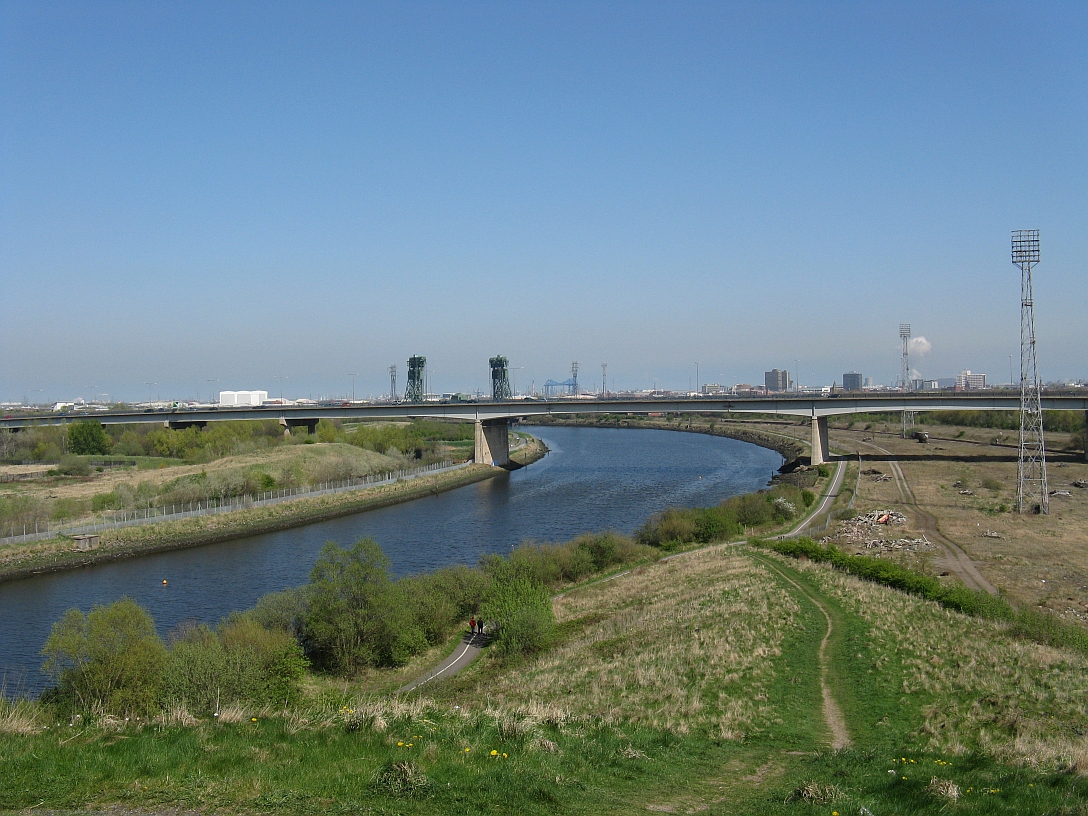
The view from Maze Park viewing hill looking west.
References
- ^ a b "Maze Park Nature Reserve". teeswildlife.org. The Wildlife Trust - Tees Valley. http://teeswildlife.org/new/node/50. Retrieved 2011-10-04.
- ^ a b c d "Maze Park". Gazette Live. Teesside: Evening Gazette. 2007-05-23. http://www.gazettelive.co.uk/news/the-environment/green-bits/2007/05/23/maze-park-84229-19363537/. Retrieved 2009-06-12.
- ^ "Brownfields - Habitat Action Plan" (PDF). teesvalleybiodiversity.org.uk. Tees Valley Biodiversity Partnership. http://teesvalleybiodiversity.org.uk/wp-content/uploads/2008/09/brownfields-draft-hap-2009-2013-19-sept-pdf-format.pdf. Retrieved 2009-06-12.
- ^ a b "Development Strategy - Green Blue Heart". smi-teesvalley.co.uk. Stockton-Middlesbrough Initiative. http://www.smi-teesvalley.co.uk/dev_strategy/gbh.htm. Retrieved 2009-06-12.
- ^ "Take a trip to Barrage". ICTeesside. Teesside: Evening Gazette. 2005-09-08. http://icteesside.icnetwork.co.uk/0100news/columnists/tm_headline=take-a-trip-to-barrage&method=full&objectid=15946163&siteid=50080-name_page.html. Retrieved 2009-06-12.
- ^ "The Green Blue Heart" (PDF). smi-teesvalley.co.uk. Stockton-Middlesbrough Initiative. http://www.smi-teesvalley.co.uk/documents/GBH%20Presentation.pdf. Retrieved 2009-06-12.
- ^ a b "Ecologists discover rare butterfly at more sites". The Northern Echo. Tees Valley. 2006-11-07. http://www.thenorthernecho.co.uk/search/1006811.Ecologists_discover_rare_butterfly_at_more_sites/. Retrieved 2009-06-12.
- ^ "The Tees Corridor Natural Regeration Project". teeswildlife.org. The Wildlife Trust. http://www.teeswildlife.org/tees.htm. Retrieved 2009-06-12.
- ^ a b "Pupils' dirty hands for a good cause". The Northern Echo. 2001-07-09. http://archive.thenorthernecho.co.uk/2001/7/9/166155.html. Retrieved 2009-06-13.
- ^ "Flickr Search". Flickr. http://www.flickr.com/search/?ss=2&ct=6&q=Maze+Park+Tees&m=text. Retrieved 2009-06-12.; "2007 Non birds". teesmouthbc.com. Teesmouth Bird Club. http://www.teesmouthbc.com/tbcweb/2007/non/1/2007none1.htm. Retrieved 2007-06-12.; "Heavy industry gives rare butterflies a lift". The Northern Echo. 2008-10-12. http://www.thenorthernecho.co.uk/business/indepth/eco/3587749.Heavy_industry_gives_rare_butterflies_a_lift/. Retrieved 2009-06-12.
- ^ a b "Teesmouth Birdclub Newsletter, Issue 34" (PDF). teesmouthbc.com. Teesmouth Bird Club. Summer 2006. http://www.teesmouthbc.com/Newsletters/tbcn034.pdf. Retrieved 2009-06-12.
- ^ Sharples, Garry. "Birds of Portrack Marsh and the Tees Barrage" (PDF). teesmouthbc.com. http://www.teesmouthbc.com/tbcweb/articles/Birds%20of%20Portrack.pdf. Retrieved 2009-06-12.
See also
- Local Nature Reserves
- Portrack Marsh Nature Reserve
- Portrack Meadows Wildlife Reserve.
External links
- Review of Maze Park Nature Reserve on Stockton-on-Tees Borough Council's M@ps Stockton site
- Pictures in Flickr.
The borough of Middlesbrough Districts, Suburbs
and VillagesConnurbation: Acklam · Berwick Hills · Brambles Farm · Coulby Newham · Easterside · Grove Hill · Hemlington · Linthorpe · Marton · Marton Grove · Middlesbrough · Netherfields · North Ormesby · Nunthorpe · Pallister · Park End · Saltersgill · Thorntree · Tollesby · West Lane · Whinney Banks · Villages: Stainton · ThorntonGovernance Middlesbrough Borough Council · Parliamentary constituencies: Middlesbrough · Middlesbrough South and East ClevelandEducation Culture & Tourism Media Sport Waterways Transport Air: Durham Tees Valley Airport · Rail: Esk Valley Line · Middlesbrough railway station · Tees Valley Line · Tees Valley Metro (Proposed) · Bus: Middlesbrough bus station · Road: A19 · A66 · A174Related articles Acklam Hall · Centre North East · Cleveland · James Cook University Hospital · Ormesby Hall · Teesside Development Corporation · Teesside · Teesside Park · Tees Valley Regeneration · The MallCategories:- Local Nature Reserves in England
- Nature reserves in North Yorkshire
-


Wikimedia Foundation. 2010.