Martin near Horncastle

Martin near Horncastle

Coordinates: 53°11′01″N 0°08′31″W / 53.18361300°N 0.14200401°W / 53.18361300; -0.14200401

Martin
St.Michael's church, Martin-by-Horncastle, Lincs. - geograph.org.uk - 95368.jpg
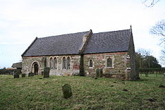
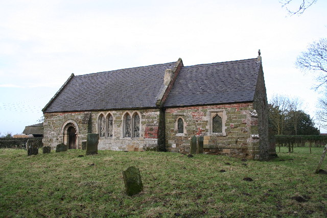
St Michaels church, Martin
Martin is located in Lincolnshire
Martin

 Martin shown within Lincolnshire
OS grid reference TF242667
District East Lindsey
Shire county Lincolnshire
Region East Midlands
Country England
Sovereign state United Kingdom
Post town Horncastle
Postcode district LN9
Police Lincolnshire
Fire Lincolnshire
Ambulance East Midlands
EU Parliament East Midlands
UK Parliament Louth and Horncastle
List of places: UK • England • Lincolnshire

Martin is a hamlet and former civil parish about 2 miles (3.2 km) south of the town of Horncastle, Lincolnshire, England. The parish of Martin was abolished in 1936 to enlarge the parish of Roughton. The church is dedicated to Saint Michael.[1]

References

  1. ^ "Vision of Britain". Martin Parish. University of Portsmouth. http://www.visionofbritain.org.uk/place/place_page.jsp?p_id=12995&st=MARTIN. Retrieved 18 June 2011. 

[[Category:East Lindsey}}


Wikimedia Foundation. 2010.

Игры ⚽ Поможем сделать НИР

Look at other dictionaries:

  • Martin — For people with the surname or given name Martin or similar, see Martin (name). Martin may refer to: Contents 1 Places 1.1 In Europe 1.2 …   Wikipedia

  • List of places in Lincolnshire — This is a list of places in the ceremonial county of Lincolnshire, England. See the list of places in England for places in other counties.compactTOC NOTOC A *Aby, Addlethorpe, Aisby, South Kesteven, Aisby, West Lindsey, Aisthorpe, Alford,… …   Wikipedia

  • Lincolnshire — For other places with the same name, see Lincolnshire (disambiguation). Coordinates: 53°4′N 0°11′W / 53.067°N 0.183°W / 53.067; 0.183 …   Wikipedia

  • Joseph Banks — For other people named Joseph Banks, see Joseph Banks (disambiguation). Sir Joseph Banks, Bt Joseph Banks, as painted by Sir Joshua Reynolds in 1773 …   Wikipedia

  • Grantham — For other uses, see Grantham (disambiguation). Coordinates: 52°55′05″N 0°38′17″W / 52.918°N 0.638°W / 52.918; 0.638 …   Wikipedia

  • List of schools in the East Midlands — The following is a partial list of currently operating schools in the East Midlands region of England. You may also find of use to find a particular school. See also the List of the oldest schools in the United Kingdom.Listed by local education… …   Wikipedia

  • Navenby — Coordinates: 53°06′36″N 0°31′26″W / 53.110°N 0.524°W / 53.110; 0.524 …   Wikipedia

  • Turf maze — Historically, a turf maze is a labyrinth made by cutting a convoluted path into a level area of short grass, turf or lawn. Some had names such as Mizmaze, Troy Town, The Walls of Troy, Julian s Bower, or Shepherd s Race (see #Maze names, below).… …   Wikipedia

  • English Reformation — The English Reformation was the series of events in 16th century England by which the Church of England first broke away from the authority of the Pope and the Roman Catholic Church.These events were, in part, associated with the wider process of …   Wikipedia

  • Grimsby — For other uses, see Grimsby (disambiguation). Coordinates: 53°33′34″N 0°04′05″W …   Wikipedia

Share the article and excerpts

Direct link
Do a right-click on the link above
and select “Copy Link”