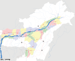
- Mariani, Jorhat
-
- for other uses see Mariani
Mariani — town — Coordinates 26°40′N 94°20′E / 26.67°N 94.33°ECoordinates: 26°40′N 94°20′E / 26.67°N 94.33°E Country India State Assam District(s) Jorhat Population 23,065 (2001[update]) Time zone IST (UTC+05:30) Area
• 155 metres (509 ft)
Codes-
• Telephone • +03771
Mariani (Assamese: মৰিয়ণী) is a neighbourhood town of Jorhat City. It is about 17.5 km for Jorhat Railway station. Mariani is in the border of Nagaland. Mariani is famous for the diamonds Gibbon Wildlife Sanctuary which is located on the road side on the way to Nakachari from Mariani at a distance of 5 km.
This small town is surrounded by some of the largest tea gardens in India. Mariani has a cosmopolitan culture with many communities speaking different languages and living in harmony for decades. The town was once well known for having one of the largest plywood factories in India which was later closed down as felling trees were banned by the law.
Dhudar Ali connects Mariani by road. Mariani is well connected by air. Nearest airport is located at Jorhat. It is also well connected with the rest of the country for it is an important railway junction.
Contents
Geography
Mariani is located at 26°40′N 94°20′E / 26.67°N 94.33°E.[1] It has an average elevation of 155 metres (508 feet).
Demographics
As of 2001[update] India census,[2] Mariani had a population of 23,065. Males constitute 54% of the population and females 46%. In Mariani, 12% of the population is under 6 years of age.
Educational institute
Colleges
Mariani College
Schools
- Mahadev Agarwalla Higher secondary School
- Edith Douglas HS School
- St. Antony's High School
- Railway High School
- Adarsh Hindi Vidyalaya
- Mariani High School
- Mariani Girls’ School
- Little Star School
- Bongshi Gopal High School
- Parijat Jatiya Bidyalaya
Politics
The present(2010) MLA Rupjyoti Kurmi of Mariani is the youngest MLA in Assam, Mariani is part of Jorhat (Lok Sabha constituency).[3]
References
- ^ Falling Rain Genomics, Inc - Mariani
- ^ "Census of India 2001: Data from the 2001 Census, including cities, villages and towns (Provisional)". Census Commission of India. Archived from the original on 2004-06-16. http://web.archive.org/web/20040616075334/http://www.censusindia.net/results/town.php?stad=A&state5=999. Retrieved 2008-11-01.
- ^ "List of Parliamentary & Assembly Constituencies". Assam. Election Commission of India. http://archive.eci.gov.in/se2001/background/S03/AS_ACPC.pdf. Retrieved 2008-10-06.
[[bpy:'মারিয়ানি]']
Categories:- Cities and towns in Jorhat district
- Railway stations in Assam
- Jorhat
- Assam geography stubs
Wikimedia Foundation. 2010.


