- Manila (province)
-
This article is about the former province. For the present city of Manila proper, see Manila. For the greater metropolitan area, see Metro Manila. For the pre-Hispanic entity, see Kingdom of Maynila. For other uses, see Manila (disambiguation).
Maynila
ManilaFormer province of the Philippines ← 
←1571-1901  →
→
→Location of the historical province of Manila.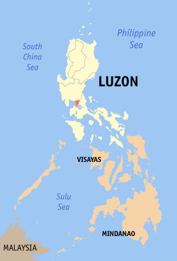
Capital Manila
Mariquina (1898-1899)Historical era Spanish era - Legazpi's conquest of Maynila and Tondo 1571 - Became capital of colonial Philippines - Occupied by Great Britain 1762-1764 - Sovereignty transferred to United States 1899 - Disestablished 1901 Today part of Caloocan, Las Piñas, Makati, Malabon, Mandaluyong, Manila, Marikina, Muntinlupa, Navotas, Parañaque, Pasay, Pasig, Pateros, Taguig, Quezon City, San Juan Manila, also formerly known as Tondo, was a historical province in the Philippines, encompassing the former Kingdom of Tondo and Kingdom of Maynila.[1] In 1898, it included the City of Manila and 23 other municipalities. It was incorporated into the Province of Rizal in 1901.
Contents
Cities and Municipalities
The province was composed of the City of Manila and 23 other municipalities. The districts of Binondo, Dilao, Ermita, Malate, Pandacan, Quiapo, Sampaloc, San Miguel, Santa Ana, Santa Cruz, and Tondo are often referred to as "pueblos", "suburbs" or "neighborhoods" of Manila. The name Manila originally referred to the "city within the walls" (now called Intramuros), but its meaning eventually came to include the suburbs surrounding it, leading to confusion about which places constitute "Manila" in the late 19th century.[1][2] From the 1860s onward, the area was often referred to as Ciudad de Manila y sus arrabales ("The City of Manila and its suburbs") or as Manila y los pueblos de extramuros ("Manila and the communities outside the walls").[2] The present-day City of Manila includes all these areas.
The table below presents information from the cited source.[1]
City/Municipality Population (1898) Notes Caloocan 9,843 situated 7 miles from Manila. There are highroads to Manila, Novaliches, Mariquina, and Sampaloc. Dilao[A 1][A 2] 4,625 situated 3 miles from Manila. Ermita[A 1] 4,726 situated 1¼ miles from Manila. Las Piñas 4,000 situated 8 miles from Manila. Malate[A 1] 2,319 situated 1⅔ miles from Manila. Malibay[A 3] 2,890 situated 4 miles from Manila. Manila[A 4] 110,000 Mariquina[A 5] 10,313 situated 7 miles from Manila. It communicates with Caloocan by a highroad. Montalban[A 6] 3,055 situated 16 miles from Manila. Muntinlupa 5,068 situated 21 miles from Manila. Navotas 9,154 situated 6¼ miles from Manila. Novaliches[A 7] 1,871 situated 10 miles from Manila. It communicates with Caloocan and Manila by highroads. Pandacan[A 1] 2,446 situated 2 miles from Manila. Parañaque 9,863 situated at a distance of 6⅛ miles from Manila. Pasig 22,000 situated 7 miles from Manila. Pateros 2,842 situated 3 miles from Manila. Pineda[A 8] 9,825 situated 3⅛ miles from Manila. San Felipe Neri[A 9] 5,465. San Juan del Monte[A 10] 2,011 San Mateo[A 11] 6,700 situated 17 miles from Manila. San Pedro Macati[A 12] 3,921 situated about 3 miles from Manila. Santa Ana[A 1] 2,194 situated about 3 miles from Manila. Taguig 9,662 situated 4 miles from Manila. Tambobong[A 13] 25,000 situated 3 miles from Manila. Additional Notes
- ^ a b c d e Now part of the present-day City of Manila
- ^ Refers to Paco, Manila
- ^ Combined with Pasay on October 12, 1903
- ^ Refers to Intramuros, Manila
- ^ Now called Marikina
- ^ Now Rodriguez, Rizal
- ^ Absorbed by Caloocan in the early 20th century. Areas that historically belonged to Novaliches are now divided between northern Caloocan and Quezon City
- ^ Now called Pasay
- ^ Now called Mandaluyong
- ^ Now called San Juan
- ^ Now San Mateo, Rizal
- ^ Now called Makati
- ^ Now called Malabon
Map
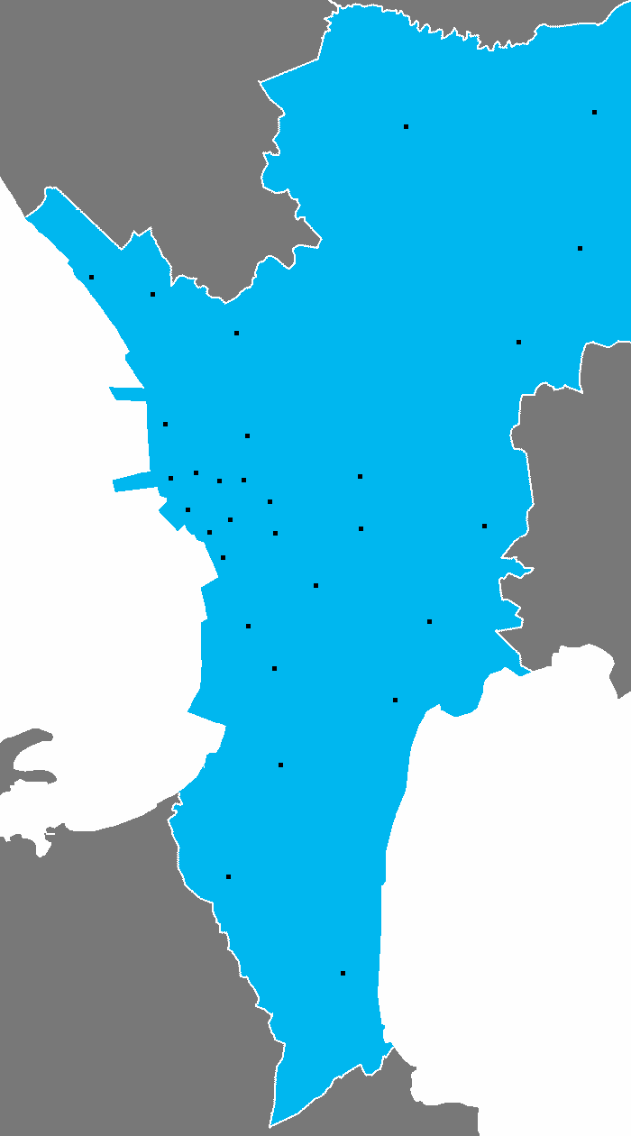
Shown below are the general locations of the municipalities of the Province of Manila. The map does not include borders between municipalities due to a lack of information about their historical boundaries. Except for Montalban and San Mateo, all these areas are included in the present-day cities of Metro Manila.[3]
 CaloocanLas PiñasMalibayParañaquePasigPinedaTaguig
The Province of Manila, as of 1898.
References
- ^ a b c Military notes on the Philippines: September 1898 By United States. Adjutant-General's Office. Military Information Division
- ^ a b Old ties and new solidarities: studies on Philippine communities, by Charles J-H. Macdonald, Guillermo Mangubat Pesigan - Shifts in the meaning of "Manila" in the Nineteenth Century - Xavier Huetz de Lemps
- ^ 1901 Map of Luzon, showing the Province of Manila
Coordinates: 14°35′N 121°00′E / 14.583°N 121°E
Provinces Agusan · Ambos Camarines · Camarines · Cotabato · Davao · Kalinga-Apayao · Lanao · Lepanto-Bontoc · Manila · Mindanao and Sulu · Mindoro · Misamis · Moro Province · Negros · Negros del Norte · Occidental Leyte · Oriental Leyte · Samar · Shariff Kabunsuan · Surigao · Tayabas · ZamboangaCities 1 Dissolved, and converted into province. · 2Formally now known as General Santos City. · 3Daraga was split from Legazpi City. Categories:- States and territories established in 1571
- States and territories disestablished in 1901
- Former provinces of the Philippines
- Philippines geography stubs

Wikimedia Foundation. 2010.